Simpson County Travel Demand Model
180 likes | 329 Vues
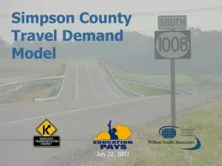
Simpson County Travel Demand Model. July 22, 2003. BACKGROUND. WSA started working on KY 1008 Pre-Design Scoping Study in November 2002 Currently, there is ¾ of a Bypass (KY 1008) around Franklin, Kentucky Planning project aimed to determine need (if any) for full bypass

Simpson County Travel Demand Model
E N D
Presentation Transcript
Simpson County Travel Demand Model July 22, 2003
BACKGROUND • WSA started working on KY 1008 Pre-Design Scoping Study in November 2002 • Currently, there is ¾ of a Bypass (KY 1008) around Franklin, Kentucky • Planning project aimed to determine need (if any) for full bypass • Traffic would be important in justification of new segment • As a result, the KYTC made the decision to develop travel demand model to coincide with study
BACKGROUND (CONT.) • Project coordinated through the Divisions of Planning and Multimodal Programs • KYTC decided to build full travel demand model for Simpson County for future uses • Air quality analysis (non-attainment) • Other transportation improvements
MODEL DEVELOPMENT • Roadway Coverage / Network • Traffic Analysis Zones • Model Development • Trip Generation • Trip Distribution • Traffic Assignment
ROADWAY COVERAGE • Roadway Coverage includes: • All state-maintained roads in Simpson County • I-65 (North / South) • US 31W (North / South) • KY 100 (West / East) • Many local roads • County Roads • City Streets
TRAFFIC ANALYSIS ZONES • Traffic Analysis Zones were based upon: • Census Blocks / Census TAZs • The highway network • Socioeconomic Data included: • Census Bureau • Dun & Bradstreet Employment Data • Franklin-Simpson Industrial Board • KYTC District 3
3-STEP MODEL • Automated using GISDK User Interface • Trip Generation (Quick Response Method) • Trip Distribution (Gravity Model with Gamma Function) • Traffic Assignment (User Equilibrium)
GISDK USER INTERFACE • Originally developed for the Madisonville UATS • Easily moved from model to model • Simplified each model run • Included Error-Prevention Strategies
RESULTS • Very good initial runs • Particular consideration given to calibration in Franklin and areas near bypass • Met FHWA calibration requirements • Overall RMSE < 30% • RMSE requirements achieved for all functional classifications • Also, met RMSE requirements for volume groups
FRANKLIN BYPASS EXTENSION • The calibrated base year model was used to forecast traffic patterns for the Future Year 2025 • As mentioned, the number of vehicles expected to utilize new bypass extension was very important • Result ranged from 6,500 – 7,000 vehicles per day on the bypass (Year 2025)
TRUCK COMPONENT • E-E truck trips are a major source of truck trips in the study area along major north/south routes (I-65/US 31W) • External-External (E-E) truck trips were simulated for this project based on existing truck counts • Internal truck trips is currently being developed
BPR CURVE • Speed Estimation has been important topic recently for the KYTC • KYTC asked to use updated BPR function parameters: • a = 0.05 (signalized); 0.2 (other) • b = 10 • Currently, conducting sensitivity analyses to study the difference between default BPR (a=0.15; b=4) parameters and updated BPR parameters
MOBILITY ANALYSIS • Another important topic for KYTC is Mobility Analysis • Currently, researching TTI methodology for computing congestion using: • Travel Time Index • Travel Rate Index • Result will be an overall value (or index) for quantifying congestions for an urban area (or other specified area)