Download
1 / 28
360 likes | 1.01k Vues
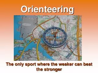
New technologies in making orienteering maps. Orienteering maps in general. Orienteering maps are one of the very few types of maps which have the same specification all over the World. Theoretically there are no national deviations, practically there can be some, but these are no t relevant.

E N D
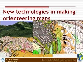
New technologies in making orienteering maps Zentai: New technologies in making orienteering maps
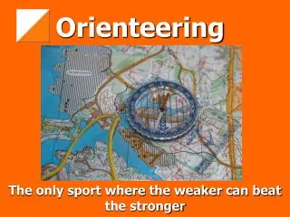
Orienteering maps in general Orienteering maps are one of the very few types of maps which have the same specification all over the World. Theoretically there are no national deviations, practically there can be some, but these are not relevant. Every country inspires their mapmakers to use the international orienteering map specifications not to make disadvantages for the national competitors. Zentai: New technologies in making orienteering maps
Orienteering maps in general 1 Generally the mapmakers of orienteering maps are not professional cartographers and to help their work or even make it possible they have to have basemaps, which can be „normal” large scale (preferably 1:10000 or larger scale) topographic maps or special photogrammetric plots. Zentai: New technologies in making orienteering maps
Orienteering maps in general 2 • The general scale of normal (foot-orienteering maps) is 1:15000, which used to enlarge to 1:10000. • Ski-orienteering maps: 1:10000-1:20000 • MTBO maps: 1:10000-1:20000 • Trail-o maps: 1:4000-1:5000 • Sprint orienteering maps: 1:4000-1:5000 Zentai: New technologies in making orienteering maps
Basemaps for orienteering maps Even the orienteers access good and up-to-date base maps in several countries mapmaking for orienteering requires lot of real fieldwork (made by orienteers), much more than in any other ordinary (topographic-like) maps. Depending on the quality of the available base maps the mapmakers regularly spend 20-30 hours on every square kilometre (foot-o maps). The quality of the basemaps affects considerably the time mappers spend on the terrain. • We can choose the most effective method: • spend more money on good base maps or • spend more time with fieldworking. Zentai: New technologies in making orienteering maps
Topographic maps as basemaps State topographic maps can be basemaps of orienteering maps if the scale is appropriate. In many countries the largest possible scale of state topographic maps is too small so in these countries the orienteers are looking for alternative solutions. Zentai: New technologies in making orienteering maps
Topographic maps as basemaps For other orienteering disciplines (ski and mountain-bike) little bit smaller scales (1:20000) can be also appropriate and the perfect accuracy of each features are not so important. The competitors in ski-orienteering and mountain-bike orienteering events can use only the path/track system so the accuracy of other elements is not so relevant (or even not represented if they are not visible from the paths/tracks). Zentai: New technologies in making orienteering maps
Topographic maps as basemaps The trail-orienteering discipline uses the map specification of the shortest form of foot-orienteering, called sprint orienteering. For sprint maps the base maps can be cadastral maps (1:1000-1:5000 scales) or very large scale state topographic maps (1:5000). Because these terrains are mostly urban or park areas we have good chance that these areas have are already been surveyed on very large scale topographic and cadastral maps. Zentai: New technologies in making orienteering maps
Airphotos as basemaps In some countries where state topographic and cadastral maps are not available in suitable scales the orienteers are looking for alternatives. Air photos or orthophotos are commonly accessible on these countries and special services are offered for making stereo photogrammetric plots with detailed contour lines. Zentai: New technologies in making orienteering maps
Photogrammetric plots as basemaps More expensive, but give lot of details … Zentai: New technologies in making orienteering maps
Airborne laser scanningas basemaps Airborne laser scanning is a remote sensing technique which measures the round-trip time of emitted laser pulses to determine the topography of the Earth’s surface (an active sensor measures the distance from the sensor to the ground on which the laser beam is reflected). Airborne laser scanning is a rapidly growing technology which has initially been conceived for topographic mapping. Zentai: New technologies in making orienteering maps
Airborne laser scanningas basemaps Zentai: New technologies in making orienteering maps
Airborne laser scanningas basemaps DTM (2,5m) Photogr. (5m) O-map (5m) DTM (1m) DTM (2,5m) Photogr. (5m) Map (5m) DTM (1m) Zentai: New technologies in making orienteering maps
Airborne laser scanningas basemaps • Advantages of laser airborne scanning for orienteering maps: • Saving of time in the terrain because of its availability without interruption and preciseness. • Time consuming work to find suitable photogrammetric pictures are not any more necessary. • Significant reduced costs compared to photogrammetric base maps (if the raw data already available). • Combination with orthophotos is easy. • The only disadvantage of laser airborne scanning is that detailed contour relief of raw data could easily lead to an overcrowded and badly generalized map image. Zentai: New technologies in making orienteering maps
GPS in orienteering mapping Orienteering maps are not regularly “georeferenced”, which means that only very few of these maps were fit to known projections and/or datum. Theoretically the orienteering maps using the same projection/datum as the original base maps, but as the time was going and the old maps were updated, new areas were added more and more small distortions were incorporated the maps. Practically if we try to use GPS measurements and fit them to the orienteering map we have to “georeference” the orienteering map first. The “unreferenced” orienteering maps were suitable for the events, because the inaccuracies were distributed on the whole area of the map and these failures don’t affected the navigation of the competitors who use only the orienteering map and compass on the terrain. Absolute positional accuracy is of little significance compared to relative accuracy and proper representation of terrain shape and features. Zentai: New technologies in making orienteering maps
GPS in orienteering mapping The number of orienteering mapmakers doesn’t increase, they may have less and less time for fieldworking and using GPS may help them to make their work more efficient. What are the main advantages of using GPS? • They are definitely more accurate than traditional mapmaking techniques (pace counting, bearing). • Absolute positions are very helpful to improve mapping, and to save minimum 25% off the fieldwork time. • Easy to see the basemap errors and uncertainties. • Sharing mapping work with non-mappers: we can ask “simple” orienteers to collaborate in measuring, they may help to complete the basemaps. It is especially useful on terrains which are frequently used for training, where the orienteering activities and continuous and orienteers visit all part of the terrains. Zentai: New technologies in making orienteering maps
GPS in orienteering mapping Differential GPS correction gives advantages (more precise measurements), but requires more skills (devices) and probably more investment. For orienteering mapping the real-time differential correction is not essential, but post-processing can be useful. Nevertheless the general accuracy of semi-professional GPS devices is already good enough for orienteering mapping if we are familiar with the technology. Zentai: New technologies in making orienteering maps
GPS in orienteering mapping Professional orienteering mapmakers have different approach to the GPS technology: • A GPS device is used an early stage of the fieldwork; but, if we have a good base-map, it is not that important whether we use GPS or not. • • Semi-professional GPS receiver is used in the initial stage of mapping. The mapmaker covers the terrain with the GPS receiver, recording anything that looks worthy, adding extra data: paths, cliffs, all kinds of point and line features. Differential corrections used as post-processing, and the data can be imported into the drawing programme. This enhanced map will be used as basemap of the fieldworking. • • On-line differential correction is used on the terrain with the orienteering map drawing software on a wearable PC, with a sunlight-readable screen. The main disadvantage of this hardware is not only the price but the lack of long time lightweight power supply (mappers regularly spend 8-10 hours on the terrain). Zentai: New technologies in making orienteering maps
GPS in orienteering mapping Zentai: New technologies in making orienteering maps
Other devices in orienteering mapping Mapmakers can use other special devices on the terrain, like laser range finder, clinometer but using these devices are not wide-spread and doesn’t effect the process of mapmaking dramatically. Using these devices may increase the accuracy of terrain measurements or may fasten the time of measurement. These devices must be small enough, easily usable on the terrain even in difficult weather conditions. Zentai: New technologies in making orienteering maps
Comparison of basemap data Based on Kotylo, 2002 Zentai: New technologies in making orienteering maps
Drawing orienteering maps Orienteering maps are special because the text features are not essential elements of the map. These elements can be supplementary, but they don’t really increase the usability of the maps for the competitors. The Swiss Hans Steinegger released the first version of his OCAD software in 1988-89 and nowadays about the 95-98% of orienteering maps are drawn with this software all over the World. OCAD is now a map production software sold in more than 60 countries and it is not anymore used only for drawing orienteering maps, the professional version is able to create other types of maps and is able to handle GIS files. The user-friendly environment of the software makes the map drawing relatively easy even for beginners who are not familiar with any type of computer software. Zentai: New technologies in making orienteering maps
Drawing orienteering maps: OCAD Zentai: New technologies in making orienteering maps
Drawing orienteering maps: Map Studio Zentai: New technologies in making orienteering maps
Alternative printing techniques The development of colour printing technologies, the price reduction of good quality colour laser printers made the colour printing technology more affordable. The number of offset printed orienteering maps is continuously decreasing and the number of non-offset printed maps is increasing. The main factor of this change is not simply financial, but the opportunity to make very late updates on the maps and/or control the whole printing process by the mapmaker/drawer. Zentai: New technologies in making orienteering maps
Alternative printing techniques It is evident that the quality of spot colour offset printed maps is the standard and non-professional colour printers are not able to reach this quality (thin contour lines are not sharp enough with colour laser or inkjet printers for the fast runners). Sometimes the two methods are combined, the maps are offset-printed, but the competition courses are overprinted by colour printers (which makes the map sizes standardized to A4 or A3 sizes). The development of colour printing technologies will continue and the quality of digital printed maps can approximate the quality of spot colour offset printed maps. Zentai: New technologies in making orienteering maps
Summary New techniques are useful only when we can improve the quality of our products or we can make the mapmaking process fast or more efficient. It is a danger of these new technologies to add more and more details to the map if we can enrich the basemaps with these details to inspire the mapmakers to transfer these features from the basemap to the final orienteering map. The complex application of available techniques can be the best approach: depending the terrains and the available basemaps the mapmakers have to collect all available information and use the most relevant ones. It is no matter which kind of future techniques will be invented, but making orienteering maps will maintain the classic job of fieldworking. Zentai: New technologies in making orienteering maps
Thank you for your attention László ZENTAI Eötvös Loránd University Department of Cartography and Geoinformatics Pázmány Péter sétány 1/A 1117 Budapest, HUNGARY Tel. + 36 1 3722975 Fax + 36 1 3722951 Email: laszlo.zentai@elte.hu Web site: http://lazarus.elte.hu Zentai: New technologies in making orienteering maps