Download
1 / 29
290 likes | 307 Vues
This presentation explores the power of Geographic Information Systems (GIS) in libraries. It discusses the origins of GIS, the concept of computer cartography, and the benefits of using a GIS. It also explains the various applications of GIS in different fields and the evolving nature of the GIS profession. Additionally, it highlights the components of a GIS, including people, technology, data, and data presentation. Lastly, it introduces the role of a GIS librarian and their responsibilities in collecting, organizing, and disseminating geographically referenced data in libraries.

E N D
The Potential ofGeographical InformationSystems (GIS)in Libraries Presented by Teri Ann Arion 24 February 2006
The Power of Mapping • The origins of GIS were in the overlay method • Before the widespread availability of computers this effect was first achieved using a base paper map and then physically overlaying transparent printouts on top
When did GIS begin? • What is now the GIS field began around 1960, with the discovery that maps could be represented with simple computer programming code stored in a computer for later modification to the map
Computer Cartography • Early versions of GIS involved simple lines representing land features • Later, the concept of overlaying different map features on top of each other was used to investigate patterns and causes of spatial phenomenon
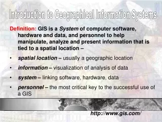
What is a GIS? • Geographic information systems are computer-based systems that facilitate the input, storage, manipulation and output of geographically referenced data
What Drives a GIS? • The driving force behind a GIS is its ability to integrate spatial information with higher end statistical and analytical processes • GIS allows the user to link location or spatial data with tabular data in order to see relationships and patterns to derive patterns not readily apparent to the observer
Why use a GIS? • In a nutshell, if you have a question, a map, tabular data, a computer, and a GIS software application, you can utilize GIS to answer your question
Who uses GIS? • GIS are rapidly becoming the essential tools of analysis at all levels of public- and private-sector management, administration and planning • People with the skill to use GIS are in demand across a broad range of professions, in government, business and nonprofit organizations
How are GIS used? • GIS provides a set of tools for planning, decision-making, operations management and inventory • GIS is now being employed in a wide range of applications including urban and regional planning, environmental risk analysis, forest management, hazard analysis, emergency response, marketing, transportation planning, wildlife management, agriculture, and health care management
The GIS Profession Evolves • While other occupations are aged, tested, and refined, the field of GIS is young and growing • GIS has rejuvenated other professions that were once set in their ways and as a result, there has been a merger between GIS and other professions
GIS Technology Evolves • In the case of GIS, it is necessary to understand basic geographic concepts in addition to developing specialty knowledge: • various software packages, programming languages, and hardware are used • vast amounts of new data requires data management systems
Components of a GIS • People • Technology • Data • Data Presentation
People as GIS Components • It is the knowledge that people carry that makes them important • In order to properly function as a GIS professional it is necessary to have at least a general knowledge of geography and GIS
GIS Technology Component • Technological necessities for today’s GIS include: • Software • Hardware • System Administration • Database Administration • Programming
GIS Software Component • May include products from ESRI, MapInfo, or AutoCAD (many other companies produce GIS products as well) • As GIS evolves, technicians and analysts must be proficient in using more than one GIS application
GIS Data Component • Data includes any information that is spatial or tabular that relates to geography and specialty fields, for example: • parcels, crime statistics, or volcanic activity • Quality and accuracy of data is important and should always be considered • Metadata, or the data about data, is very important as more data becomes available
GIS Data Presentation Component • Representation of space and time can take the form of maps, graphs, charts, animations, and simulations • Visualizing aspects in 3D or using creative symbology gives users new perspectives and can enable a higher level of communication • The World Wide Web offers a forum for interactive mapping
GIS Specialty Fields • There is a need for GIS users to be able to make specific queries and analyses best conceptualized with a specialized knowledge base • As a result, GIS Specialists are learning specialized and focused fields while people in specialized fields are learning to use GIS
What is a GIS Librarian? • A GIS Librarian is a library professional with knowledge of GIS data models, concepts, techniques, technologies, and information and library science, and who can apply this knowledge in collecting, organizing, disseminating, and preserving geographically referenced data, providing general help in GIS reference and in displaying geospatial data
What Does a GIS Librarian do? • Technical Services aspect: • metadata, cataloging, and selection • Public Services aspect: • depends on the resources (people and dollars) of the library • depends on the Mission of the library
GIS in Library Public Services • Suppose a student comes to the library reference desk needing to create a map detailing the moose population for Anchorage • Let's also suppose that this student knows little about GIS except hearing that GIS is a wonderful tool
GIS in Library Public Services • This is something that would take a GIS Librarian no more than 15 minutes to do for the student • Not every library has someone on staff who can help with GIS • Or, should the student learn the skills and resources necessary to create the map on their own? • Who or where should this student bereferred?
GIS in Library Public Services • Some libraries are more in the teaching mode, offering GIS workshops, one-one instruction, and in depth project assistance • These libraries likely have librarians that are on par with GIS Technicians and are GIS savvy, devoting the bulk of their day primarily to GIS and/or maps
GIS in Library Public Services Reality: • Most libraries do not have titled 'GIS' Librarians • Most librarians have subject specialty/liaison duties of which GIS may be just one small part • individual GIS instruction is just not practical or feasible for most libraries
GIS Services in Libraries • If a library chooses to provide a GIS service beyond collecting GIS data, the library staff, and their library administration must acknowledge, that a high end service is being offered
GIS Services in Libraries • Being able to assist users with the functionality of a GIS and the ability to work with digital datasets is very different than providing bibliographic instruction on how to use a bibliographic database or providing reference assistance to determine whether the library owns a particular title
Marketing GIS to Libraries • GIS needs to be marketed not only to reference librarians, but library administrators, as a management tool • Libraries won’t adopt GIS until they understand that it has a management application that offers real value to libraries, and that library directors could be using GIS for their own planning processes
GIS in Library Strategic Planning • Analyze patterns of patron use in their libraries and branches using GIS tools to answer questions: • What areas of the community are the patrons coming to use library services? • What are the characteristics of the populations served by each library? • Do the materials used vary by area served?
Learn More About GIS There are many websites where you can learn more about GIS and other geospatial technologies, for example: http://www.gis.com http://www.esri.com/industries/libraries/index.html http://www.gisportal.com http://www.giscafe.com