Download
1 / 19
200 likes | 414 Vues
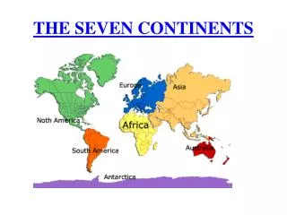
South Asia: Landforms & Resources. South Asia-region includes India, Pakistan, Bangladesh, Bhutan, Nepal, Sri Lanka, & the Maldives. South Asia is sometimes called a subcontinent-large land mass that is smaller than a continent. India dominates the region.

E N D
South Asia-region includes India, Pakistan, Bangladesh, Bhutan, Nepal, Sri Lanka, & the Maldives.
South Asia is sometimes called a subcontinent-large land mass that is smaller than a continent. • India dominates the region.
South Asia is about half the size of the U.S., it has more than 1 billion inhabitants! • One fifth of the world’s population.
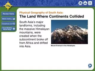
Natural barriers help separate the South Asian subcontinent from the rest of Asia. • Himalayas in the north.
South Asian peninsula extends into the Indian Ocean • Bordered by the Arabian Sea on the west & Bay of Bengal on the east.
Himalayas are a system of parallel mountain ranges. • They contain the world’s highest mountains.
Stretch for 1,500 miles & form a giant barrier between the Indian subcontinent & China.
Mt. Everest-world’s tallest peak sits at the heart of the Himalayas.
The Hindu Kush are mountains that lie at the west end of the Himalayas. • Form a rugged barrier separating Pakistan from Afghanistan to the north.
The Karakoram Mountains rise in the northeastern portion of the chain. • Home to the 2nd highest peak, K2.
Vindhya range is in central India. • To the south lies the Deccan Plateau. • This large tableland tilts east, toward the Bay of Bengal, & covers much of southern India.
The Western Ghats & the Eastern Ghats flank the Deccan plateau, separating it from the coast. • They block most moist winds & keep rain from reaching the interior. • Deccan is a largely arid region.
The North Indian or Indo-Gangetic Plain lies between the Deccan Plateau & the northern mountain ranges. • Large lowland region stretches across Northern India & into Bangladesh. • It is formed by 3 great river systems: Indus, Ganges, & Brahmaputra.
Fertile Plains • These rivers play a key role in supporting life in South Asia. • Waters provide crucial irrigation for agricultural lands. • Carry rich soil & deposit this soil on alluvial plains.
Indo-Gangetic Plain is one of the most fertile farming regions in the world. • It is also the most heavily populated part of South Asia.
Two island groups are also countries of South Asia. • Sri Lanka is located in the Indian Ocean just off India’s southern tip.
The Maldives island group is situated farther off the Indian coast to the southwest. • The Maldives comprise an archipelago or island group, of more than 1,200 small islands