Download
1 / 26
260 likes | 283 Vues
This study aims to analyze the long-term urban dynamics in Lyon, focusing on the interactions between society and environment in the Rhône and Saône alluvial corridor. Using GIS and historical data, the research will examine land use change since 1840, particularly in relation to flood risk.

E N D
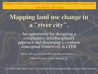
Mapping land use change in a "river city". An opportunity for designing a comparative interdisciplinary approach and discussing a common conceptual framework in LTER Thierry Joliveau, Jean-Paul Bravard, Bernard Dupuis (1) Charles Redman, Cathryn Meegan (2) (1) CNRS UMR 5600. France (2) Centre for Environmental Studies. Arizona State University
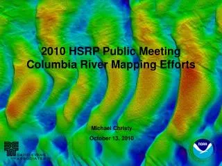
The Lyon Y project • Aim • a geo-historical analysis of the interactions between society and environment in the Rhône and Saône alluvial corridor of Lyon • Context • A “Workshop site” of the “Zone Atelier du Rhône” (ZABR), • supports collaborative interdisciplinary research • is intended to provide historical data and information needed by the public and decision-makers to understand the long-term dynamics of the fluvial environment. • First application • a historical and spatial approach of the risk of flood since 1840
Temporal GIS as a collaborative tool • A support for • interdisciplinary research, • multi-field workshops with scientists, decision-makers, stakeholders, public • 3 geographical databases Central area River tract Metropolitan area
GIS Features • General features • Based on GIS capacities to integrate multi-source and multi-scale data • Long term GIS Project (several years) • Geo-referenced to the geographical database of Grand Lyon administration. • Specific methodological approach • Integration of historical maps and data • Temporal dimension of the GIS • Multi-scale articulation (coherence, compatibility) • Collaborative and interdisciplinary context • Metadata, means of diffusion … Historical maps image database
Mapping land use in historical and multi-scale perspective • Historical • Stability of LULC typologies definitions through time? • Same name, different realities ? • Ex.: industry, recreational areas • Multiscale • Center area : • Categories of buildings • River tract : • Categories of land use according to vulnerability analysis • Metropolitan area : • Generalized land cover types
Metropolitan scale • Objective: analyze the long term urban dynamic • Scale of use: between 1:50,000 and 1:100,000 • Error of precision in the localization: 75 m • Minimal area of a surface object: 2,5 ha • LULC relating objects: • Main communication network (roads, railways...) • Generalised land use areas • Census zones
River tract scale • Objective: understand the interactions between society and environment in relation to the river • Scale of use: between 1:20,000 and 1:50,000 • Error of precision in the localization: 25 m • Minimal area of a surface object: 2500 m² • LULC relating objects: • Roads and main streets network • Medium scale LULC areas (ecological assessment, flood vulnerability analysis) • Land use plans and regulations • Objects affecting the geometry of the flood plain
Center area scale • Objective: confront flood and urbanisation dynamics in the middle of the 19th Century • Scale of use: between 1:10,000 and 1:20,000 • Error of precision in the localization: 15 m • Minimal area of a surface object: 1000 m² • LULC relating objects: • Buildings • Blocks • Streets
Progress report • Model/prototype of integration of historical data in Y Lyon • Methodological approach of historical and spatial analysis of the risk of flood • Inventory of the historical maps and plans available • Methodological phase for analysing the changes in land use at the metropolitan scale (1840-2000)
Land use change in the Lyon metropolitan area since 1840 • General aim • Mapping the global urban dynamic to understand the driving forces of river tract evolution • Specific aim • Develop a general method for analyzing land use change in an urban context • LTER Cooperation • Exploratory work realized in collaboration with the Phoenix LTER : • methodological analysis • comparison of 1902 and 1980 topographic maps
Previous works • Projects • USGS Urban Dynamics Research Program • Systematic approach : San Francisco Bay Region, Detroit River Corridor, and Philadelphia-Wilmington … • Phoenix Historic generalized land use project • LTER approach • Philadelphia and Cologne Sinton’s projects • Delaware, Cologne • Using old European topographical maps
Metropolitan scale LULC Database • General questions • Definition of the LULC categories according to the objective of the project and the information available • Stability of categories • “Objective categories” : vineyard and orchards, forest, built-up areas and water; • Integrating information from very heterogeneous maps in scale and semiology • Managing temporal discordances • Specific Y Lyon Project questions • Compatibility of the data between different scales • Elaboration of a topographic maps images database on-screen digitalization
Comparing techniques • Techniques : polygon digitalization, grid or point selection, • Evaluation factors : rapidity, facility, accuracy, limited subjectivity • Point digitalization method adopted
Preliminary results : technical tasks • Improve the formalization of protocols • Precise category definitions and status : • Gardens • Transportation areas • Squares, urban parks status • …
Methodological questions • Map semiology bias (roads width) • Land cover vs. land use • Ex : Large opened areas (airports, military zones, outskirts commercial centers) • Utilization of other topographic map data : • Wetland, ponds, swamps, edges … • Category definitions depends on the goals of the research : • Urban sprawl analysis ? • Geographical analysis of urbanization trends and forms ? • Global ecological evaluation of Land Use change ? • LULC Change analysis methodology options determine many aspects of a research project
Interest of a historical and generalized LULC database • Y Lyon team level • Formalization of the urban sprawl dynamics • Spatial frame for analysing the evolution of interactions between the city and the river corridor • Quantification of the built-up areas • Modelling the spatial diffusion of urbanisation • ZABR level • Providing historical data and information needed by the public and decision-makers to understand the long-term dynamics of the fluvial environment. • Comparing relations between urban growth and river tracts in different Rhone Valley cities • Analyzing the ecological effect of land use changes (fragmentation, disconnections, disturbance, …)
LTER Approach • In search of a more complete and comprehensive model of Human-Ecosystem Interaction, Grimm, Grove, Picket, Redman (2000)
Human-ecosystem Interaction • In a Zone Atelier, an interdisciplinary research involving hydrologists, ecologists, engineers, geographers, historians and sociologists can’t avoid a debate on the Human-ecosystem Interaction • The new general orientation of French Zone Ateliers, which plans to organise the research on a common conceptual base, the anthroposystem, requires discussion of such a conceptual framework
A central parameter • Land use appears as a central factor of the conceptual models allowing integration of the social and ecological systems in an urban environment Grimm, Grove and al. (2000)
Interest of an historical LULC database • Despite (or because) of its (false) simplicity, LULC mapping could be the first step to a conceptual exchange about Urban Ecological Systems in an interdisciplinary context • The history of LULC change is a key to the understanding of human activities dynamics • The comparative approach proposed could facilitate the common conceptual work which is needed between LTER teams.
Conclusion • An harmonized LULC mapping method could (simply) contribute to the cooperation between different urban LTER projects • a comparative approach of relations between urban growth and river tracts • a conceptual framework to studies of urban ecological systems