Download
1 / 19
200 likes | 407 Vues
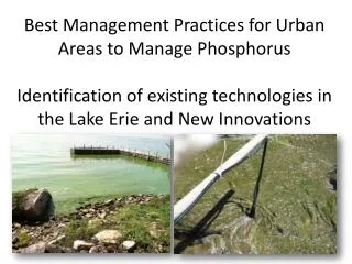
EcoFore: Assessing the causes, consequences and remedies for hypoxia in Lake Erie. Ecosystem Forecasting of Lake Erie Hypoxia. What are the Causes , Consequences , and Potential Remedies of Lake Erie Hypoxia? Linked set of models to forecast: changes in nutrient loads to Lake Erie

E N D
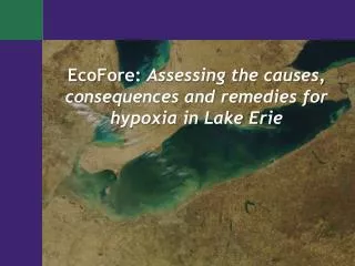
EcoFore: Assessing the causes, consequences and remedies for hypoxia in Lake Erie
Ecosystem Forecasting of Lake Erie Hypoxia • What are the Causes, Consequences, and Potential Remedies of Lake Erie Hypoxia? • Linked set of models to forecast: • changes in nutrient loads to Lake Erie • responses of central basin hypoxia to multiple stressors • P loads, hydrometeorology, Dreissenids • potential ecological responses to changes in hypoxia
Watershed Modeling David Allan, UM - Lead Nate Bosch, Grace College David Dolan, UWGB Pete Richards, Heidelberg Tom Croley, GLERL Chansheng He, WMU Hypoxia Modeling Don Scavia, UM – PI, co-lead Joe DePinto, LTI – co-lead Dmitry Beletsky, GLERL-UM Dave Schwab, GLERL Tom Johengen, UM Steve Ruberg, GLERL Ecological Effects Modeling Tomas Hook, Purdue - Lead Kristen Arend, Purdue Stuart Ludsin, OSU Ed Rutherford, GLERL Steve Bartell, E2 Consulting Doran Mason, GLERL Steve Brandt, OR Sea Grant Management Partners Roger Knight, ODNR Paul Horvatin, EPA-GLNPO Glenn Warren, EPA-GLNPO Lake Erie EcoFore Team
1D DO Model Findings Time-Series of Annual Calibrated WCOD Values Correlated with SRP Loads (Rucinski, et. al., 2010)
Other LimnoTech Projects in Maumee Watershed and Western Basin of Lake Erie Blanchard and Tiffin River Watershed Models USACE – Buffalo District (516e program) WLEEM (Western Lake Erie Ecosystem Model) USACE – Buffalo District NSF WSC Project
Blanchard River Watershed: Project Overview Fine-scale Watershed Models within the Maumee Basin (6,300 mi2) Objectives • Continue effort to apply fine-scale models to Maumee watersheds (build upon Upper Auglaize) • Use AnnAGNPS model • Quantify sediment and nutrient loading • Evaluate land management alternatives to estimate potential benefit in reduced loading • Support broader sediment and nutrient modeling efforts of the lower Maumee River and Maumee Bay Funding: USACE-Buffalo under 516(e) authority in WRDA Timeline: Jul 2009 to Oct 2010
Blanchard River Watershed Population : 91,266 Area : 771 miles2 6 major subbasins within 6 counties Low slope (typically < 2%) Poorly drained soils (42% hydric) Cropland > 80% (Beans, Corn, Wheat) Drains into the Auglaize River
Comparison of Extent of Ephemeral Gully Erosion (8/21/2007) Ephemeral Gullies “Off” Ephemeral Gullies “On”
Sediment Alternative Scenario Results Base versus Combined Management • Random 10% cropland conversion = -2% • Targeted 10% cropland conversion = -54% • Combined management = -60%
Tiffin River Watershed • 778 Square miles • 44% in MI, 56% in Ohio • Agriculturally dominated watershed • 66.5% cropland, 20% pasture • Major crops include beans, corn, wheat • Livestock production • Tiffin River is ~110 miles long • Major tributaries - Lick Creek, Brush Creek, Beaver Creek, Mill Creek, and Bean Creek. • Primary sources of impairment include siltation, habitat alteration, and organic enrichment/low dissolved oxygen
Objectives of Tiffin Modeling Effort • Continue effort to apply fine-scale models to watersheds within the Maumee Basin (e.g., Upper Auglaize, Blanchard, Tiffin) • Use SWAT at fine scale (NHD+ scale) • Add ephemeral gully erosion algorithms to SWAT • Quantify sediment and nutrient loading from the Tiffin River watershed • Determine spatial and temporal distribution of sediment and nutrient sources in the watershed • Estimate potential benefits of improved land management • Support broader sediment and nutrient modeling efforts of the lower Maumee River and Maumee Bay • Funded by USACE-Buffalo under 516(e) • NRCS, 2009
WLEEM Model Objectives(NSF WSC Project) • Original model developed under funding from USACE-Buffalo District • Model ecological response of Western Basin of Lake Erie to external (Maumee Watershed) and internal (wind-driven resuspension) sources: • Sediment sedimentation and turbidity • Nutrients nuisance & harmful algal blooms • Support WSC Great Lakes Project: • Link with watershed modeling computation of sediment and nutrient load response to climate change driven extreme events • Simulate surface water quality responses to climate change driven extreme event scenarios developed by Climate Change and Human Response and Adaptation teams • Support Education and Outreach activities and products
Western Lake Erie Ecosystem Model (WLEEM) Framework EFDC Model “Simulating Waves Nearshore” (SWAN) Hydrodynamic Sub-Model Hydrodynamics • Water level • Current velocity Wind-Wave Sub-Model • Current velocity Wind-Waves • Significant height • Direction • Frequency Shear Stress Sediment Transport Sub-Model Nutrient & Eutrophication Sub-Model (A2EM) Water Quality Linkage • Flows • Suspended solids • Settling/resuspension rates
Phosphorus Cycling in WLEEM Filtering Release of PO4 Feces/Pseudofeces Deposition Solar Radiation External P Loads (SRP, PIP, POP) SRP <-- > PIP POP mineralization Release of PO4 Uptake of PO4 Upper Trophic Levels Predation Grazing Zooplankton Phytoplankton Decay and Mineralization - release of PO4 Exchange with Offshore Phytoplankton Settling Fecal Pellet Settling Resuspension Lyngbya , Other Benthic Algae Particulate P Settling Diffusive Exchange
Baseline (calibration) run of TP spatial distribution on July 12, 2004
Same model run with 40% reduction in Maumee River TP load (July 12, 2004)
Miles from Waterville Lateral Averaging Area
Monthly Average TP and Chlorophyll- August 2004 40% Reduction of Maumee River 40% Reduction of Detroit River Baseline River Bay Western Basin
NSF WSC team plans to run WLEEM for 2011 Taken by Richard Kraus, USGS, Great Lakes Science Center - October 10, 2011 8/17/2011 979 cfs