Download
1 / 18
180 likes | 340 Vues
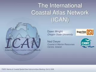
The International Coastal Atlas Network (ICAN). Dawn Wright Oregon State University. Ned Dwyer Coastal & Marine Resources Centre, Ireland. FGDC Marine & Coastal Spatial Data Subcommittee Meeting, Oct 8, 2008. Outline. Outline Background Strategic Aims Membership Workshop 3

E N D
The International Coastal Atlas Network (ICAN) Dawn Wright Oregon State University Ned Dwyer Coastal & Marine Resources Centre, Ireland FGDC Marine & Coastal Spatial Data Subcommittee Meeting, Oct 8, 2008
Outline • Outline • Background • Strategic Aims • Membership • Workshop 3 • Prototype • ICAN Future • Conclusion • Background • Strategic Aims • Current Membership • ICAN Workshop 3 • Interoperability Prototype • Strategic Directions • Conclusion FGDC Marine & Coastal Spatial Data Subcommittee
Background: Intellectual Merit • Outline • Background • Strategic Aims • Membership • Workshop 3 • Prototype • ICAN Future • Conclusion • Issues of regional governance, coordination • Significant capacity, varying approaches • Best practices? • Widespread solutions needed • Access to and documentation of data • Integration of tools • Decision support for coastal mgmt via atlases • “Semantic interoperability” FGDC Marine & Coastal Spatial Data Subcommittee
Emergence of “Coastal Web Atlases” • Outline • Background • Strategic Aims • Membership • Workshop 3 • Prototype • ICAN Future • Conclusion “A collection of digital maps and datasets with supplementary tables, illustrations, and information that systematically illustrate the coast, oftentimes with cartographic and decision support tools, all of which are accessible via the Internet.” (O’Dea et al., 2007) Coastal Zone Management, Governance Governments, NGOs, Citizen Groups FGDC Marine & Coastal Spatial Data Subcommittee
Emergence of “Coastal Web Atlases” • Outline • Background • Strategic Aims • Membership • Workshop 3 • Prototype • ICAN Future • Conclusion Marine Irish Digital Atlas, mida.ucc.ie Oregon Coastal Atlas, www.coastalatlas.net FGDC Marine & Coastal Spatial Data Subcommittee
Oregon Coastal Atlas, USA MIDA, Ireland De Kustatlas, Belgium Magic, UK NOAA Digital Coast, USA And many MORE …
Background: Workshop 1, Cork, Ireland • Outline • Background • Strategic Aims • Membership • Workshop 3 • Prototype • ICAN Future • Conclusion • To create & strengthen relationships between experts in marine & coastal mapping in North America and Europe • To identify state of the art approaches to coastal mapping and informatics FGDC Marine & Coastal Spatial Data Subcommittee
Background: Workshop 2, Corvallis, USA • Outline • Background • Strategic Aims • Membership • Workshop 3 • Prototype • ICAN Future • Conclusion • Improve searches between atlases • metadata to ontologies • Marine Metadata Interoperabilty • Semantic interoperability • Linkages to use cases, communities • Proof-of-concept ontologies & interoperability prototype • Large, collaborative funding proposals FGDC Marine & Coastal Spatial Data Subcommittee
ICAN Strategic Aims • Outline • Background • Strategic Aims • Membership • Workshop 3 • Prototype • ICAN Future • Conclusion • Share experiences and find common solutions to coastal web atlas development • Knowledge portal:Guides, cookbooks, “engines”, discussion boards, code, use cases… • Globally integrate and interoperate among locally-maintained atlases • Inform regional decision- and policy-making across several themes: • Climate change - coastal vulnerability • Coastal governance (boundaries, protected areas, etc.) • Coastal hazards • Population pressures • Marine spatial planning • Resource availability and exploitation FGDC Marine & Coastal Spatial Data Subcommittee
Current Membership • Outline • Background • Strategic Aims • Membership • Workshop 3 • Prototype • ICAN Future • Conclusion FGDC Marine & Coastal Spatial Data Subcommittee
Workshop 3, Copenhagen, July 2008 • Outline • Background • Strategic Aims • Membership • Workshop 3 • Prototype • ICAN Future • Conclusion • Advance actions in: • Technical developments • Review of interoperability prototype • Strategic directions • Governance structure • Welcome new members • Link to European relevant activities • Full proceedings at ican.science.oregonstate.edu FGDC Marine & Coastal Spatial Data Subcommittee
Global atlas Local atlases Interoperability Prototype • Outline • Background • Strategic Aims • Membership • Workshop 3 • Prototype • ICAN Future • Conclusion • Integrate and facilitate access to several distributed & heterogeneous coastal atlases … FGDC Marine & Coastal Spatial Data Subcommittee
Technical Developments • Outline • Background • Strategic Aims • Membership • Workshop 3 • Prototype • ICAN Future • Conclusion • Focus on coastal erosion as a use-case • Overarching view : vulnerability of coastal communities to climate change • Key Future work on prototype • At least 6 new nodes • Implement OGC WMS on all • Implement WFS on advanced subset FGDC Marine & Coastal Spatial Data Subcommittee
Strategic Directions • Outline • Background • Strategic Aims • Membership • Workshop 3 • ICAN Future • Conclusion • Clarified vision and goals of ICAN • Identified a range of key activities in following areas: • Technical project development • Awareness raising and publicity • Outreach and training activities • Documentation of resources, tools, expertise • Development of ICAN portal FGDC Marine & Coastal Spatial Data Subcommittee
Governance Structure • Outline • Background • Strategic Aims • Membership • Workshop 3 • ICAN Future • Conclusion • Generated Document outlining: • Committee structure • Governance activities • Pathway towards a sustainable funding model • Develop a transition plan from ad-hoc steering to formalized governance FGDC Marine & Coastal Spatial Data Subcommittee
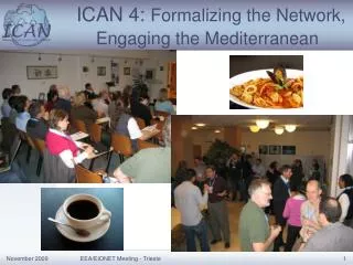
ICAN Workshop 4 • Outline • Background • Strategic Aims • Membership • Workshop 3 • Prototype • ICAN Future • Conclusion UNESCO University Trieste, Italy Autumn 2009 FGDC Marine & Coastal Spatial Data Subcommittee
For More Information… • Outline • Background • Strategic Aims • Membership • Workshop 3 • Prototype • ICAN Future • Conclusion Workshop 1 in Cork, Workshop 2 in Corvallis • workshop1.science.oregonstate.edu Workshop 3 in Copenhagen • ican.science.oregonstate.edu ICAN Interoperability Prototype • ican.ucc.ie FGDC Marine & Coastal Spatial Data Subcommittee
Acknowledgments U.S. National Science Foundation Irish National Development Plan Marine Institute (Ireland), Marine RTDI Networking & Technology Transfer Initiative European Environment Agency Oregon Coastal Mgmt Program FGDC Marine & Coastal Spatial Data Subcommittee