Download
1 / 10
100 likes | 119 Vues
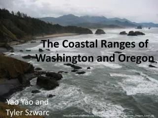
Oregon Coastal Atlas. Tanya C. Haddad, Oregon Coastal Management Program CoastGIS 2013, June 16, 2013, Victoria, BC. Background. The Oregon Coastal Atlas is a venue for sharing data, information and analysis tools with decision makers and constituents of the Oregon coastal zone.

E N D
Oregon Coastal Atlas Tanya C. Haddad, Oregon Coastal Management Program CoastGIS 2013, June 16, 2013, Victoria, BC
Background • The Oregon Coastal Atlas is a venue for sharing data, information and analysis tools with decision makers and constituents of the Oregon coastal zone. • Entire Oregon coastal zone which encompasses the full drainages of the coast range (except the Columbia, Umpqua and Rogue basins) , plus 3nm Territorial Sea & ocean stewardship area http://www.coastalatlas.net
History • Oregon Coastal Atlas Project launched 2001 • Multi group project involving Oregon State University Geosciences, Ecotrust and Oregon Coastal Management Program • Funded initially by NOAA CSC, NSF, FGDC. Now maintained by OCMP. • Initial version was active 2001 to 2006 • Saw considerable growth over that period • Many significant changes occurred in both the tech and user communities • OCMP became main steward, and version 2.0 was 2007 to 2012 • Recently revamped to Atlas 3.0 • New work focusing on exposing data archive via services • Upcoming replacement of main map interface • Always adding new data http://www.coastalatlas.net
Function • What do people do with the Coastal Atlas? • Search • Learn • Tools • Map http://www.coastalatlas.net
Quick Tour http://www.coastalatlas.net
Technology MapServer OpenLayers Dojo GeoMoose MySQL MapServer PostGIS OpenLayers etc. PHP MySQL GeoNetwork PHP MySQL MapServer Joomla! CMS: PHP, MySQL
MySQL Server PostgreSQL Server w/ PostGIS Sharing the Data Catalog OR Spatial Data Library FGDC CSW Some users only want data (& metadata) Requires a catalog application to manage documented resources New focus on enabling services ICAN Portal v 3.0 GeoNetwork
Oregon Data Network • Oregon Coastal & Marine Data Network • An approved framework team (FIT) • Our aim is to support the community of producers and users of Oregon coastal and marine data to proactively address emerging data needs. http://www.coastalmarinedata.net
Regional Activities • Much is happening at the west coast regional level • Over the coming year these activities are increasing as the west coast data network becomes more active • There are opportunities for funding to connect data products to the emerging regional portal • More work ahead… Weare here!
Thanks! tanya.haddad@state.or.us Tanya C. Haddad, Oregon Coastal Management Program