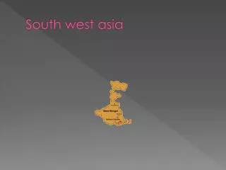
South West Asia
140 likes | 318 Vues
South West Asia. The “Middle East”. Why is Southwest Asia called the Middle East?. It was in the middle of the route to the East!! The first major trade route was the Silk Road into China and India, the only way to get there was through the Middle, The Middle East!!!!!!!.

South West Asia
E N D
Presentation Transcript
South West Asia The “Middle East”
Why is Southwest Asia called the Middle East? • It was in the middle of the route to the East!! • The first major trade route was the Silk Road into China and India, the only way to get there was through the Middle, The Middle East!!!!!!!
Trade Routes of the Ancient World This is why Arabia was called “The Middle East?”
Middle East Geography • 1. Location • Impacts: a. Access to the products from Asia (India-China). • b. Tremendous economic growth before an all water route was discovered. • All traders had to go through the Middle East to trade with Asia.
c. Advanced technology and civilization. Due to Cultural Diffusion (the sharing of Ideas) • d. Cultural diversity. Many people moved to this region to be closer to the wealth. As a result, there were many foreigners that moved to the middle east. • e. Easy to invade. There were no natural barriers like mountains to protect them from invasion.
How many Rivers do you see?What is the impact of these Rivers on the Middle East?
2. Rivers: The Nile, Tigris, and Euphrates • Impacts: • a. Good agricultural development. • b. Easy access to trade. • c. Population distribution near the rivers. The River valley regions are very DENSELY populated. (very crowded) • 3. Climate:Arid, 75% of the Middle East receives less than 10" of rain a year. • Impacts: • a. Overpopulated (not enough food to feed their people) • b. Fertile land is densely populated.
How do these mountains impact the people of the Middle East?
Impacts of Mountains: • a. They prevent moisture (clouds) from reaching the interior. Deserts are on the opposite side of the mountains. • B. Made it difficult to invade across the mountains.
6. Topography: 90% of the Middle East is desert, Sahara and Arabian.