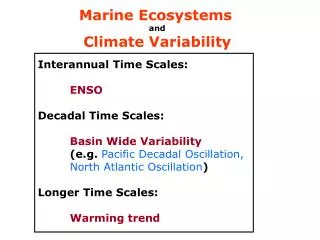
Time scales
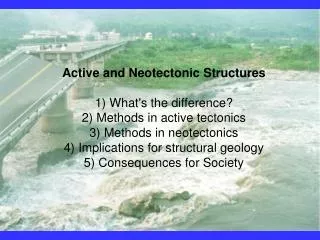
Active and Neotectonic Structures 1) What's the difference? 2) Methods in active tectonics 3) Methods in neotectonics 4) Implications for structural geology 5) Consequences for Society. Time scales .

Time scales
E N D
Presentation Transcript
Active and Neotectonic Structures1) What's the difference?2) Methods in active tectonics3) Methods in neotectonics4) Implications for structural geology5) Consequences for Society
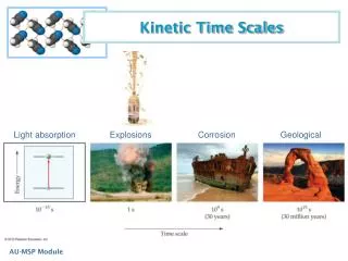
Time scales • Tectonics- study of large scale deformations and Earth evolution processes at scales of millions to tens of millions of years; focus of this class • Neotectonics = thousand to tens of thousand years • Active tectonics = happens during a person's lifetime
Uniformitarianism Present is key to the past Or is it?
Methods in Active tectonics 1) Seismology 2) Measuring recent movements • Surveying • GPS techniques • Radar interferometry
Earthquakes occur all the time- all over the world They produce ground motion (seismic waves), that we can measure
>3000 seismological observatories around the world, continuously recording seismic waves
How long did it take seismic waves to travel from Alaska to Tucson?
Real-time action; Real-time measurement- what can we learn from seismology about structural geology?? 1) Location and depth of faulting (brittle-ductile transition) 2) fault plane solutions- orientation of fault and sense of slip- geometry and kinematics 3) Energy release- size of fault, rupture characteristics- unidirectional, bidirectional, chaotic?
Seismic hazard Bad: destruction of property and life Good? Funding for geology?
The wave of the future-GPS Global Positioning System Satellite navigation system
Accurate and precise knowledge of motion over timescales of years
What we are learning from GPS1) Plate tectonic assumptions OK- but only to first order- Within plate deformation can be huge2) How continents deform during orogenesis- diffuse? plate like?3) What parts of faults are slipping vs. what parts are "locked" up- important for EQ predictions4) unprecedented knowledge of recent movements on Earth
GPS is great, but requires lots of stations and time to wait around. Scientists are greedy- we want more data on ground motion and with less effort- is it possible?
Scientific advancements are simply awesome! Wide-area, high-precision surveying from Space Satellites beam microwave radiation (radar) down on Earth
The Earth reflects back to the satellite microwaves of different phases that yield X,Y,Z information.
Two passes of a satellite with imaging radar over the same area produce two images. The difference between two images provides the displacement field over the entire area (often, 100 km 100 km) between the time of the two passes.
A real example- ground motion due to an earthquake in a thrust belt
Movement of glaciers over six days- think about how many GPS stations would be required to provide this kind of detailed information
Displacement due to an EQ in Turkey. Can also determine displacement in between EQ's!
This technique is called InSAR- for Interferometric Synthetic Aperture Radar. The potential is endless!
It is estimated that a magnitude 8 or larger earthquake in a major metropolitan area, such as Los Angeles or Tokyo would cause more than 40,000 fatalities, up to 250,000 injuries, and $100 billion dollars in damage What else do we need to know to be able to predicts earthquakes?
Study the earthquake cycle- recurrence intervals of major events through neotectonic studies 1) study deformed historic sites of known ages (Great Wall of China) 2) Paleoseismology 3) offset geomorphologic surfaces + surface dating
Paleoseismology San Gorgonio, CA
Paleoseismology: results for one fault system
Fault-scarp profiling- gives displacement and age— as well as other interesting info regarding structure
Laser theodolite for surveying. Gary Axen wishes that a satellite would fly over and beam down those microwaves!
A cheaper way to fly!
Neotectonic mapping 400 m in 10000 yrs 40 mm per year Long term plate motion- 5 cm/yr
The scarp hidden by the waterfall is about 7 meters high. The bridge failed where it crosses the fault to the right a few hundred meters, out of the frame of the photo. It is being reconstructed in the same location.
Assignment Visit the following website: http://quake.wr.usgs.gov/research/index.html http://quake.wr.usgs.gov/research/deformation/modeling/index.html Surf around. Check out the cool animations! Download 4 of your favorite geology-related images. Then email to me (pkapp@geo.arizona.edu). This will be graded as a "What is it quiz".