Download
1 / 24
330 likes | 643 Vues
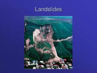
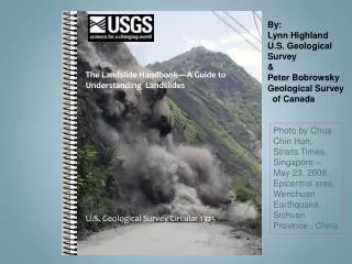
By: Lynn Highland U.S. Geological Survey & Peter Bobrowsky Geological Survey of Canada. The Landslide Handbook—A Guide to Understanding Landslides. Photo by Chua Chin Hon, Straits Times, Singapore – May 23, 2008, Epicentral area, Wenchuan Earthquake, Sichuan Province , China.

E N D
By: Lynn Highland U.S. Geological Survey & Peter Bobrowsky Geological Survey of Canada The Landslide Handbook—A Guide to Understanding Landslides Photo by Chua Chin Hon, Straits Times, Singapore – May 23, 2008, Epicentral area, Wenchuan Earthquake, Sichuan Province , China U.S. Geological Survey Circular 1325
Includes: New photos and information on the deadly Wenchuan Earthquake, Sichuan Province, China Photo by Lynn Highland U.S. Geological Survey
The Purpose of the Handbook : To provide a basic, practical overview of landslide science with provisions and suggestions on reducing hazards from landslides The Target Audience: *Decision-makes in the urban and rural communities around the world. *Written at the level of a layperson’s understanding, initially in English *Plan is to provide translations – French, Spanish, Mandarin and possibly, others.
The U.S. Geological Survey Landslide Information Center (NLIC , Lynn Highland, Coordinator ) It will provide a resource center for those using the book who need help with its contents, and who would like more in-depth information. The NLIC is accessible through a website, email, and toll-free telephone. http://landslides.usgs.gov
The goal is to have several translations of the handbook In areas of variable literacy, Target audience is community leaders Following: Overview of a selection of nations showing primary languages and Literacy Rates:
Language Translation Goals 2. 1. 3a. 3b. 1Encompasses multiple dialects, including Hindi and Urdu. Source: Ethnologue, 13th edition and other sources, 2007
Reason for Book: There was found to be no comprehensive guide to basic landslide Education that included sufficient illustrations or provided a user back-up/support approach *No comprehensive, illustrated landslide handbook aimed at the developing world was found to be in print in English or other languages *Exhaustive literature search to prevent duplication of effort
Part I – Basic Information about landslides Part II – Evaluating and Communicating Landslide Hazard Part III– Mitigation concepts and approaches
Appendices Appendix A -Basic Information About Landslides Appendix B - Introduction to Mapping, Remote Sensing, and Monitoring of landslides Appendix C– Introduction to landslide Stabilization and Mitigation Methods Appendix D- Sample Safety Information for Landslides/Debris Flows – Suitable for Posting and/or Distributing
Types of landslides are presented and described, featuring a graphic representation and an actual photo ROCKFALL
DEBRIS FLOW Leyte, Philippines
Photos and explanations For Rock fall Mitigation
Concrete Debris Flow Catchment Basin (California, USA) Debris-flow Mitigation Techniques Debris-flow retaining wall (Japan)
Handbook Feataures Descriptions of Investigative Tools: *Types of Maps – Susceptibility, Geologic Etc. *Monitoring & Instrumentation Examples *Remote Sensing
Examples of schematics of debris-flow mitigation for the homeowner
4. Landslide Dam mitigation There are many problems encountered when landslides dam waterways. Dams caused by landslides are a common problem in many areas of the world. Landslides can occur on the valley walls of streams and rivers. If there is enough displaced material (rock, soil, and/or debris), to fill the waterway the landslide will act as a natural dam, blocking the flow of the river, creating flooding upstream. As these natural dams are composed of loose, unconsolidated, material they are often inherently weak and may soon be overtopped and will fail, due to erosion. When breaching happens quickly, the backed-up water, rushes down the waterway, causing potentially catastrophic downstream flooding. An example of, and one of the largest landslide dams in the world is the 600-meter-high Usoi landslide dam in Tajikistan. A large earthquake-induced landslide dammed the Murghab River, creating Lake Sarez. The situation is a hazard for people living downstream. Also, future seismic action may cause more landslides to slide into the dammed lake, causing a seiche, (a tsunami-like tidal wave in a lake), which may weaken and/or overtop the landslide dam. Figure 42—Two photos of the Thistle landslide, Utah, USA. This 1983 landslide dammed the Spanish Fork River, backing up water that flooded the town of Thistle. Many landslide dams are much smaller than the one shown here, and can be potentially overtopped or eroded. Some are much larger, and damaged roads and railroad lines must be diverted around the landslide mass, as shown by tunnels at far left of photo on the right. This landslide is too large for removal and it has not overtopped or eroded. It still continues to move from time to time (Photos by Robert L. Schuster, U.S. Geological Survey). See Appendix C for more details on mitigation methods for landslide dams.
Slope Stabilization using vegetation 1. 2. 3. Example of Vetiver Grass as a soil stabilizer – can be grown throughout the world
Sample Safety information for landslides/debris flows suitable for posting and/or distributing. Examples of Signage:
Basic Safety Information for Homeowners and Safety/Emergency Managers *What to do if you suspect imminent landslide danger *What Can You Do If You Live Near Steep Hills? *What Can You Do If You Live Near Steep Hills? *After landslides occur. . .
Book is available for free from the U.S. Geological Survey Publications Warehouse and is in downloadable form on the USGS website http://www.usgs.gov
Thank you for your attention . . . We welcome your opinions and comments! ------The Authors