Download
1 / 8
80 likes | 233 Vues
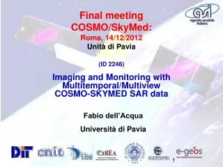
(ID 2246) Imaging and Monitoring with Multitemporal/Multiview COSMO-SKYMED SAR data. Final meeting COSMO/SkyMed: Roma, 14/12/2012 Unità di Pavia. Fabio dell’Acqua Università di Pavia. Purpose and dataset. During the work it has been analyzed different potentialities of SAR dataset:

E N D
(ID 2246) Imaging and Monitoring with Multitemporal/Multiview COSMO-SKYMED SAR data Final meetingCOSMO/SkyMed:Roma, 14/12/2012Unità di Pavia Fabio dell’Acqua Università di Pavia
Purpose and dataset During the work it has been analyzed different potentialities of SAR dataset: Linear Feature Extraction Building height estimation using radar shadows Building vulnerability assessments The output of these algorithms were used to determine parameters, such as footprint of the building and its height, which are critical for assessing e.g. its seismic vulnerability. Test Site:Pavia, Vienna, L’Aquila
Vienna test site – road extraction Example of road network and building extraction
Building height estimation • Building height estimation algorithm in urban areas relies on SAR backscattering; It’s a supervised methodology. • The procedure developed by Pavia is based on the different areas in SAR data Buildings typically consist of three identifiable areas: • layover area, characterized by strong reflection due to double bounce of electromagnetic waves; • roof area, characterized by reflection depending on roof roughness, shape and features; • shadow area, characterized by a “weak” reflection. Each of the three areas is expected to show some degree of inherent homogeneity, which is assumed sufficiently homogeneous. City blocks are outlined by using ancillary (GIS) layers of the same area
Analysis on relationship between: building features and the geometry of their backscatter
Building height extraction Study area Heights estimation Building selection
Vulnerability estimation on L ’Aquila Regular and irregular footprints The considered area around downtown L’Aquila, Italy Example of vulnerability class assignment L’Aquila colors-coded vulnerability classes
Conclusion • In this first phase the algorithms were tested on other COSMO/SkyMed data already in possession of the research team in connection with previous or other ongoing activities. • The results of linear feature extraction appeared satisfactory, although the procedure of merging linear elements to form the footprint of the identified buildings still requires heavy manual intervention. The calculation of the building heights from the shadow length also seems satisfactory, although it highlights some problems in very complex scenes.