Download
1 / 7
90 likes | 102 Vues
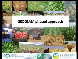
GEOGLAM: Achievements & Planned activities. http://www.earthobservations.org/geoglam. Achievement : GEOGLAM Crop Monitor. Developed in response to G-20, together with AMIS* (end user driven)

E N D
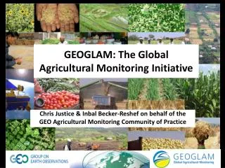
GEOGLAM:Achievements & Planned activities http://www.earthobservations.org/geoglam
Achievement: GEOGLAM Crop Monitor • Developed in response to G-20, together with AMIS* (end user driven) • First time, operational crop condition assessments produced by consensus of the international community (over 30 national and international partners) • Release monthly bulletin highlighting potential hotspots (maps & pie charts of stress / bumper crop) for the four main crops: wheat, corn, rice and soybeans • Operational since September 2013 • Community of practice guiding the research agenda • Developed awareness & demand for RS based information • Next steps • Release best available crop type maps & crop calendars • R&D on RS based crop condition indicators & alerts • Improve charts & maps • Grow the Crop Monitor activity beyond AMIS http://www.geoglam-crop-monitor.org AMIS: Agricultural Market Information System
A Crop Monitor for Countries at Risk Collaborative production among WFP, FAO, FEWS NET, JRC, RADI, WMO & UMD, Prototyping by FEWS NET & UMD Being discussed now: Identification of countries & crops covered Common definitions & thresholds Forecast of trend or future crop condition Platform for data & information sharing Cross-checking & verification of crop condition classifications & any consequent alerts Network expansion to bring in regional & national organizations Under devt: Early Warning Crop Monitor (EWCM) Prototype: Ethiopia, March 2015
Under devt: GEOGLAM RAPP Rangelands and Pasture Productivity sub-task • Objectives: • Global monitoring of dynamics of available plant biomass (nature & quantity), incl. its condition & trends in productivity, as affected by natural & human-induced impacts; • Monitoring of nature & quality of animals that feed on biomass & their protein production • Accurate forecasts of pasture & rangelands productivity declines • Early warning of pasture decline, food production shortfalls Based on spatially explicit biomass dynamics and biomass utilization with: • wall-to-wall satellite data • standardised land-cover mapping approaches, • integrated ground measurements of aboveground biomass • simulation modelling • A meeting coming up in July in Campinas, Brazil – CSIRO/EMBRAPA to advance the work plan See: http://www.geo-rapp.org
A global network of 33 sites R&D to support enhancements for operational agricultural monitoring systems Next 2 years: Multi-site SAR experiment building on Minimum Dataset exercise & NASA and ESA support for SIGMA optical inter-comparison research JECAM: Joint Experiment for Crop Assessment & Monitoring www.jecam.org
Achievements & 2015 Plans GEOGLAM : a global collaborative initiative with already significant achievements… … with a need for continuous support to address monitoring of continuously changing global agricultural issues Asia-RiCE developt of methods (JAXA-ASEAN) Asia-RiCE transfer of methods (JAXA-ASEAN) Asia-RiCEreporting to GCM (JAXA-ASEAN) CB projects in Argentina, Brazil, Mongolia, Pakistan, Ukraina… Early Warning Crop Monitor (FEWSNET) Global Crop Monitor (UMD) Close links with Committee of Earth Observation Satellites (CEOS) 1. Global / Regional System of Systems main producer countries, major commodities National Capacity Building for agricultural monitoring using earth observation 3.Monitoring countries at risk food security assessment Rangelands& PastureProductivity (RAPP-CSIRO) Joint Experiment for Crop Assessment & Monitoring – JECAM (AAFC – UCL) 4. EO data coordination EC FP7 SIGMA project Stimulating Innovation for Global Monitoring of Agri-culture and its Impact on the Environment in support of GEOGLAM (VITO) 5. Method improvement through R&D coordination 6. Data products and information dissemination Data services prototypes developed/ testedNASA/CEOS SEO • ESA projects: • SEN2-FOR-AGRI (UCL)4 Agri. Products + Software + 4 Use cases • GEORICE (CESBIO) • Radar for Ricegrowth monitoring STARS (BM Gates) Spurring a Transfor-mation for Agricul-turethroughRemoteSensing(ITC-UMD) GEONetCast Satellite Broadcasting Mature / On going Emerging or R&D
Much needed support for Regional Coordination… http://www.earthobservations.org/geoglam 7/6 GEOGLAM, Global Agricultural Monitoring