Download
1 / 19
200 likes | 429 Vues
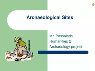
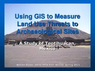
Using GIS to Measure Land Use Threats to Archaeological Sites. A Study of Teotihuacan, Mexico. William Dietze GEOG 596A Peer Review Spring 2011. Presentation Overview. Problem Location of Study Background – PreHispanic Background – Modern Municipios Statistics Conservation

E N D
Using GIS to Measure Land Use Threats to Archaeological Sites A Study of Teotihuacan, Mexico William Dietze GEOG 596A Peer Review Spring 2011
Presentation Overview • Problem • Location of Study • Background – PreHispanic • Background – Modern • Municipios Statistics • Conservation • Controversy • Goals and Objectives • Proposed Methodology • Land Use Categories • Proposed TimeLine • Preliminary Results • Further Work
Acknowledgements • Dr. L.J. Gorenflo Department of Landscape Architecture Pennsylvania State University • Dr. Ian G. Robertson Department of Anthropology Stanford University
Problem Continuing population increases often results in the geographic expansion of urban and developed land. Archaeological sites in and near these cities are a cultural and historical resource which must be balanced against the needs of the communities and preserved for future generations.
Location of Study • Teotihuacan is approximately 45 km northeast of modern Mexico City.
Background – Pre-Hispanic • Teotihuacan is believed to have been built in 100 BCE and reached the height of its population around 550 CE. At its peak it is estimated to have had a population of over 100,000, spanned approximately 20 square kilometers • René Millon’sTeotihuacan Mapping Project (TMP)
Background – Modern • Two municipios(or municipalities, similar to counties in the US) overlay the extent of Teotihuacan – San Juan Teotihuacan and San Martín de lasPirámides . • Approximately 80% land use in these municipios is agriculture with only 7% urban • Both have shown a marked population increase of 15% - 20% between 2000 and 2010.
Conservation • Teotihuacan was entered into the UNESCO World Heritage List in 1987. In 1988, the Monuments Archaeological Zones Decree expanded the original zone set in 1965 and established three defined areas surrounding the central monuments: • Zone A – Central Area of Archaeological Monuments. • Zone B – Extended Area of Archaeological Monuments. • Zone C – General Protection Area.
Controversy • In 2004, a Wal-Mart was built in Zone C. Although outside of the restricted monuments zones A and B, many felt this commercialized the site and there were allegations that artifacts were destroyed.
Controversy • In 2009, INAH granted permission for a sound and light show “Teotihuacan Resplendence”. • The installation involved metal structures, 2,500 lights, and over 3 kilometers of electrical cable. Workers drilled over 8,000 holes into the pyramids to secure the lights and framework. • Following national and international outcry, the show was cancelled.
Goals and Objectives • Examine the loss of the Teotihuacan site due to changing modern land use patterns in the Mexico Valley • Special regard to impact on Zones A, B, and C. • Determine what impact expanding settlement and agriculture have had on the site.
Proposed Methodology • Define the study area rendered as a GIS polygon. • Identify extent of ancient Teotihuacan and render as a GIS polygon. • Identify land use patterns from aerial imagery and other geospatial data. • Calculate percentage of the prehistoric site that is impacted by modern land use practices.
Land Use Categories • Undeveloped – denoted by a minimal presence of structures and no apparent foliage patterns. • Agricultural – denoted by a minimal presence of structures but regular patterns of plant life. • Urban – denoted by a moderate to high density of structures.
Proposed TimeLine • This project is dependent principally on the acquisition of historical imagery and/or historical topographic and street maps in digital form. • Current imagery is immediately available through Google Earth and ArcGIS Online.
Preliminary Results • Zone B has the same protections as Zone A, but approximately 11% has been developed. • Zone C has less restrictions, and nearly 47% has been developed. • Zone A shows a very small percentage of urbanization which are the result of later archaeological finds in urban areas that were afforded Zone A protection.
Preliminary Results • Areas identified as most critical are those regions within the extents determined by the TMP but fall outside the protected archaeological zones.
Further Work • Measure the expansion of urban areas within the study zone over time that impact the site. • Determine the expansion of farming areas with the shift to mechanized agriculture.