Download
1 / 17
170 likes | 206 Vues
This case study focuses on the state of natural resources in the Sibalom watershed, revealing key environmental issues and stakeholder needs. By outlining goals, objectives, financial aspects, and responsible institutions, the plan seeks to address deforestation, erosion, water quality, and stakeholder involvement to achieve sustainable basin management. Priority issues, scenarios, and a detailed action plan for short and long-term measures are outlined, emphasizing the importance of monitoring and stakeholder cooperation.

E N D
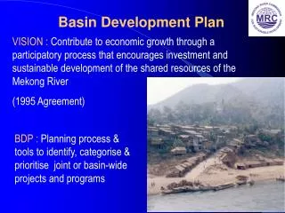
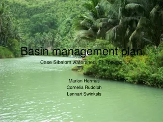
Basin management plan Case Sibalom watershed, Philippines Marion Hermus Cornelia Rudolph Lennart Swinkels
Description • State of basin natural resources • 18% of the original primary forests left (1999) • Water intensively used • Mineral rich area • Trends: Environmental degradation • Deforestation of rain forests and mangroves • Erosion and sedimentation • Floods and droughts • More extreme precipitation • Monitoring • No sign of basin management plans • No monitoring programs
Inventories • Land use • 80% cultivated land (mostly grassland, secondary forest, 1992) • Ecosystems • Tropical climate • 85% mountainous, 15% lowland • Water availability and demands • Seasonal dependancy and availability • 942 Mm³ runoff yearly • Pollution sources • minimal fertilizer use and only on terraced fields • No optimal information basis, more research/monitoring needed
Assessment • Ecosystem needs • Erosion • Sedimentation • Water allocation • Vulnerability • Sedimentation problems at corral reefs • Groundwater refill • Rain and groundwater availability • Implications of changing land use • Change in land use is necessary • Overview of current land use needed • Overview of possible types of land use, more suitable, economical suitable • Spatial planning
Stakeholders • Stakeholders • Inhabitants • 135 Barangays • 7 Municipalities • DENR • NGO’s (WWF) • Stakeholder needs • Housing, fuel wood, agricultural goods, etc. • Preserve political structure/organisation • Overview of needs and interests of other stakeholders • Mechanisms for participation • Gather information about current ways of participation; current democratic structure; • Create awareness among inhabitants, GO’s and NGO’s by informing and communication • Communicate with the leaders of barangays and municipalities
Priority issues • Get to know the ecological, social and economical system • Approach stakeholders, researchers, GO’s, NGO’s • Investigate lacking data • Start awareness process with local inhabitants and stakeholders
Goals • Short-term • Bring back forest cover on critical sites • Protect nature reserves by enforcing of existing rules and developing new rules • Long-term • Extend natural bio-dynamics • Erosion • Groundwater • Enhance the activities stability (sustainable economy) • Mitigate vulnerability to drought and flooding
Objectives • Water quality • Fertilizers • No exceeding of the carying capacity • Silt, floating matter • Coral • Decrease erosion processes • Water allocation • Fair distribution between nature and agriculture • Come up with and implement innovative solutions for water usage
Benefit shares • Compromises between stakeholders • National, regional and local • Win-win situation between nature and socio-economy • Using natural resources in a sustainable way • E.g. Forestry; • More nature, less floods and erosion
Scenarios • Scenarios • Autonamous • Worst case • Implement short term measures • Implement long term measures • Best case • Use • Awareness • Financial picture • Vision
Plans • Create a Basin Management Organization • Legal power to implement measures/plans • Enforcement ability • Start with priority issues • Getting to know the system, collecting information • Stakeholder involvement • Short term measures • Long term measures
Financing • International funding • WWF (nature) • World Bank (socio-economic) etc. • Development funding/aids • German technical cooperation (GTZ) etc. • National government • Local government • Taxes and fees
Responsibilities • Institutions involved • International and national policies and laws • Basin Management Organization • Municipal governments • Local Barangays • Local inhabitants • Guideline schedule • Gather information and talk to stakeholders: 1st year • Make detailed basin action plan: 1st and 2nd year • Work on short term measures: 1st till 3rd year • Work on long term measures: 3rd to 5th year
Monitoring • Monitoring of the adherence of laws, rules • Especially illegal logging • Monitoring of water quality and quantity • Flood early warning systems
Assignment 2 • Assumptions • 10 million m³ per river • 400 m wide • 1 meter depth: 25 km of river • 2 meter depth: 12,5 km of river • 3 meter depth: 8,3 km of river
Possible implications • Disturbed ecosystem in the riverbed and surroundings of the river • More drainage of the surrounding land • Groundwater flows might change • Erosion patterns will change (less coarse material) • Less floodings • Periodically disturbance traffic along the river, more noise from excavation activities