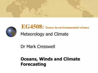
EG4508: Issues in environmental science
590 likes | 695 Vues
This article explores the physical properties and dynamics of the oceans, including their vastness and significant role in climate forecasting. The ocean depths average 3,730 meters, and they cover 70.9% of Earth's surface. We discuss the structure of the ocean, including thermoclines and currents, and how sea surface temperatures (SSTs) impact atmospheric pressure, evaporation, wind, and precipitation patterns. The interplay between salinity and climate is also examined, alongside the global wind systems, including trade winds and monsoon patterns, vital for weather phenomena.

EG4508: Issues in environmental science
E N D
Presentation Transcript
EG4508: Issues in environmental science Meteorology and Climate Dr Mark Cresswell Oceans, Winds and Climate Forecasting
Properties of the oceans • The amount of water in the oceans is huge! • The average depth is 3,730 m - over 4 times the mean elevation of the world’s land above sea-level • The oceans cover 70.9% of the planet surface
Properties of the oceans • The total heat capacity of the entire atmosphere is equal to that of merely 3 metres of ocean depth • Both the atmosphere and the oceans are fluids and so behave in very similar ways
Ocean structure and circulation • At the ocean surface, winds produce a thermally mixed surface layer averaging a few tens of metres deep poleward of latitude 60º, 400 m at latitude 40º and 100-200 m at the equator
Ocean structure and circulation • Below the (relatively) warm, thermally mixed layer is the thermocline • The thermocline is a layer in which (vertically) temperature decreases and density increases • The thermocline layer exhibits a stable stratification which tends to inhibit vertical mixing and and acts as a barrier to warmer water above and colder water below
Ocean structure and circulation • The ocean currents of the world are thought to move in accordance with a conveyor belt paradigm • This deep ocean thermohaline circulation system has been accepted theory for some time • The theory has recently come under close scrutiny - and may soon be revised
Sea surface temperature • Sea surface temperatures (SSTs) were first mapped by Alexander von Humboldt in 1817 • SSTs vary from about -1.9ºC at the poles to over 30ºC in the Persian Gulf and the Red Sea in july. • Differences in temperature between oceans near the coast and areas inland lead to the creation of coastal breezes
Sea surface temperature • Isotherms of SST generally change as a function of latitude - although variations occur at coasts where the isotherms bend poleward on East coasts and equatorward on West coasts • Changes in SST greatly influence pressure, evaporation and hence wind and rainfall patterns • Sometimes relationships between SST patterns and pressure/precipitation anomalies occur over a great distance from each other and are called teleconnections
Sea surface temperature • The most well known SST anomaly is ENSO • Normally easterly trade winds prevents eastward movement of warm water from western Pacific to eastern Pacific • When trade winds weaken, warm water propagates eastward, the low pressure over Indonesia breaks down and so too does the Walker circulation with its downward branch over the eastern Pacific • It is essentially a change in SST brought about by a change in circulation
Salinity • There are normally about 34.5 grams of salts dissolved in each kilogram of sea water - written as 34.5%0 • The salinity affects climate by altering the density of the sea - thus changing the patterns of pressures which govern ocean currents and hence heat transport around the globe
The global winds • The driving force of ANY wind is the local pressure gradient expressed as: • ∆p/ ∆n where: • ∆p is the difference between the pressures at points separated horizontally by a distance ∆n
The global winds • Where there is a chain of centres of convergence associated with convective storms air moves vertically into the upper atmosphere • The raised air increases upper level pressure which creates poleward winds • The Coriolis deflection prevents the upper winds from reaching beyond 30º creating a belt of subtropical highs
The global winds • The accumulated air gradually cools, then sinks and creates surface high pressure • The descending air then replaces air moving equatorward at the surface to feed convection their - thus forming a circuit of motion we call a Hadley Cell
The global winds • Winds within 30º of the equator in the Atlantic and Indian oceans were first mapped by Edmund Halley in 1686 • The maps which developed from this time were invaluable for shipping and hence commercial and military strategies
The global winds • Winds between the tropics converge on a line called the Inter-Tropical Convergence Zone (ITCZ) • This line of convergence can be discerned on a map of streamlines and visualised on a satellite image from space
The global winds • Winds are mainly easterly at latitudes between 10-30º - these are known as the trade winds or trades • Westerly winds prevail at about 35-60º and are known as the midlatitude winds • There are polar easterlies at latitudes above 60º
The global winds • The seasonal Monsoon circulation (West African, Asian and Northern Australian) result from moist south westerlies converging with dry north easterlies at special regions • Monsoon winds bring large amounts of rainfall to their respective regions • Desert winds can be vigourous - generating winds such as the Harmattan, Scirocco, Haboob and Willy willies
The local winds • Sea breezes: due to SST varying each day by only a degree or so - whilst surface air temperatures onshore change by around ten times as much • Land breeze: the opposite of a sea breeze happens at night when the land has cooled below that of SSTs • Mountain winds: the foehn effect, when the warming of winds blowing down mountains after there has been rainfall on the windward side • Katabatic and Anabatic winds: katabatic winds are downhill flows of cold air driven by gravity
The local winds • The daytime counterparts of katabatic winds are anabatic winds - they flow up sunny slopes fuelled by solar convectional heating and provide thermals for gliders • Anabatic winds are deeper and more gusty than katabatic winds
Predictability is to prediction as romance is to sex Miyakoda, 1985
Ancient climate prediction • The earliest attempts to predict the weather were by farmers and the military • The Greeks successfully used predictions about the wind to defeat the Turkish during sea battles • Predicting weather could make the difference between life and death for farmers
Weather vs Climate • Weather forecasting is concerned with accurate descriptions of weather type for a short period of time • Climate forecasting deals with how different future conditions may be from those expected in an average year • Weather describes specific conditions (raining, wind speed and direction, dew-point etc). Climate discusses anomalies
Short, medium and long-range • Short-range is between 3 and 72 hours • Medium-range is between 3 days an a week • Long-range is a month or more ahead • Experimental-range (X-range) includes new seasonal forecasts up to 6 months ahead • Global climate prediction looks at climate out to 50 to 100 years
Short, medium and long-range good forecast accuracy poor short long Range
Statistical Forecasting • The oldest form of formal weather forecasting • A statistical model is constructed from regression and correlation analyses • Model is trained on past (historical) weather observations • Model is given data relating to patterns of SST or other large-scale conditions prior to the period the weather changed
Statistical Forecasting • The model thus learns what sets of conditions (certain SST pattern, persistence of pressure, timing of snowmelt etc) are associated with a particular weather regime • To use a statistical model you enter details about large-scale conditions and it matches those with its historical database to give a prediction • Drawback - can only “see” extremes encountered in training data
Chaos theory • One of the most fundamental advances in the prediction of any natural process (climate and weather included) occurred after the discovery of chaos • Chaos theory is an amalgamation of game theory, probability theory and fluid dynamics
Chaos theory • Edward Lorenz realised that although the atmosphere behaved as a chaotic and random system, there were aspects of it which could be solved within a phase-space • The strange attractor (Lorenz attractor) was his visualisation of this hyperspace and initialised fractal theory
Dynamical forecasting • Dynamical forecasting is the most advanced and current method of weather/climate prediction • Unlike a statistical forecast, it is based on the calculation of weather/climate conditions from first principles (Physics) • Calculation is undertaken for each time-step for regularly spaced grid-points across the earth and up through the atmosphere
Dynamical forecasting • A modern Atmospheric Global Circulation Model (AGCM) solves many equations for each grid-point for the earth surface, atmosphere and oceans • This type of model requires extremely powerful computers (supercomputers) and the science of GCMs only developed after such computers became available
Dynamical forecasting • A single model integration provides a deterministic solution • A better approach (originally proposed by Lorenz) was to use a probabilistic ensemble approach • Ensemble forecasting strategy allows greater uncertainty to be sampled
Dynamical forecasting • 1) Define an “event” (e.g. rainfall above normal or presence/absence of high pressure) • 2) Run the climate model over a period of days • 3) Compare model output with event criteria
Dynamical forecasting • By repeating the model integration many times we can sample more of the uncertainty and generate a probability estimate of our event occurring • Models are thus initialised on separate days and then run forward in time • Models are initialised with actual observations for that particular day • Result is an ensemble of integrations - referred to as ensemble members
Dynamical forecasting • Example: Let us assume we wish to forecast the probability rainfall in Greater Manchester on 25th December 2009 – 1 month in advance • First, we initialise our model with actual observations TEN days before 25th November (15th) • We repeat this model initialisation on each successive day (16th, 17th...24th) • We end up with 10 model integrations - each one suggesting either rain will or will not occur • The proportion of members that agree with the event gives us our probability
Dynamical forecasting 3 rainfall quantity 2 1 0 5 6 7 8 9 10 11 12 13 14 15 Day
Dynamical forecasting Probability = f/n where f is number of members in a category where n is total number of integrations 3 rainfall quantity 2 1 0 5 6 7 8 9 10 11 12 13 14 15 Day
Dynamical forecasting Probability = f/n where f is number of members in a category where n is total number of integrations 3 rainfall quantity 2 1 3 0 7 5 6 7 8 9 10 11 12 13 14 15 Day
Dynamical forecasting Probability = f/n Prob of Rain = 0.3 (30%) Prob of NO rain = 0.7 (70%) 3 rainfall quantity 2 1 3 0 7 5 6 7 8 9 10 11 12 13 14 15 Day
Dynamical forecasting • The UKMO and ECMWF utilise the ensemble forecasting approach to determine rainfall, temperature, El Niño and general weather patterns many weeks or even months in advance • El Niño forecasting is considered VERY important.......