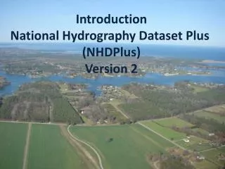
Introduction National Hydrography Dataset Plus (NHDPlus) Version 2
180 likes | 319 Vues
NHDPlus Version 2.0 integrates the National Hydrography Dataset (NHD), Watershed Boundary Dataset (WBD), and National Elevation Dataset (NED) to provide enhanced water resource analysis capabilities. Key features include improved spatial data resolution, comprehensive stream network mapping, and advanced tools for flow analysis and watershed management. Users can perform critical tasks such as finding permitted discharges, assessing habitat accessibility post-dam removal, and evaluating the impact of toxic spills on drinking water. Get started with powerful tools and detailed datasets to support effective water management.

Introduction National Hydrography Dataset Plus (NHDPlus) Version 2
E N D
Presentation Transcript
Introduction National Hydrography Dataset Plus (NHDPlus) Version 2
NHDPlus Concepts: Integration of NHD, WBD, and NED National Hydrography Dataset (NHD) Watershed Boundary Dataset (WBD) National Elevation Dataset (NED)
NHDPlus Concepts: Integration of NHD, WBD, and NED WBD Boundary “walled” Into Elevation NHD Streams “burned” Into Elevation
NHDPlus Concepts: Link the Landscape to the Mapped Stream Network NHDPlus Elevation Derivatives: Flow Direction Grid to perform “raindrop” transport
NHDPlus Concepts: Link the Landscape to the Mapped Stream Network NHDPlus Catchments: Define the land surface that drains to each stream segment.
NHDPlus Concepts: Link the Landscape to the Mapped Stream Network NHDPlus Catchments in 3D
NHDPlus Concepts: Link Landscape Characteristics to the Stream Network
NHDPlus Concepts: Navigation of the Linear Surface Water Network Susquehanna River Drainage Basin Susquehanna River Main Stem
NHDPlus Concepts: Navigation of the Linear Surface Water Network Stream Drainage Within 50 Miles of the Mouth of the Susquehanna River
NHDPlus Concepts: Network Analysis All Gages on the Susquehanna River
NHDPlus Concepts: Network Analysis • Find the nearest Permitted Discharge. • How long will it take to transport this toxic spill to the nearest downstream drinking water intake? • If we remove this dam, how much usable upstream habitat can the fish access? NHDPlus makes these analyses possible. NHDPlus make them fast and easy to implement.
NHDPlus Ver 2.0: Content • NHD Snapshot • More Names • More Lakes • More than 7500 Isolated Networks Connected • NED Snapshot • Nearly Wall-to-Wall 10 Meter Source Data • WBD Snapshot • Nationally Complete
NHDPlus Ver 2.0: Content • USGS NWIS Streamflow Gage Network Locations – 23,000 in V01 – 30,000 in V02 • Major Divergence Fractions - % of flow down divergent paths • Major Water Flow Additions, Removals & Inter-basin Transfers • TBD – NID Dam Network Locations
NHDPlus Ver 2.0: Content • 2001 National Land Cover • Land Cover • Impervious Surface • Canopy • 1992-2001 Change • PRISM – Temperature (1971-2000) • PRISM – Precipitation (1971-2000) • Annual and Monthly Runoff
NHDPlus Ver 2.0: Tools(Enhanced and New) • Network Navigators • Basin Delineator • Catchment Attribute Allocation and Accumulation • Network/Catchment/Attribute Generalization
NHDPlus Ver 2.0: Flow Estimation • Version 2.0 – Mean Flows - Monthly & Annual • Divergence Fraction • Runoff Estimate • Flow Additions and Removals • Evapotranspiration • Streamflow Gage Adjustments
NHDPlus Ver 2.0: Questions? LDM@Horizon-Systems.com NHDPlus@hscnet.com