Download
1 / 21
210 likes | 394 Vues
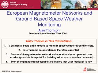
European Magnetometer Networks and Ground Based Space Weather Monitoring. Alan Thomson. Major Themes in This Presentation: Continental scale often needed to monitor space weather ground effects. International co-operation is therefore essential.

E N D
European Magnetometer Networks and Ground Based Space Weather Monitoring Alan Thomson • Major Themes in This Presentation: • Continental scale often needed to monitor space weather ground effects. • International co-operation is therefore essential. • Successful magnetometer network collaborations have operated over decades (possible ‘blueprint’ for building wider space weather networks). • Ever-changing technical capabilities implies that user feedback is key.
Acknowledgments • Dr Jim Wild, University of Lancaster, UK (on behalf of Prof. F. Honary, PI, SAMNET) • Dr Ari Viljanen, Finnish Meteorological Institute, Helsinki, Finland (PI, IMAGE) • Dr Jurgen Watermann, Danish Meteorological Institute, Copenhagen, Denmark (Project Scientist, Greenland Magnetometer Array)
TIK CCS DIK The Global Context: Magnetometer NetworkExamples 1. National Geomagnetic Observatory Networks – Issues:Regional/Global Field Modelling & Baseline Stability 2. Space Weather ‘Flavoured’ Networks: Alaska: Geophys. Inst. Mag. Array Canada: Canopus Russia AE Stations: PURAES CHINA low-latitude: SMALL Antarctica/Australasia: Geos. Austral.
SAMNET • History/Development • Commenced 1st October 1987 (as a UK ‘national facility’ for STP) at 5 sec sampling • Since 1995 sampling at 1 second (H, D, Z) • Operated by Univ. York until 2003; Univ. Lancaster since 2003 • Funding may end in March 2007 (through restructuring of UK STP science) • Also stores (some) IMAGE and BGS magnetometer data at 1 second sampling • Instruments • Variometer stations equipped with fluxgates (of Ukranian and York design) • Communications • Dial-up modem (and daily processed) • Only Lancaster site is real-time (for ‘Aurora Watch’ http://www.dcs.lancs.ac.uk/iono/aurorawatch/) • Many Applications • Substorm/Pi2 timing; current wedge detection/location • ULF waves • ‘Magnetoseismological’ study of plasma mass loading of geomagnetic field lines
IMAGE • History/Development • International Magnetospheric Study (1976); EISCAT (1982); IMAGE (1991); MIRACLE • Instruments • Fluxgates (Tromso, DMI) • Data Rates and Communications • 10 sec, some 1 sec; ISDN download per day; real time displays from host institutes • Data server at FMI, which is a kind of "regional data centre". There are the following "nodes" gathering data: TGO: 11 Norwegian sites FMI: 10 Finnish sites (+ 1 in Norway + 1 in Estonia) RF/Kiruna: 2 Swedish sites and SGU/Uppsala: 2 Swedish sites GFZ/Niemegk: Hornsund (via IGF/Warsaw) PGI/Apatity: Lovozero • All contributors check their own data before FMI adds them to the final database. Data are transferred to the nodes via internet or ISDN. • Applications • Both events and statistical studies • Improved knowledge of the full 3-D ionospheric current system derived from combined magnetometer, radar and satellite measurements
IMAGE: http://space.fmi.fi/image/index.html MIRACLE: http://space.fmi.fi/MIRACLE/
Greenland (DMI; SPRL, Univ. Michigan) • History/Development Qeqertarsauq (1926); Qaanaq (1947); Narsarsuaq (1967) • Instruments Triaxial fluxgate magnetometer (Model FGE, DMI) • Applications Ionospheric current systems and external field studies (e.g. collaborations with IMAGE, MACCS (USA), CARISMA (Canada))
Greenland Magnetometry Dotted gridgeographic latitude and longitude Dashed linescorrected geomagnetic latitude (epoch 2000.0) Dotted line best-fit great circle (west coast stations) Blue circlesDMI variometer stations Red circlesMAGIC sites (SPRL, Univ. of Michigan) Blue trianglesDMI geomagnetic observatories Blue diamond Sondrestrom Research Facility Full circlesdata from preceding day are transmitted to DMI via modem and telephone line (presently every morning around 03 UT) Open circlesdata are stored locally and sent to DMI via snail mail (up to several months delay) Black Romandata are transmitted to DMI in near real time (presently every 15 min) Courtesy of Jurgen Watermann (jfw@dmi.dk) http://www.dmi.dk/projects/chain/
DMI Greenland Magnetometers sensor type dual-core tri-axial fluxgate with main field compensation gravity-controlled gimbal system at several stations axes misalignment < 2 mrad sensitivity 0.1 nT broadband noise (~DC – 1 Hz) long-term drift < 3 nT / year temperature drift < 0.2 nT / ºC (sensor) < 0.1 nT / ºC (electronics) temperature resolution 0.1 ºC sampling rate20 s and 1 s (dual acquisition system) acquisition digital, 16-bit signed integer final resolution 0.25 nT at 20-s sampling rate 0.125 nT at 1-s sampling rate time accuracy typically ±1 s (precision clock), GPS implementation under consideration data delivery delay east coast several months, west coast 1-2 months (unless telephone transmission) service interval site visit by DMI engineer once every ~5 years Courtesy of Jurgen Watermann (jfw@dmi.dk) http://www.dmi.dk/projects/chain/
INTERMAGNET • History • IAGA discussions in 1986 (Ottawa) • Pilot project connecting US-UK in 1987 by satellite • IAGA sanctioned INTERMAGNET in 1990 • Founders were US, UK, France, Canada • Key Idea = Establishing standards across the community • Applications • Global and regional geomagnetic field modelling • Space weather studies • www.intermagnet.org
Individual research scientists, “value-added” suppliers of near-real-time data; e.g. for activity indices, ionospheric current models – space weather science GIN Data transmission by satellite, email, internet Definitive data Users of definitive data; e.g. for reference geomagnetic field models - geophysics Annual CD-ROM Summary of INTERMAGNET Operations: A Template for Space Weather Network Building Samples at 10 seconds or faster - filtered to one-minute values Preliminary data to a GIN within 72 hours Observatory
Applications to join Technical help and training Data supply: GINs/Web Measurement standards Data formats Instruments and techniques CD-ROM Technical Manual Practical Activities Operations Committee
CountriesObservatories Intermagnet: Shaping The Future • Technical Developments • What do users want? • 1 second data feasible • Better instrumentation and communication • Continued Observatory Network Growth • Smaller scale field variations
European SW Networks: Issues and Prospects • Existing magnetometer networks may be a template to help develop new or more extensive ground based space weather monitoring networks. • But there are questions to be asked: • Who are the data users? • What do they want from magnetometer or more general space-weather networks? • What is the strength (e.g. continuity) of demand for data? • What is the reliability and quality of data supply? • What is the maturity/adaptability of data collection and supply? • What technical innovations are needed/foreseen? • Higher sampling rates; novel data dissemination methods • ….
Magnetometer Networks: For Space Weather Science and Applications • The importance of near-real-time data for science & services related to space weather hazard is clear, for example, … • Magnetic activity index production (both near real time and definitive) • e.g. in co-operation with the International Service for Geomagnetic Indices (ISGI) • ‘Nowcasting’ • General monitoring of magnetic conditions • Modelling of the effects of observed geomagnetic field variations (e.g. online rapid ‘forensic analysis’ of GIC, or LEO satellite drag) • Forecasting • Many applications for geomagnetic indices & field variations
Real Time Magnetograms - 2 Minute Update Real time estimated Ap & ap - updated at least every hour using data assimilation -
BGS Real Time Magnetograms - 2 Minute Update Real time plasmasphere monitor
Geomagnetically Induced Currents: ‘Nowcasts’ and Forensic Analysis of Recent Events Equivalent currents GIC data dB/dt data Above: 14 July 2000 Left: 6 Nov 2001
Summary • For the scientists who run magnetometer or ground based space weather networks, the possibilities for developments (scientific, technical and for applications) are probably clear. • But what do the space weatherdata users want in detail? • This will shape how/what network scientists and technicians actually choose to do next. • For example Intermagnet would like to know if there is a user community for 1-sec data, and what format, data communications systems are needed. • Please contact Intermagnet with your ideas: Simon Flower: smf@bgs.ac.uk.
European Magnetometer Networks and Ground Based Space Weather Monitoring Alan Thomson • Major Themes in This Presentation: • Continental scale often needed to monitor space weather ground effects. • International co-operation is therefore essential. • Successful magnetometer network collaborations have operated over decades (possible ‘blueprint’ for building wider space weather networks). • Ever-changing technical capabilities implies that user feedback is key.