Download
1 / 16
340 likes | 2k Vues
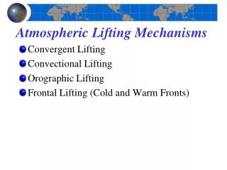
Atmospheric Lifting Mechanisms . Convergent Lifting Convectional Lifting Orographic Lifting Frontal Lifting (Cold and Warm Fronts) . Atmospheric Lifting Mechanisms . Figure 8.6. Local Heating and Convection. Figure 8.7. Convection over Florida. Figure 8.8.

E N D
Atmospheric Lifting Mechanisms • Convergent Lifting • Convectional Lifting • Orographic Lifting • Frontal Lifting (Cold and Warm Fronts)
Atmospheric Lifting Mechanisms Figure 8.6
Local Heating and Convection Figure 8.7
Convection over Florida Figure 8.8
Orographic Precipitation Figure 8.9
Chinook, Foehn and Santa Anna Winds Chinook Winds: The warm and dry winds move down the east slope of the Rockies. As the air descends adiabatically, it is warmed up rapidly. When this occurs in the winter or spring, the winds can melt the snow rapidly. Santa Ana: During the autumn season, an anticyclone (High pressure center) can reside over the Great Basin of California, the clockwise flow directs air from Arizona and Nevada westward through the Santa Ana Canyon . The already warm and dry winds become warmer and drier (90-100oF) as they descent the mountain slopes. Southern California is dry in the summer, the strong Santa Ana wind (40mph) makes it ready for catastrophic fire. Foehn Winds: Similar winds created by the Alps in center Europe. Figure 8.9
Orographic Patterns Figure 8.10
Frontal Lifting • Font: The boundary between two air masses , i.e. the “battle” front between two air masses. • Cold Fronts • Cold air forces warm air aloft • 400 km wide (250 mi) • Warm Fronts • Warm air moves up and over cold air • 1000 km wide (600 mi)
Cold Front • Cold air advances into the warm air, forcing the warm air the rise. • Cold air is heavier than warm air, thus the warm overruns the cold air. • Slope is 1:100, i.e. the frontal surface rise 1 km in height over 100 km distance on the ground. • Intense precipitation over shorter period of time compared to warm front. Figure 8.11
Cold FrontandSquall Line This is a cold front seen from space. Due to the rapid lifting of warm air by the advancing cold air, a sharp line of cumulonimbus clouds can occur, called the squall line. Figure 8.12
Warm Front • warm air advances, pushing the cold air to retreat. • Cold air is heavier thus more difficult for the warm air to displace. • Slope is 1:200, i.e. the frontal surface rise 1 km in height over 200 km distance on the ground. • Light-to-moderate rain over large area for an extended period. Figure 8.13
Life Cycle of a Midlatitude Cyclone • Midlatitude cyclones are low pressure systems with diameter exceeding 1000 km that travel west to east across the planet in the middle latitude regions, lasing several day to more than a week. • Cyclogenesis • Open stage • Occluded stage • Occluded front • Stationary front • Dissolving stage
Cyclones and Anti-Cyclones Cyclones and Anticyclones
Midlatitude Cyclone • Several factors can cause the front line to wave: • Topography • Temperature contrast • Intensification of divergence in the upper atmosphere by Jet Stream, particularly when it waves from north to south. Figure 8.14
Midlatitude Cyclone Figure 8.15
Average and Actual Storm Tracks • The general west-to-east movement of the air in the context of global air circulation. • The counter-clockwise movement of the air on the ground around a cyclone. Figure 8.16