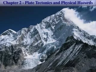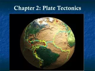
Chapter 2 Plate Tectonics and the Ocean Floor
350 likes | 801 Vues
Chapter 2 Plate Tectonics and the Ocean Floor. Essentials of Oceanography 7 th Edition. Continental drift. Alfred Wegener, a German meteorologist and geophysicist, was the first to advance the idea of mobile continents in 1912

Chapter 2 Plate Tectonics and the Ocean Floor
E N D
Presentation Transcript
Chapter 2Plate Tectonics and the Ocean Floor Essentials of Oceanography 7th Edition
Continental drift • Alfred Wegener, a German meteorologist and geophysicist, was the first to advance the idea of mobile continents in 1912 • Wegener identified several lines of evidence to support the idea that the continents had drifted
Evidence for continental drift • Matching coastlines on different continents Figure 2-2
Evidence for continental drift • Matching mountain ranges across oceans Today 300 million years ago Figure 2-4
Evidence for continental drift • Glacial ages and climate evidence Figure 2-5
Evidence for continental drift • Distribution of fossils such as Mesosaurus Figure 2-6
Objections to the continental drift model • Wegener envisioned continents plowing through ocean basins • Wegener did not provide a plausible mechanism to explain how the continents could have drifted apart • Most Earth scientists rejected continental drift because it was • Too far-fetched • Contrary to the laws of physics
The theory of plate tectonics • Continental drift was reexamined in the 1960s when new information became available • Sea floor features became better known • A technique was developed that enabled scientists to determine the original positions of rocks on Earth (paleomagnetism)
Evidence for plate tectonics • Earth’s magnetic field affects all magnetic objects on Earth Figure 2-7
Evidence for plate tectonics • When rocks cool at Earth’s surface, they record Earth’s magnetic field (normal or reversed polarity) Figure 2-9
Evidence for plate tectonics • Paleomagnetic studies indicate alternating stripes of normal and reverse polarity at the mid-ocean ridge • Pattern was created by sea floor spreading Figure 2-11
Evidence for plate tectonics • Harry Hess envisioned new sea floor being created at the mid-ocean ridge and destroyed in deep ocean trenches Figure 2-10
Evidence for plate tectonics • Age of the sea floor matches pattern predicted by sea floor spreading • Youngest sea floor is at mid-ocean ridge • Sea floor is older with increasing distance from mid-ocean ridge Figure 2-12
Evidence for plate tectonics • Pattern of worldwide earthquakes (left) matches plate boundaries (right) Figure 2-13
Earth structure • Chemical composition • Crust • Mantle • Core • Physical properties • Lithosphere • Asthenosphere • Mesosphere • Outer core • Inner core Figure 2-14
Principles of plate tectonics • The outermost portion of Earth is composed of a mosaic of thin rigid plates (pieces of lithosphere) that move horizontally with respect to one another • Plates interact with each other along their edges (called plate boundaries) • Plate boundaries have a high degree of tectonic activity (mountain building, earthquakes, active volcanoes)
The 3 types of plate boundaries • Divergent • Convergent • Transform Figure 2-17
Divergent plate boundaries • The Mid-Atlantic Ridge is a divergent plate boundary where sea floor spreading occurs Figure 2-18
Divergent plate boundaries • Iceland sits atop a divergent plate boundary where continental rifting occurs Figure 2-19
Divergent plate boundaries • Formation of an ocean basin by rifting and sea floor spreading Figure 2-20
Convergent plate boundaries a. Ocean-continent • Convergent plate boundaries vary depending on the type of crust Figure 2-23 c. Continent-continent b. Ocean-ocean
Convergent plate boundaries • An ocean-continent convergent plate boundary produces the Cascadia subduction zone and Cascade Mountains Figure 2-24
Convergent plate boundaries • A continent-continent convergent plate boundary produces the Himalaya Mountains Figure 2-25
Transform plate boundaries • Transform plate boundaries occur between segments of the mid-ocean ridge • Can also occur on land (ex: San Andreas Fault) Figure 2-26
Hotspots and plate tectonics • Hotspots are stationary and have abundant volcanic activity • The lithospheric plate moves over the hotspot • Creates a row of volcanoes progressively older toward one end (called a nematath) Figure 2-28
Stages of coral reef development • If in tropical shallow water, coral reefs can form on the tops of volcanoes • Fringing reef • Barrier reef • Atoll Figure 2-30
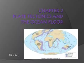
Atoll and barrier reefs in the Society Islands Figure 2-32
Satellite positioning of locations on Earth • Shows good agreement with predicted plate motion Figure 2-33
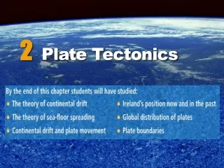
Paleogeography: A look at the past • The positions of continents and oceans have changed in the past • Internet site showing more detailed maps Figure 2-34
The world as it may look 50 million years in the future Figure 2-35
End of Chapter 2 Essentials of Oceanography 7th Edition