Download
1 / 58
630 likes | 1.45k Vues
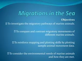
Lesson 5. Migrations in the Sea. Humpback whales. Humpback whale migration to queensland. https://www.youtube.com/watch?v=v12skYeF91o.

E N D
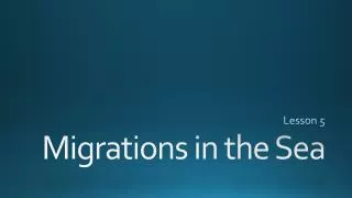
Lesson 5 Migrations in the Sea
Humpback whales Humpback whale migration to queensland https://www.youtube.com/watch?v=v12skYeF91o • A Humpback Whale and her calf migrate north in search of food. Animal tracking is an effective way to learn science. The ocean is an excellent context in which to study the interactions between Life and Earth Sciences.
Whale Migration • Humpback whales are found in northern and southern hemisphereand all major basins • Grow up to 43 feet • Longest recorded migration – 5,100 miles • Completed by 7 animals including a calf • From Costa Rica to Antarctica • Humpback whales feed at the surface on krill
Humpback Whale in the Pacific takes a dive. Scientists use patterns on the animals' tails to identify individuals.
Whale Migration Gray whale migration • Gray whales also undertake long migrations • Grow up to 50 feet • Bottom feeders – roll onto their side and filter seafloor mud through their baleen plates • Baleen are broom-like plates • Mainly found in shallow coastal waters of Pacific Baleen! Blue whales don’t migrate…
A juvenile Gray Whale looks up off the Southern California Coast. Calves and their mothers will normally bask in relatively warm, shallow waters of Mexico and Southern California during the winter.
After studying the map above, answer the following Q’s about the general patterns of migratory behavior for Humpback and Gray Whales. • Describe the journeys of the two whale species. • What are the differences in activities at winter and summer sites? • What is the general direction of travel? • Use the scale to determine the maximum total distance traveled during the migration.
After studying the map above, answer the following Q’s about the general patterns of migratory behavior for Humpback and Gray Whales. • Describe the journeys of the two whale species. • Humpbacks begin migration at their birthing area north of the Dominican Republic on the Silver Banks. They end their voyage in the Labrador Sea, in the Gulf of St. Lawrence, or in areas off the Canadian Maritime Provinces. Gray Whales begin their journey near Baja California and then swim northward to the waters of Alaska, the Bering Sea, and the Chukchi Sea (CHOOK – chee).
After studying the map above, answer the following Q’s about the general patterns of migratory behavior for Humpback and Gray Whales. • What are the differences in activities at winter and summer sites? • The waters in southern areas are used for breeding or birthing in winter. Northern waters are used for feeding in spring and summer.
After studying the map above, answer the following Q’s about the general patterns of migratory behavior for Humpback and Gray Whales. • What is the general direction of travel? • From southern to north waters in spring, and the opposite in fall.
After studying the map above, answer the following Q’s about the general patterns of migratory behavior for Humpback and Gray Whales. • Use the scale to determine the maximum total distance traveled during the migration. • Humpback Whales will travel approximately 4500 km (2800 miles), while Gray whales will travel approximately 9000 km (5600 miles).
Sea Turtle migration Explore - Leatherback Sea turtle • Leatherback hatchling on a beach in Indonesia may grow to be approximately 2 meters (~7 feet) and weigh 900 kilograms (~2,000 pounds). The Leatherbacks' paddle-like flippers make the sea turtle uniquely equipped for long-distance migrations for feeding.
Explore – Leather back Sea Turtle • Video was filmed in Solomon Islands • Migrate from Japan to the west coast of USA in search of jellyfish • Record holders for migration • 10,000 miles
Leatherbacks • Adult turtles can grow to 2 meters (6.5 ft) • Weight 900 kg (2000 lbs) • Do not have a hard shell • Leathery skin that covers a series of bony plates • Females return to coastlines to lay eggs every 2-3 years • Lay ~100 eggs • Build a new nest ~10 days • After ~65 days, hatchlings crawl back to the ocean
Leatherbacks are the largest and most far-ranging of all sea turtles.
Leatherbacks • Endangered species • Scientists estimate 35,000 nesting females worldwide • Males do not go to shore making it difficult to estimate
Activity: Plotting Animal Movements • 1. Plot each date’s location on your copy of the map by approximating it from the given latitude and longitude coordinates on the Leatherback Sea Turtle Plotting Map. p. 82
2. Describe Jamur’s overall path and calculate his approximate distance traveled. What is the average movement of the animal in kilometers per week? Jamur traveled from Central America, through the Atlantic, across to Europe (off the coast of Portugal), and South to Africa. If the distance measured is approximately 31 cm (acceptable range is 29-33 cm), the distance traveled is approximately 12,200 km. Over 54 weeks, Jamur’s traveled an average of ~226 km per week.
3. Why do you think scientists track animals such as the Leatherback Sea Turtle? What do they want to learn? Where they go so humans can protect them. In what climates and marine ecosystems they can be found.
Leatherback Sea Turtle Observations • As you watch the video, list two types of observations or data that the scientists collect, and two questions that they still have.
Global conveyor belt • https://www.youtube.com/watch?v=L9zjmC8InKA
Tracking the Signals of Spring • Signals of Spring classroom was initiated with NASA sponsorship in 2000 to afford educators and students to use various types of Earth imagery to track animals by satellite • Since then, hundreds of animals have been tracked • Scientists travel across the globe to attach satellite transmitters to animals • Provides dive depth, water temp, light level info, etc.
Transmitters and Satellites • Polar orbiting satellites, including those from NOAA and the European Space Agency's MetOp satellite, house the Argos instrument.
Transmitters and Satellites • Animal wears a transmitter and VHF (very high frequency) signals are picked up by receivers • Begins with scientists trapping and tagging animals • At regular intervals, device transmits HF radio signal to NOAA polar orbiting satellites overhead
Transmitters and Satellites • Uplink – transmitting signal sent up to satellite • Downlink – signal sent down from a satellite to ground station • As it passes over a ground/receiving station, Argos data collection relays information
Natural and Human-made Satellites • Natural satellites • A planet or moon that orbits around another celestial body • Ex: Moon orbiting Earth • Ex: Earth orbiting Sun • Artificial satellites • Created by humans to gather many types of data • Remote sensing satellites - type that provide data to study marine mammals
Map showing Loggerhead Sea Turtle location data. Scientists use satellite tagging data to learn and understand different species' behavior, about where they travel and the habitats that they use, and more. • The Loggerhead Sea Turtle is a common species in Atlantic and Caribbean waters. These animals are named for their large, brownish head.
Polar and Geostationary Satellites • Polar satellites • Orbit from pole to pole and help track animals • Geostationary satellites • Remain fixed above one specific location • Orbit the Earth at a speed in tandem with the rotating Earth
Relative locations of polar and geostationary satellites from Earth. Polar satellites orbit from pole to pole. Geostationary satellites orbit over the same location over the Equator.
Polar Satellite • Earth spins from east to west as polar satellites orbit Earth’s poles. Within a day, it will collect data from all over Earth’s surface. Observe volcanoes, polar ice, bodies of water, specific ecosystems, rainfall, and more.
Sea ice concentration imagery is derived from data collected from polar orbiting satellites. • Argos instruments onboard the satellites provide the locations of tagged animals so scientists and students may learn how animals interact with their habitats.
As Earth rotates east, geostationary remain above the same location. Move at a constant rate as Earth spins. Advantage is they can record more frequently over an entire hemisphere.
Geostationary satellites help scientists track weather systems like Hurricane Isabel, which approached North Carolina in 2003.
Satellite Transmitters • Several types of satellite transmitters used for animal tracking • Smart Position or Temperature Transmitting Tags (SPOTs)
Pop-up Archival Tag • Used for fish and sharks that do not spend much time at sea surface • Programmed to be released from animal at a specific time • Most are preset for 1-3 months release time • Floats to surface when released
Attaching a satellite tag • https://www.youtube.com/watch?v=-IJ0uLh9UAs http://www.youtube.com/watch?v=2SOh6roc3Rk
A Tiger Shark wears a pop-up tag. Pop-up tags archive data for weeks or months at a time, and then detach from the animal and float to the surface. At that time, the data are transmitted to a satellite and are available to scientists and students.
Satellite Relay Data Logger (SRDL) • Bulky, box-shaped tag that compresses more data than any other tag • Scientists use these to measure salinity, temp, and depth • Relays info to understand how ocean conditions affect animal movement Used on large organisms that dive: Southern Elephant Seals, California Sea Lions, and Leatherback Sea Turtles
Satellite Imagery • Remote sensing – science of gathering and interpreting data from human-made satellites • Orbiting satellite equipped with digital imaging sensors • Scans Earth’s surface 24 hours a day • Records radiation reflected from Earth’s surface
One type of sea bird sometimes tracked by satellites is the Sooty Shearwater.
Using scientific data, researchers from various backgrounds can study and draw conclusions about the movements of marine animals that are tracked by satellite on a temperature map.
Remote sensing satellites • Create high-resolution imagery • Sensors represent a portion of Earth’s surface as a single data point • Data point on a digital image is a called a pixel
Sample of satellite imagery demonstrates that 4-kilometer resolution (km) imagery, where each pixel in the image represents an area of 4 km x 4 km, is more detailed than 16-kilometer resolution.
Scientific Discoveries • Scientists now have more access to diversity of ocean organisms • Helpful in marine protected areas (MPAs) • Black-footed albatross studied by Dr. Hyrenbach