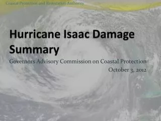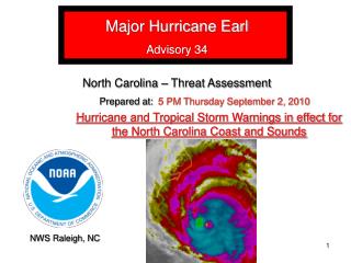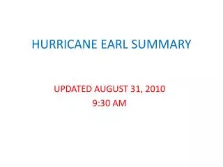
HURRICANE EARL SUMMARY
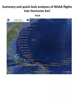
HURRICANE EARL SUMMARY. UPDATED SEPTEMBER 3, 2010 2:00 PM. Hurricane Earl – 12:45 PM . HURRICANE EARL PROJECTION. Earl will pass about 75 miles southeast of Nantucket around or just after midnight tonight as a weakening but large Category 1 hurricane


HURRICANE EARL SUMMARY
E N D
Presentation Transcript
HURRICANE EARL SUMMARY UPDATED SEPTEMBER 3, 2010 2:00 PM
HURRICANE EARL PROJECTION • Earl will pass about 75 miles southeast of Nantucket around or just after midnight tonight • as a weakening but large Category 1 hurricane • Primary area of concern continues to be Cape Cod, Nantucket and Martha’s Vineyard for wind • Primary area of concern for localized flash flood potential is broader and covers eastern Massachusetts and Rhode Island
HURRICANE EARLWATCHES/WARNINGS • Hurricane Warning: • Cape Cod, Nantucket, and Martha’s Vineyard • Tropical Storm Warning • New Haven CT to Woods Hole MA • North of Sagamore Beach to Hull • Tropical Storm Warning over land north of Hull canceled but remains over Mass Bay, Stellwagen Bank, and coastal waters about Cape Ann
SOUTHERN NEW ENGLAND IMPACTSMarine • High seas, high surf, and dangerous rip currents through Saturday • Along most ocean exposed beaches whether south or east facing • High surf and dangerous rip currents may be the greatest risk to life • Seas over open coastal waters • 10 to 20 feet to left of track • 20 to 30+ feet very near track • 30 to 40+ feet to right of the track
HURRICANE EARL IMPACTSWind • Tropical Storm Force winds Cape Cod and the Islands with hurricane force gusts possible – especially over the outer Cape and Nantucket • Tropical Storm force gusts likely rest of Massachusetts and Rhode Island coastline • Possibility of a short duration of sustained tropical storm force winds immediate Rhode Island south coast , including Block Island, Buzzards Bay coast, and Plymouth County coast • Gusts strong enough for scattered tree damage and scattered power outages along and southeast of a Boston to Providence corridor
WIND SPEEDS • Outer Cape and Nantucket • NE, then N, and NW 40 to 50 mph with gusts 70 to 80 mph possible • Rest of Cape and Martha’s Vineyard • NE, then N and NW 30 to 40 mph with gusts 60 to 70 mph possible • Rhode Island coast (incl. Block Island) and Plymouth County coast in Massachusetts • NE to N to NW winds 25 to 35 mph with gusts 50 to 60 mph • Rest of immediate Massachusetts coast and along Boston to Providence corridor: • NE to N to NW winds 20 to 30 mph with gusts 40 to 50 mph possible
WIND TIMELINE • Gusts to near Tropical Storm force arrive south coast and islands by around 5 PM • Strongest winds for a 3 to 6 hour duration between 8 PM and 3 AM for most locations • Signal suggesting peak gusts could be from N or NW 11 PM to 3 AM • Winds diminishing 4 to 8 AM • W to NW winds gusting to 30 knots Saturday late morning and afternoon
HURRICANE EARL IMPACTSHeavy Rain/Flooding • 2 to 4 inches of rain with narrow band or two of higher amounts eastern Massachusetts and Rhode Island • Flash Flood Watch for all of eastern Massachusetts and Rhode Island • For localized urban poor drainage or small stream flooding • 1 to 3 inches possible for eastern Connecticut and portions of Worcester County • Heaviest rain 4 PM to midnight • Tropical downpours can dump over an inch within an hour • River flooding not so much a concern as street flooding and flooding of small streams with urban drainages
HURRICANE EARL IMPACTSMinor Storm Surge Flooding at Worst • Storm surge of 2 to 4 feet may cause minor flooding along vulnerable portions of the Nantucket, Chatham and Martha’s Vineyard shoreline during this evening’s high tide • Surge of around 2 feet may cause spotty minor coastal flooding Narragansett Bay – not a serious concern • Rain runoff will come after high tide along Narragansett Bay • Splash over around the time of the late afternoon high tide ocean exposed RI south coast due to large breakers • Up to 2 feet of surge rest of Massachusetts east coast during the evening high tide with splash over possible • Minor storm surge flooding possible for Wellfleet and Provincetown harbors after Earl passes Friday night • 3 to 6 foot surge possible 2 to 4 AM but between high tides
POST HURRICANE EARL • Mostly Sunny and gusty Saturday • NW wind gusts 30 to 35 mph • Swells, surf, and rip currents subsiding during Saturday but still dangerous • May have some lingering rip current concerns on Sunday…especially east facing coasts