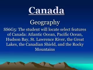
Canada’s Landform Regions
360 likes | 657 Vues
Canada’s Landform Regions. Cross section p. 31-34 landform – a natural feature of a land surface . Vocabulary . Erosion – the process of the wearing down of the earth’s landscape Peneplain – ‘almost a plain’ Lakescape – landscape with many lakes

Canada’s Landform Regions
E N D
Presentation Transcript
Canada’s Landform Regions Cross section p. 31-34 landform – a natural feature of a land surface
Vocabulary • Erosion – the process of the wearing down of the earth’s landscape • Peneplain – ‘almost a plain’ • Lakescape – landscape with many lakes • Badlands – area of hills and deep gullies formed by erosion, with sparse vegetation • Moraine - an accumulation of earth and stones carried and finally deposited by a glacier • Plateau – elevated area of fairly level land • Continental plate – shallow ocean floor bordering a continent • Heartland – region with a large, concentrated population considerable manufacturing, and influence over surrounding regions.
Precambrian Shield akaCanadian Shield Covers almost half of Canada – 4 800 000 km²
Name pre cambrian indicates the rocks were in place before the Cambrian period of the earth • Canada’s oldest rocks
Only the roots of mountains remain • Erosion has reduced the area to a peneplain • Today elevation is seldom over 600m
Landscape is very rugged, like a lakescape Precambrian bedrock of the Canadian Shield rising out of Reindeer Lake, on the border between northeastern Saskatchewan and northwestern Manitoba. • Lakes numerous, Pleistocene ice ages added to the shape of the region (saucer shape), tends to drain towards Hudson Bay
Tourist playground • Many minerals because of metamorphic rocks • Lowest population of Canada’s four major southern landform regions; population widely scattered; most live in or near major mining areas or forestry centers • Not exclusively Canadian Athabasca Basin – northwestern Saskatchewan, northeastern Alberta
The Great Plains • Extends over central Canada, from near the Ontario-Manitoba border to the Rockies • Vast majority of the population of the Prairie Provinces and Northern Territories live here
Almost entirely in Canadian Territory • Formed after the Shield – the sedimentary rocks on the plains were deposits from the Shield • Shallow seas invaded North America during the early eras. Shells formed part of the thick strata of limestone and chalk. Material from the Cenozoic Era later eroded adding to more layers.
Three different levels • Region grows higher as it approaches Cordillera • Deep valleys cut by rivers • Covered by glaciers in the last ice age, there are scattered morainic features, also contains badlands
Not a source of metallic minerals; however, natural oil and gas collected in region’s porous rocks Manitoba
Saskatchewan Grazing Oil Grain Potash is mined to be used in the manufacture of fertilizer and other chemical products.
Rich soil is the greatest physical resource; Canada’s breadbasket • Soils developed from glacial deposits • Settlement pattern of region determined by agriculture
The Western Cordillera • Forms the western boundary of the Great Plains • Separates most of British Columbia’s population from the rest of Canada
Highest most rugged of the regions • Larger interior plateau between two mountain ranges: Columbia Mountains (west side; oldest of the two regions) and Rocky Mountains (east side)
Bugaboo Glacier Provincial Park, British Columbia • Both ranges formed mostly of folded sedimentary rock; both were once sea floors
Upper Arrow Lake, British Columbia • Rockies folded because of the movement of the North American plate toward the Pacific Plate – 65 million years ago; erosion has affected the mountains
Mountain Range that extends from British Columbia into New Mexico • Volcanic activity nearby because the North American Plate rides over the Pacific Plate just off the coast of B.C.
Interior Plateau highland area; not as rugged as the mountains; resembles area of low mountains • Provides good farmland • Sparsely populated; people concentrated in the valleys and troughs Okanagan Valley, British Columbia
Largest cities are on the coast – Vancouver Vancouver, British Columbia
The Great Lakes/St. Lawrence Lowlands • Smallest of the four southern landform regions – yet largest population – close to three fifths of Canada’s population
Known as nation’s heartland – Ontario and Quebec • Forms one region, yet is separated by projection of the Shield into eastern Ontario • More heavily populated because most favoured landform region in Canada
Excellent base for agriculture and settlement • Reaches farther south than any other region; most pleasant climate
Close to trading partner USA • Region was submerged under inland seas; sediments were deposited from the shield and Appalachians; seas drained away and left material – developed into sandstone, limestone, and shale Flowerpot Island, Ontario
Rock in place is old sea floors – glacier moraine • Ice formed Great Lake basins
Mont St-Hilaire, east of Montreal • St Lawrence Lowlands have a top layer of sediment laid down by the Champlain Sea – sea flooded inland covering entire lowland area • Sea receded leaving behind excellent deposits which formed into excellent soil
The Appalachians • Sediments were laid down in the Appalachian region; fold mountains formed due to the collision of the North American and European plates – early in the Mesozoic era
Geologists believe that Atlantic Canada was once joined to northern Europe • Appalachians continue out onto the continental shelf – submerged
Volcanism occurred as the plates collided – volcanoes erupted and magma intruded into the sedimentary layers; considerable faulting occurred; ie Cape Breton Highlands (above)
Prince Edward Island • Erosion has reduced much of the Canadian Appalachian to a peneplain – as on the shield • Glacial moraines are common
Prince Edward Island • Terrain generally rugged; population concentrated in areas favoured with deep soil and level relief
Larger cities are located on deep harbours • Great variety of rocks – mineral base also varied • Igneous, sedimentary and metamorphic rocks provide mineral resources
The Northern Mountains and Hudson Bay Lowlands • Least known, least settled and economically, the least used of all regions
Barbeau Peak, Nunavut • Mountains result of folding and faulting • Mountains are found on the northernmost islands of the Arctic archipelago. Some are quite high. The highest, Barbeau Peak, reaches 2616 m.
Hudson Bay Lowlands, Manitoba • Two separate areas: Hudson Bay Lowlands and Lowlands on the more southern islands of the Arctic archipelago • Very low population