Download
1 / 40
400 likes | 580 Vues
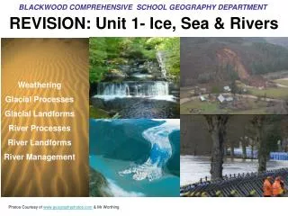
BLACKWOOD COMPREHENSIVE SCHOOL GEOGRAPHY DEPARTMENT. REVISION: Unit 1- Ice, Sea & Rivers. Weathering Glacial Processes Glacial Landforms River Processes River Landforms River Management. Photos Courtesy of www.geographyphotos.com & Mr Worthing. 30 Q’s + 1 extended question Skills

E N D
BLACKWOOD COMPREHENSIVE SCHOOL GEOGRAPHY DEPARTMENT REVISION: Unit 1- Ice, Sea & Rivers Weathering Glacial Processes Glacial Landforms River Processes River Landforms River Management Photos Courtesy of www.geographyphotos.com & Mr Worthing
30 Q’s + 1 extended question Skills Annotating sketches and sketch design Extended word response Personal viewpoints Interpreting photos/images
Question 1. Which of the following is an example of a weathering process? • Freeze Raw • Freeze Thaw • Thaw Freeze • Anti- Freeze
Question 2. Name the three types of weathering processes? • Biological, Chemical, Physical • Maths, English, Science • Erosion, Transportation, Deposition • Rain, Hail, Snow
Question 3. Which of the following is a definition of weathering? • When the sun melts the snow and washes it away • The wearing away of the land by the weather • The thawing of the land due to global warming • The reduction in the surface area of the land due to erosion
Question 4. What type of weathering process is shown in the photo? • Soil Creep • Freeze Thaw • Rock Snowballing • Exfoliation
Question 5. In what conditions does chemical weathering mainly occur? • Freezing • Warm and wet • Cold and wet • Warm and dry
Question 6. Which of the letters on the diagram shows a swallow hole? • A • B • C • D
Question 7. Which feature associated with limestone scenery is shown in the photo? • Limestone Blocks • Stalagmites • Limestone Pavements • Limestone Karsts
Question 8. Which place below is Limestone scenery found? • Malham Cove, Yorkshire • Cardiff Bay, Cardiff • Swanage Bay, Dorset • Clydach Gorge, Gwent
Question 9. What is a Dry Valley? • a valley where it never rains • a valley where the locals never drink alcohol • a valley where there is no river • a valley where the river is hidden beneath the surface
Question 10. SKETCH TIME! On one full page of your exercise books, draw a diagram showing freeze thaw weathering? (6)
Answers 1. B 2. A 3. B 4. D 5. B 6. A 7. C 8. A or C 9. C
Question 11. What is the name given to the downhill movement of material due to gravity? • Falling Movement • Mass Movement • Solid Movement • Gravitational pull
Question 12. Where is this place? • Haiti • Abervan • The Phillipines • Markam Colliery
Question 13. What is the main cause of a mudslide? • Too much mud being dumped by miners • the ground becomes saturated • the slope angle is too steep • the gravitational pull is too strong
Question 14. Personal opinion response question Mudslides are only ever a problem when humans interfere with nature What is your opinion about the statement above? Write down your view.
Question 15. What is the name of the process shown by the diagram? • Slumping • Rockfalls • Soil Creep • Cracking
Answers 11.B 12.B 13.B 14. Mass Movement processes such as mudslides are not always the consequence of mankinds actions (such as dumping coal waste). Mudslides are natural processes. However, human interference often makes the slide worse – so too if towns and villages are built in the path of potential ‘slip area’ such as at the foot of a hill. 15. Soil Creep
Question 16. What is the name given to a valley carved by ice? • U Shaped Valley • Y Shaped Valley • V Shaped Valley • Hanging Valley
Question 17. Name the 2 processes of erosion associated with glaciers • Hydraulic action and carving • abrasion and attrition • abrasion and plucking • abrasion and corrosion
Question 18. Which of the word lists below are not glacial landforms? • Hanging valley, truncated spurs • Terminal, medial, lateral morraine • Interlocking spurs, ox-bow lakes • aretes, pyramidal peaks, ribbon lakes
Question 19. What is the name of the feature shown in the photograph? • Meander • Ribbon Lake • Pyramidal Peak • Corrie • Drumlin
Question 20. Extended Writing question Describe how a v-shaped valley is altered by a glacier (8) • You will need to mention: • The processes of erosion (P & A) • The widening and deepening of the valley • Truncated spurs and hanging valleys • Deposition (Morraine) • Other landforms created by glaciers
Answers • 16. A • 17. C • 18. C • 19. D • 20 SEE PREVIOUS CLUES
Question 21. Name 2 processes of erosion associated with RIVERS? • hydraulic action and carving • traction and attrition • abrasion and plucking • hydraulic action and corrosion
Question 22. What river process is illustrated below? • Deposition • Transportation • Erosion • Weathering
Question 23. What is the name given to an area drained by a main river and its tributaries? • Watershed • Drainage Basin • Water Basin • Confluence
Question 24. What happens to the flow of water on the outside bend of a river? • The water is much clearer and so easier to see the river bed • The water is moving slower so deposition takes place • The water contains more rocks and pebbles so is darker in colour • The water is fast flowing so erodes the river bank and bed
Question 25. Using a diagram or sketch to help you, explain how a waterfall is formed (6)
Answers 21. D 22. B 23. B 24. D 25 • The Formation of a Waterfall • Water passes over hard rock and erodes the softer rock below • A plunge pool is formed and the river erodes backward as the water and rock swirl around • Eventually the hard cap rock overhangs and collapses under gravity • This process continues over time and the waterfall moves backwards or recedes to form a gorge • SKETCH ALSO NEEDED
Answers 25
Question 26. What is the name given to the river feature below? • Watershed • Rapids • Ox Bow Lake • Confluence
Question 27. What is the name of the natural bank at the side of the river which often forms following a flood? • Levee • Flood Armour • Water Basin • Flood Plain
Question 28. Describe how the material transported by a river changes as you move downstream along its course?
Question 29. Put the 4 options below in rank order of importance as to why councils allow developers to build on floodplains? • Nice view • Cheap land to purchase • Flat land so easier to build • Because there is no room anywhere else
Question 30. Which of the schemes below is NOT a flood control method • Embankments • Levees • Gabion Cages • Groynes
Answers 26. C 27. A 28 29 30. D
Extended question • How does flooding differ in a MEDC compared with a LEDC? Use case study examples to help.