Download
1 / 11
110 likes | 119 Vues
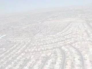
Impervious Surface Area of the Conterminous United States. Christopher D. Elvidge John B. Dietz Paul S. Sutton. Research Approach / Methods 1 km Grids.

E N D
Impervious Surface Area of the Conterminous United States Christopher D. Elvidge John B. Dietz Paul S. Sutton
Research Approach / Methods 1 km Grids • Aggregated 30 meter land cover from Landsat TM (MRLC) from the early 1990’s. Classes found most useful include 21 , 22, and 23 (low density residential, high density residential, and commercial / transportation). • Radiance calibrated nighttime lights from the DMSP-OLS (2001) • Aggregated road density processed from the U.S. Census Bureau TIGER (2000) • DOE Landscan population density data (2000)
Research Approach / Methods (continued) • For calibration, the percent cover of impervious surface was measured being measured with gridded point counts made on 1 km tiles of high resolution aerial photograpahy (1998-00) acquired along transects crossing major metropolitan areas in each region of the country. Each photo tile covers a 1Km Albers Equal Area grid cell.
Regression Results • Radiance only: %ISA = 21.17 + .348 Radiance (R2 = 0.53) • Radiance & roads: %ISA = 3.91 + 0.214 Radiance + .0021 Roads (R2 = 0.79) • Radiance, roads & MRLC: %ISA = 2.242 + .136*Rad + .0010*Roads + .00452*MRLC23 + .00286*MRLC22 + .00278*MRLC21 (R2 = 0.85 • MRLC only: %ISA = 7.6625 + .0085 MRLC23 + .0060 MRLC22 + .0047 MRLC21 (R2 = 0.78)
%ISA Model From DMSP Radiance, Road Density and MRLC Classes 21, 22, 23
%ISA From Four Models DMSP Radiance MRLC 21,22,23 Radiance, Road Density, MRLC 21,22,23 Radiance & Road Density
Conclusion To Date • ISA can be modeled regionally to globally at 1 km resolution. • DMSP radiance is insufficient as a sole predictor. • DMSP radiance plus road density works well. • DMSP radiance, road density plus Landsat land cover gave the best results. • Effort required to generate continental scale Landsat land cover results in long delays and high cost. Other sources of land cover should be considered (e.g. MODIS). • Level of effort for Landsat land cover for ISA estimation could be reduced by focus on areas with DMSP lights.