Download
1 / 68
681 likes | 910 Vues
Learn about the causes of land slides and effective measures to prevent them. This article discusses various types of earth movements, such as solifuction and soil creep, as well as the classification of landslides. It also covers the effects of water, geological structures, and human activities on slope stability.

E N D
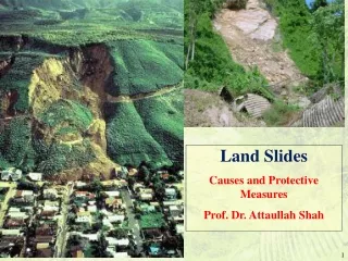
Land Slides Causes and Protective Measures Prof. Dr. Attaullah Shah
Landslide: refers to the downward sliding of huge quantities of land mass, which occur along steep slopes of hills or mountains and may be sudden or slow Geological Phenomena involving downward movement of large quantities of material such as rocks, earth, sand and combination The Movement may be slow from few millimeters per year to few centimeter per year. In flow type land slides, it may be 15km/h in some cases The collapse of masses may also be suddent as in case of Avalanche on the steep slope. In recent days, the earthquake at Nepal led to huge avalanche at the bases camp of Mount Everest which caused huge human losses.
Classification of Earth Movements • All movement of land masses are referred as landslides, but differ in many respects, therefore all types of landslides are categorized as Earth Movements. • These are classified as Landslides Subsidence Earth Flow Debris slide or slump Plastic flow Solifluction Rock slides Creep collapse Rock falls Rapid flows
SOLIFUCTION • Solifuction is a downward movement of wet soil along the slopes under the influence of gravity.
SOIL CREEP • Creep is extremely slow downward movement of dry surficial matter. • Movement of the soil occurs in regions which are subjected to freeze-thaw conditions. The freeze lifts the particles of soil and rocks and when there is a thaw, the particles are set back down, but not in the same place as before. • It is very important for CEs to know the rate of movement • RAPID FLOWS: Rapid flow is similar to the creep, but differ in terms of speed and depth. It is faster. • Creep is involved upto shallow depth (app. 1-2 m), whereas the rapid flow is involved to greater depth (app. upto 5 m or more)
Landslides • If a mass of earth moves along a definite plane or surface the failure is termed as Landslide • Large block known as a slump block moves during the landslide. • The scar above a landslide is easily visible. • They can occur along a slope where the internal resistance of the rocks are reduced or they loose their holding capacity. • Common after earthquakes or after removal of part of the slope due to construction, particularly for construction of roads.
During the movement landslide can result into the Debris slides - are failure of unconsolidated material on a surface; Rock slide or Rock Fall – where movement of large rock block rolls • They are also common along the steep banks of rivers, lakes etc. • Pore Water Pressure is the key to monitoring landslides. Shear strength (a resisting force) decreases and the weight (a driving force increases).
Talus – accumulation formed by the coarser rock fragments resulted from the mechanical weathering along a slope under influence of gravity
Subsidence • It represents the downward movement of the surface • It may occur due to plastic outflow of the underlying strata or due to the compaction of the underlying material • (1) Subsidence due to Plastic outflow: It may occur when a plastic layer like clay bed is squeezed outward due to overlying heavy load • (2) Subsidence due to collapse: It occur due to extensive pull out of large volume of underground water or due to subsurface solution activity in limestone terrain.
The Leaning Tower of Pisa, Italy, the tilting of which accelerated as groundwater was withdrawn from aquifers to supply the growing city.
CAUSES OF LANDSLIDES • LANDSLIDES OCCUR DUE OF VARIOUS REASONS • Internal Causes: • Influence of slope- Provides favorable condition for landslides; steeper slope are prone to slippage of land. It is known that most of the materials are stable upto certain angle- “Critical angle” or “angle of repose” – it varies from 300 for unconsolidated sediments to 900 for massive rocks and 600-900 for partially jointed rocks. • Ground water or associated water- Main factor responsible for slippage. Suppose the hard or massive rocks are underlaid by softer rocks (shale or clay bed) • When rain water percolates through some fractures or joints the clayey beds becomes very plastic and acts as slippery base, which enhance the chances of loose overburden to slip downward. • Water is the most powerful solvent, which not only causes decomposition of minerals but also leaches out the soluble matter of the rock and reduces the strength.
Lithology- rock which are rich in clay (montmorillonite, bentonite), mica, calcite, gypsum etc are prone to landslide because these minerals are prone to weathering. • Geological structures- Occurrence of inclined bedding planes, joints, fault or shear zone are the planes of weakness, which create conditions of instability. • Human Influence- undercutting along the hill slopes for laying roads or rail tracks can result into instability. • Deforestation in the uplands, result into more erosion during the rainy season.
External factors • Most common is the vibration resulted due to earthquakes; blasting to explosives; volcanic eruption etc. • Earthquakes often initiate mass failures on large scale e.g. 1897 Assam quake produced gigantic landslide ever recorded in the region.
Geological process causing Landslides • Erosion: • Cause steepening of slopes • Remove cementing material • Weathering of Rocks • Freeze and Thaw actions ( Swelling and expansion) • Shearing, jointing and cracks etc • Leaching of limes and earth
Human actions causing landslides • Construction of human settlements at vulnerable areas near the critical slopes. • Blasting and mining • Vibrations of machines and earth moving equipment • Dumping of Rocks and debris causes lateral pressure • Vegetation and tree roots bind the slopes, but its cutting can cause slides. • Overgrazing in unconsolidated soils • Water leakages from utilities
Natural Causes • Heavy rainfalls leads to saturation of soils • Erosion and undercutting of slopes by rivers • Earthquakes and ground movements • Excessive water filtration in ground • Volcanic eruption • Ocean waves may also cause coastal slides • Freeze and Thaw actions • Action of thunder and storms
PREVENTIVE MEASURES • The main factors which contribute to landslides are Slope, water content, geological structure, unconsolidated or loose sediments, lithology and human interference. • Slope: Retaining wall may be constructed against the slopes, which can prevents rolling down of material. Terracing of the slope is an effective measure. • Effect of water: Make proper drainage network for quick removal of percolating moisture or rain water by constructing ditches and water ways along the slope • Geological structures: Weak planes or zones may covered or grouted to prevent percolation of water, this increases the compaction of loose material.
LANDSLIDES AND MUDFLOWS • Plant ground cover on slopes and build retaining walls. • In mudflow areas, build channels or deflection walls to direct the flow around buildings. • Install flexible pipe fittings to avoid gas or water leaks.
Landslide Mitigation measures • Afforestation • Local suitable plants that can withstand the existing hydrological conditions • Modification of Slope geometry • Drainage arrangement for Ground water management • Slope Reinforcement • Retaining Structures • Other methods; • Electro Thermo Osmosis • Use of Geogrids and Geotextiles • Use of steel wire meshes and Gabions • Soil nailing
Landslides: Introduction Temporarily Safe Landslide Warning Consequence Remedial Measures Remove Consequence Consequences of Landslides • Injury • Death • Economic Loss • Disruption to Transport Links Stability Assessment Landslide Preventive Measures Landslide Design Cost Build Safe at the moment
Landslides: Removing the Consequence Manchester Main Manchester – Sheffield Road (A625) Alternative route – only suitable for light vehicles – gradient of 1 in 4 1 km
Landslides: Removing the Consequence Landslides in Kowloon East 28th - 31st May 1982
Landslides: Engineering Modelling Methods Loading Slope Angle Material Properties (Shear Strength) Hydrology Temporarily Safe Landslide Warning Consequence Safe at the moment Remedial Measures Remove Consequence Man’s Influence (Agriculture /Development) Geology Stability Assessment Landslide Preventive Measures Landslide Design Cost Build But only for specific slopes
Landslides:Engineering Modelling Methods • Applicable to very specific locations only • Can have moderate to good accuracy for spatial predictions where information exists • Moderate accuracy for temporal predictions (good if accurate ground water temporal variations are available) • Poor for overall spatial coverage • Is costly to implement. But one must not be complacent
berms Landslide in man made Cut Slope at km 365 west of Sao Paolo - August 2002
Landslides: GIS Modelling Methods Land Use General Slope (and aspect) Soil Type Hydrology Geology Cataloguing slopes and landslides Classification into potential Areas of Risk Database of existing Landslides General Planning Guidelines of Landslide Risk Identification of areas for detailed Engineering Study
Landslides:GIS Modelling Methods • Good spatial (geographic) coverage of likelihood of landslides • Poor to moderate prediction of precise locations of landslides • Effective use of resources • Poor accuracy for temporal predictions • i.e. precisely when landslides occur Accuracy is dependant on existence of a good unbiassed database of landslides and slopes
Landslides:Categorisation of Slopes Cut Slope Fill Slope Retaining Wall “Natural” Slope e.g. North Coast Road, Trinidad
Landslide at Maracas December 2002 December 2004 – note the slide is much more extensive
December 9th Landslide 3 km beyond Las Cuevas as seen on TV half of road blocked Landslide 11th December 2004 at approximately 13:00 1 km before Las Cuevas half of road blocked
Slope before failure at Couva Slope after Landslide Slide by Derek Gay, UWI
LANDSLIDE HAZARD: ALASKA • Slope failure was induced by ground shaking of “Quick Clay.”
Landslides:GIS Modelling Methods: Requirements for the future Landslides triggered by anthropogenic activity • Cut Slopes • Fill Slopes • Retaining Walls • Hybrids: Cut/Retaining Wall / Fill/Retaining Wall • “Natural” Slopes - is there a better word? slopes where there has been no anthropogenic activity, or where there is such activity it causes small changes to the geometry of the slope so that the Factor of Safety is largely unaffected. Deep seated landslide unaffected by anthropogenic activity
Landslides: Statistical Methods Rainfall Data Historical Database of Landslide Occurrence Research to correlate Rainfall with Landslide Incidence Antecedent Rainfall Current/ Predicted Rainfall Prediction of exactly when landslides are likely to occur Mobilise Emergency Teams Issue warnings to affected people Aim: to minimise injury and loss of life
Landslides:Statistical MethodsLandslide Warning System • Poor prediction for spatial location of Landslides. • Potentially effective use of resources to minimise death and injury. • Moderate ability to predict when landslides are likely to occur. • Requires automatic recording of rainfall over short periods of time (e.g. 5 – 15 minute intervals). • Requires a robust historic database of landslides and associated rainfall. Method aims to alert people to impending danger so they can seek safety during critical periods – it will not prevent landslides
Rain Gauge Network in Hong Kong Built Up Areas
Landslides: Landslide Warning System Requirements: It should: 1) provide sufficient warning of an event • to alert general public • to mobilise Emergency Services • to open temporary Shelters 2) predict IN ADVANCE all serious EVENTS 3) minimise number of false alarms Three criteria can be in conflict: • How long should warning be? • Longer the time, the less accurate will be prediction – more false alarms
Landslides: Landslide Warning System Background to Warning System Two Approaches • Detailed Warning - e.g. 1. Conduit Road • Warning based solely on Rainfall automatic piezometer gives warning when ground water level gets above a critical level as determined by Slope Stability Analysis Aim to give warning when a significant number of landslides are likely to occur. (>10)