Download
1 / 7
70 likes | 221 Vues
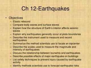
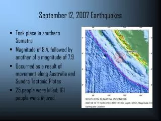
September 12, 2007 Earthquakes. Took place in southern Sumatra Magnitude of 8.4, followed by another of a magnitude of 7.9 Occurred as a result of movement along Australia and Sundra Tectonic Plates 25 people were killed; 161 people were injured.

E N D
September 12, 2007 Earthquakes • Took place in southern Sumatra • Magnitude of 8.4, followed by another of a magnitude of 7.9 • Occurred as a result of movement along Australia and Sundra Tectonic Plates • 25 people were killed; 161 people were injured
Both S and P waves are body waves- travel through Earth’s interior Higher frequency than surface waves P wave (aka Primary waves)- fastest; travel through solids and fluids; compressional waves “push and pull” P waves travel at about 4.8 – 8.0 km/sec (USGS) S waves travel at about 3.2 – 4.8 km/sec (USGS) To see a visualization of their travel, click on the link located on the webpage S and P Waves
Proof That LIGO Detected Earthquake was the 8.4 Magnitude Earthquake in Sumatra • This seismograph from the USGS shows its recordings at different stations on 9/12/07 around the time of the Sumatra earthquakes. The topmost on, NLWA is located in Washington state, just like the Hanford LIGO station. The times match up quite well. The first indications here are about 1,250 seconds after 11:10 UTC, or about 21 minutes after the Earthquake started. The next two graphs show recordings at about the same time.
Proof That LIGO Detected Earthquake was the 8.4 Magnitude Earthquake in Sumatra • Microseisms- or Earth’s ambient noise can be filtered- it’s usually in the range of 0.1-0.3Hz (kiska.giseis.alaska.edu/input/west/qmda_proj/crustal_convolution.html) • Also, P wave theoretical travel time (USGS) on the date to Washington state was about 15 minutes, 25 seconds, meaning it hit the LIGO system between 11:25- 11:27 UTC. This is shown on the graph.
Proof That LIGO Detected Earthquake was the 8.4 Magnitude Earthquake in Sumatra • “Seismic X” (as in previous graph) is direction in same propagating motion of wave- longitudinal • “Seismic Z” (graph on left) is perpendicular to the longitude – S waves travel this way, perpendicularly to direction of propagation of a wave • So, P and S waves travel in a X-Z plane • To see this in a more visual way, see • http://web.ics.purdue.edu/~braile/edumod/waves/WaveDemo.htm
Other Graphs This graph shows the seismic data from the vault sensor at LIGO. The y-axis is the raw ADC voltage, and therefore is negative.
Other Graphs This graph also shows the seismic data from the vault sensor at LIGO. The y-axis is the raw ADC voltage, and therefore is negative.