Download
1 / 28
280 likes | 640 Vues
Integrated Global Observing Strategy (IGOS) Geohazards Hormoz Modaressi BRGM-French Geological Survey. Presentation Outline. Introduction to the IGOS partnership IGOS Geohazards: Past work and current status A brief history of IGOS Geohazards Context Objectives Strategy Method

E N D
Integrated Global Observing Strategy (IGOS)GeohazardsHormoz ModaressiBRGM-French Geological Survey
Presentation Outline • Introduction to the IGOS partnership • IGOS Geohazards: Past work and current status • A brief history of IGOS Geohazards • Context • Objectives • Strategy • Method • IGOS Geohazards Working Groups • Working Groups • Expected Outputs • Future actions ...
Integrated Global Observing Strategy (IGOS) • Partnership of international organisations concerned with global environmental change issues created in 1998 http://www.igospartners.org
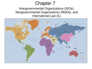
CEOS FAO GCOS GOOS GTOS ICSU IGPB IGFA IOC UNEP UNESCO WCRP WMO Committee of Earth Observation Satellites Food and Agriculture Organization Global Climate Observing System Global Ocean Observing System Global Terrestrial Observing System International Council for Science International Geosphere-Biosphere Programme Int'l Group of Funding Agencies for Global Change Res. Intergovernmental Oceanographic Commission United Nations Environment Programme United Nations Educational, Scientific and Cultural Organization World Climate Research Programme World Meteorological Organization International Organisations concerned by IGOS
The IGOS Theme concept • “Theme” approach allows for a coherent definition and development of an overall global strategy for observing selected fields of common interest among a group of the IGOS partners. • The Ocean Theme • The Global Carbon Theme • The Global Water Cycle Theme • The Geohazards Theme • The Atmospheric Chemistry Theme • The Coastal Theme
IGOS-Geohazards IGOS-Geohazards is concerned by all natural hazards that originate from the Solid Earth such as Earthquakes, Volcanoes, Ground Instabilities (i.e. landslides, subsidence, collapse, rock falls, shrinkage/swelling of soils, etc…) but also Tsunamis
IGOS Geohazards: past work and current status • UNESCO, CEOS and ICSU initiated and scoped the IGOS Geohazards Theme in 2001. • An Ad-hoc Working Group was formed, held an international workshop in Frascati (Rome), and delivered a proposal to the IGOS partnership in May 2002. • The resulting IGOS Geohazards Theme Team delivered a Theme Report to the IGOS Partners in May 2003. • Following an international peer review, the Geohazards Theme Report was published in April 2004. http://www.igosgeohazards.org
IGOS Geohazards: Context (1/3) • Theme report proposed a strategy structured by five elements of critical importance to the Geohazards: • Underpinning Science • Observations • Modelling and Integration • Infrastructure and Access • Capacity Building • One recommendation was the setting up of a Geohazards Bureau to monitor and coordinate implementation • The IGOS Geohazards Bureau created by the BRGM (French Geological Survey) and the European Space Agency (ESA) in last quarter 2004 initially for a three year period (igosg@brgm.fr).
IGOS Geohazards: Context (2/3) • GEOSS : Global Earth Observation System of Systems • Newly established GEOSS Secretariat in Geneva • Geohazards included in the “Disasters” Societal Benefit Area, which is of paramount importance for GEOSS. • National, Regional and International initiatives • Proposals from learned international associations
IGOS Geohazards: Context (3/3) • Recent tragedies: • Bam Earthquake : about 40 000 killed (Dec 2003) • Indian Ocean Tsunami : more than 200 000 killed (Dec 2004) • Frequent disasters: • Landslides, rock avalanches, debris flows, … • Moderate earthquakes and volcanic eruptions • Subsidence • Swelling- Shrinkage of Clays together with concentration of populations in risk prone areas
IGOS Geohazards: Objectives (1/3) 1- Bring together the actors from the Geohazards community across different disciplines (Earthquakes, Volcanoes, Ground Movement) and methods (in-situ measurements - remote sensing, modeling,...) with the aim of • stimulating co-operation • generating synergy
IGOS Geohazards: Objectives (2/3) 2- Gather information on the state of the art in • observations • modelling, data analysis • infrastructure and data dissemination • capacity building This information will come from the community and be made available to the community (via the web).
IGOS Geohazards: Objectives (3/3) 3- Evaluate gaps between existing and needed tools with respect to • observations • modelling, data analysis • infrastructure and data dissemination • capacity building for all Geohazards 4- Establish priorities 5- Provide recommendations for filling gaps in an optimal way
IGOS Geohazards: Strategy (1/2) 1- GeoHazNet : a Geohazards Network • A forum within which the Geohazard related disciplines can meet, exchange and propose joint projects • A cross-disciplinary approach with continental and sub-continental ramifications (Africa, Asia, Australia, Europe, Middle East, North and South America) • Hazard Focused (as compared to International Associations such as): • International Association of Seismology and Physics of the Earth's Interior (IASPEI), • International Association for Earthquake Engineering (IAEE). • International Association of Volcanology and Chemistry of the Earth's Interior (IAVCEI), • International Consortium on Landslides (ICL), • International Society of Soils Mechanics and Geotechnical Engineering (ISSMGE), • International Society for Rock Mechanics (ISRM), • International Union of Soil Sciences (IUSS), • International Union of Geological Sciences (IUGS), • International Association for Engineering Geology and the Environment (IAEG), • International Association for Mathematical Geology, (IAMG), • International Union of Geodesy and Geophysics (IUGG), • International Geographical Union (IGU), • Etc…
IGOS Geohazards: Strategy (2/2) 2- Provide the infrastructure for stimulating co-operation and generating synergy by means of : • working groups • events such as international workshops, …. • website and other dissemination activities 3- Promote results through information dissemination among end-users, decision makers and other dedicated structures
IGOS Geohazards Working Groups • Science : the state of the art and attended evolution • Observations: existing and expected observing tools • Infrastructure: structures/techniques for data/information storage/dissemination • Integration: data processing, interpretation, modeling, fusion.. • Capacity Building: facilitating knowledge transfer
IGOS Geohazards Working Groups (detailed 1/5) • Science • Addresses principally the fundamental research and provides input for Observations and Integration WGs Considers • fundamental research to identify the measurement of new parameters that may help improve understanding of Geohazards phenomena • fundamental research into modeling or data fusion for the generation of information products
IGOS Geohazards Working Groups (detailed 2/5) • Observations • Addresses principally observing tools, their accuracy and other characteristics (frequency, …) Considers • satellite, in-situ and airborne data that is used for Geohazard mitigation • Mainly in-field measurements building on already extensive work on satellite based data • data as being “well-established” not experimental in nature - this is included in Science WG but • the synergy generated between different data types is NOT considered here but in Integration WG
IGOS Geohazards Working Groups (detailed 3/5) • Infrastructure • Addresses principally the support structures and techniques Considers • Structures and techniques that allow dissemination of data, tools and information on Geohazard mitigation • Databases and associated technology • System interoperability, ancillary data and meta-data requirements • Networks of sensors • Delivery of information to end-users such as decision-makers in a timely fashion
IGOS Geohazards Working Groups (detailed 4/5) • Integration • Deals with data Considers • data processing methods: qualitative interpretation, multi-parametric data analysis, modeling • fusion of different data streams • extracting information from data but • “systems” aspects such as interoperability are considered by the Infrastructure WG
IGOS Geohazards Working Groups (detailed 5/5) • Capacity Building • Deals essentially with knowledge transfer Considers • means for the consolidation of an international Geohazards community through existing associations and programmes • mechanisms for developing Geohazard mitigation globally • facilitating knowledge transfer in data integration • Identification of appropriate infrastructures and dissemination technology to develop capacity under different circumstances (geographical and disciplinary gaps)
IGOS Geohazards Workshop - Outputs • Clear terms of reference for each of the working groups • Detailed planning with description of any individual contribution • Proposal for enlargement of working group teams • Recommendations for GeoHazNet extension to outside Europe • Effective proposals for GEOSS 2006-2007 work plan
IGOS Geohazards Workshop Outputs detailed (1/2) • A1- Define a Sampling Strategy in time/ space/ resolution/ accuracy/ scale covering both background monitoring and crisis response. Prioritise on risk versus reward basis. • A2- On the basis of the Sampling Strategy, define Observational Requirements across all platforms for earthquakes, volcanoes, ground instability and tsunami. Feed this into IGOS Partners’ database managed by WMO. • A3- Analyse current and future means (techniques or systems) for quantitative deformation measurement and their suitability to the geohazards • A4- Identify one community test site for each geohazard and document the data available. Propose cross-validation activities. • A5- Compile and maintain an inventory of existing materials (tutorials, courses), programmes and training infrastructure (e.g. regional/national centres) • A6- Identify and structure list of geographical zones and concerned geohazards where capacity building activities must be developed in the short term.
IGOS Geohazards Workshop Outputs detailed (2/2) • A7- Identify existing regional/global archives of data (including hazard maps) and historical events. Facilitating access to this resource through the web should allow: • Rapid access to existing data • The development of baseline states for anomaly detection • Stimulation of continuity in data acquisitions • A8- Identify projects working in the area of data harmonisation/interoperability for the geohazards. Propose a interoperability demonstrator on databases that would benefit from being linked together through interaction with the appropriate projects • A9- Inventory and develop contacts with projects employing a multidisciplinary approach to the integration of different data sources in the geohazards. • A10- Identify and evaluate existing multihazard approaches used in information products for end-user landuse planning and decision support systems.
Proposed way forward • The databases to be developed for inventory purposes: • Data Needs (A1 and A2) • Existing Capacity Building resources (A5) • Existing archives of data and historical event (A7) • Projects – containing three parts: interoperability/harmonisation(A8); multidisciplinary approach to data integration(A9); multihazard approach(A10) • Analysis tasks are the following: • Quantitative Deformation measurement: Analyse current and future means (techniques or systems) and their suitability to the geohazards (A3) • Identify one community test site for each geohazard and document the data available. Propose cross-validation activities. (A4) • Identify and structure list of geographical zones and concerned geohazards where capacity building activities must be developed in the short term. (A6)
IGOS-Geohazards Newsletter http://www.igosgeohazards.org
IGOS Geohazards eProject space https://eprojet.brgm.fr/egroupgen/wks/user/
Future Actions … • Continue to provide support to the GEOSS Work Plan Team • Organise future working group meetings within 12 months • Integrate inputs from inventory activity • Seek funding for a Geohazards Network project