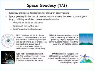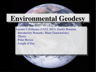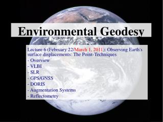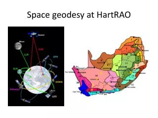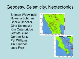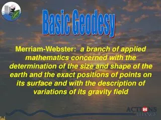
Basic Geodesy
Basic Geodesy. Merriam-Webster: a branch of applied mathematics concerned with the determination of the size and shape of the earth and the exact positions of points on its surface and with the description of variations of its gravity field. Basic Geodesy.


Basic Geodesy
E N D
Presentation Transcript
Basic Geodesy Merriam-Webster: a branch of applied mathematics concerned with the determination of the size and shape of the earth and the exact positions of points on its surface and with the description of variations of its gravity field
Basic Geodesy Basically it is what we use to geo-reference or position our civil works projects with respect to other related projects such as SLOSH models, historical high water marks, ADCIRC models, DFIRMS, Bridges, etc.
Alexandria 500mi Syene Sun not directly overhead 7 º 12’ or 1/50th of a circle Eratosthenes had observed that on the day of the summer solstice, the midday sun shone to the bottom of a well in the Ancient Egyptian city of Swenet (known in Greek as Syene). He also knew that Alexandria and Syene were 500 miles apart The accepted value along the equator is 24,902 miles, but, if you measure the earth through the poles the value is 24,860 miles He was within 1% of today’s accepted value Eratosthenes' conclusions were highly regarded at the time, and his estimate of the Earth’s size was accepted for hundreds of years afterwards. To these observations, Eratosthenes concluded that the circumference of the earth was 50 x 500 miles, or 25000 miles. He knew that at the same time, the sun was not directly overhead at Alexandria; instead, it cast a shadow with the vertical equal to 1/50th of a circle (7° 12'). Eratosthenes Egypt about 240 BC
Gravity: Local Attraction Unfortunately, the density of the earth’s crust is not uniformly the same. Heavy rock, such as an iron ore deposit, will have a stronger attraction than lighter materials. Therefore, the geoid (or any equipotential surface) will not be a simple mathematical surface. Vertical Datums The Geoid
“The equipotential surface of the Earth’sgravity field which best fits, in the least squares sense, global mean sea level.” Can’t see the surface or measure it directly. Modeled from gravity data. Vertical Datums What is the GEOID? The Geoid
Vertical Datums The Geoid Equipotential Surfaces Topography Reference Surface (Geoid)
Earth An ellipsoid of revolution is the figure which would be obtained by rotating an ellipse about its shorter axis. The GRS80 ellipsoid is used for the NAD83. So we squash the sphere to fit better at the poles. This creates a spheroid Close Fit At The Equator But The Poles Are Out • b = 6,356,752.31414 m • a = 6,378,137.00000 m GRS80 fits geoid to about +/- 300’ • a= 6378137.00000 meters • b= 6356752.31414 meters • f= 1/(a-b)/a = 298.2572220972 NAD83 uses the GRS80 Ellipsoid
P Prime Meridian Latitude - Longitude GRS80 Ellipsoid h Earth’s Surface Equator
Datum: A point, line, or surface used as a reference, as in surveying, mapping, or geology.
Local vs. Global Reference Ellipsoid Basic Geodesy CLARKE 1866 GRS80-WGS84 Earth Mass Center Approximately 236 meters GEOID
UNITED STATESELLIPSOID DEFINITIONS Basic Geodesy BESSEL 1841 a = 6,377,397.155 m 1/f = 299.1528128 CLARKE 1866 a = 6,378,206.4 m 1/f = 294.97869821 GEODETIC REFERENCE SYSTEM 1980 - (GRS 80) a = 6,378,137 m 1/f = 298.257222101 WORLD GEODETIC SYSTEM 1984 - (WGS 84) a = 6,378,137 m 1/f = 298.257223563
Ellipsoid Simple Mathematical Definition Described by Two Parameters Cannot Be 'Sensed' by Instruments Geoid Complicated Physical Definition Described by Infinite Number of Parameters Can Be 'Sensed' by Instruments Vertical Datums Ellipsoid vs. Geoid
Vertical Datums Ellipsoid vs. Geoid High Density ellipsoid Low Density geoid Earth’s surface
H = elevation relative to geoid (orthometric or NAVD88) They are instead referenced to the GRS80 ellipsoid, that squashed sphere that best fits the earth and is used for NAD83 The geoid is the equipotential surface of the earth’s attraction and rotation which, on the average, coincides with mean sea level in the open ocean. h = elevation relative to ellipsoid (GRS80) N = separation between geoid and ellipsoid (Geoid03) This is what we reference our project elevations to. These are the elevations you get from the NGS datasheets and traditionally were obtained from geodetic leveling To convert GPS derived heights to NAVD88 you must use the latest geoid model (currently Geoid03) GPS heights are not related to either orthometric or hydraulic/tidal elevations. Let’s take a look at the difference between NAVD88 elevations (orthometric heights) and the ellipsoid heights from GPS h h = H+N H Ellipsoid (GRS80) N Earth's Surface Geoid
Geoid Model GRS80
N N N N N Geoid Model GRS80 Geoid Surface
Vertical Datums h= H + N H is measured traditionally h is measured with GPS ObservationsN is modeled using Gravity Models
GRS80 (NAD83/GPS) -59.56' 14.00' 13.51' 13.01' LMSL NAVD88 NGVD29
Latitude & Longitude State Plane Coordinates UTM Coordinates NAD 83 NAD 27 NSRS Coordinate Systems
Surfaces Used In State Plane Coordinate Systems Basic Geodesy Lambert Projection Transverse Mercator Projection IMAGINARY CONE IMAGINARY CYLINDER EARTH A B EARTH A B D C 158 miles wide C D North-South East-West • Conformal (preserve distances and directions within defined limits) • 158 miles for 1:10,000
Conic Projections(Lambert) The lines where the cone is tangent or secant are the places with the least distortion.
Cylindrical Projections(Mercator) The lines where the cylinder is tangent or secant are the places with the least distortion. Panhandle of Alaska Transverse Oblique
2 3 4 5 6 7 8 9 10 11 12 13 14 15 16 17 18 19 20 21 22 168W 162 156 150 144 138 132 126 120 114 108 102 96 90 84 78 72 66 60 54W Basic Geodesy UTM Zones
UTM Zone 14 Basic Geodesy -99° -102° -96° 6° Origin Equator -90 ° -120° -60 °
Basic Geodesy NAD83 State Plane Coordinate Zones State Plane Coordinate System - 1983
Basic Geodesy NAD83 State Plane Units of Measure 2007
Questions? Additional Information Available at: http://crunch.tec.army.mil/information/SM_CoP/ndsp mark.w.huber@usace.army.mil