Analyzing Data
Final Jeopardy!. Mapping Vocabulary. Finding Locations. Analyzing Data. Tools to use. Patterns. 100. 100. 100. 100. 100. 200. 200. 200. 200. 200. 300. 300. 300. 300. 300. 400. 400. 400. 400. 400. *. What are the cardinal directions?. Answer.

Analyzing Data
E N D
Presentation Transcript
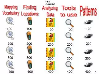
Final Jeopardy! Mapping Vocabulary Finding Locations Analyzing Data Tools to use Patterns 100 100 100 100 100 200 200 200 200 200 300 300 300 300 300 400 400 400 400 400 *
What does GIS stand for and what was the name of the program we used? Answer
What is it called when 3 satellites are required to find your location? Answer
Triangulation Back
An intersection is when a north/south and east/west street meet. Back
What device did we use to map the sewer locations outside of Broughal and what do the letters stand for? Answer
When recording sewer locations, was our longitude positive or negative. Answer
Negative Back
Latitude are lines that run north and south of the equator.Longitude are lines that run east and west of the prime meridian. Back
What program did we use to create and analyze maps and what type of program is it? Answer
AEJEEGIS program Back
Generally, where were most of the sewers located, near intersections or not near intersections and why? Answer
At intersections Back
Look at the picture above. Broughal is marked with a star. What pattern do you see with the double sewers? Answer
What significant landmark divides us into the south side of Bethlehem? Answer
The Lehigh River Back
Please identify the tool above and describe its function. Answer
This is the zoom tool. It is used to zoom in on data in AEJEE. Back
Please identify the tool above and describe its function. Answer
This is the identify tool. It is used to identify information about sewers or streets in AEJEE. Back
What is the name of the “table” above and what is its significance? Answer
The attribute table. It contains all the information recorded for each of the sewers. Back
Please identify the tool above and describe its function. Answer
This is the add data button. This is used to add the sewers and streets to the GIS map. Back
If you walk North to come to school, what direction do you walk home and why? Answer
Mapping Jeopardy Directions • The class will be split into two teams. • Each team must choose a representative to speak for the team. • When it is your team’s turn you must choose a category and amount. • Your team will be given time to discuss the answer. • Your team representative will give one answer for the group. • If the answer to the question is correct, you will receive the points for that question. Next
Jeopardy Directions Continued • If the answer is incorrect, the other team may “steal” the question. • If the other team gets the question correct, they receive the points and they will get the next question. • If neither team answers the question correctly, the question is thrown out of the game. • Although correct answers result in gaining points, incorrect answers do not result in losing points. Start
Look at the picture below. Each yellow dot is an Earthquake. What pattern is evident? Answer
Most of the earthquakes occur on or near the tectonic plates Back
Look at the picture below. What pattern is evident with the first 13 U.S. settlements? Answer
The colonies are located along the coastline. This is because travel and trading was done by sea. Back
You are hired to analyze flooding problems in the south side of Bethlehem. List the steps you would follow to solve this problem. Answer
1. Collect data2. Data entry3. Data analysis 4. Data solution Back
You are standing at the following location: 40.60789, -75.34678You move to the location below:40.60000, -75.34678What changed: latitude, longitude or both and in what direction? Answer
Your latitude has changed because it has gone down. You have moved south. Back