Download
1 / 15
150 likes | 179 Vues
Learn about the MARSIS mission objectives to map water, solid, and liquid distributions in Mars' crust, and its ionospheric sounding capabilities. The mission aims to detect and characterize subsurface material discontinuities, aquifer search, and study polar regions.

E N D
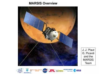
MARSIS Overview J. J. Plaut G. Picardi and the MARSIS Team
MARSIS Mars Advanced Radar for Subsurface and Ionospheric Sounding Science Objectives Primary “Map the distribution of water, solid and liquid, in the upper portions of the crust of Mars.” How?: Detect, map and characterize subsurface material discontinuities in the upper crust of Mars. These may include boundaries of: Liquid water-bearing zones Icy layers Geologic units Geologic structures Secondary Characterize and map the elevation, roughness and electromagnetic properties of the surface. Probe the ionosphere of Mars to characterize the interaction of the atmosphere and solar wind.
MARSIS Deployed on Mars Express • Radar Channels • 1.8, 3.0, 4.0, 5.0 MHz • (166, 100, 75, 60 m) • Antenna Sizes • Dipole: 40 meters tip-to-tip. • Monopole: 7 meters.
MARSIS Antennas 7 meter monopole 20 meter dipoles (2)
MARSIS Science Themes • Global reconnaissance, subsurface sounding • Aquifer search • Polar region studies • Stratigraphy and geologic structure • Ionospheric sounding
MARSIS Science Themes • Ionospheric sounding • Reconnaissance of ionosphere under varying conditions: • Solar zenith angle, latitude, season. • Solar activity/cycle and distance. • Crustal magnetic field. • Nightside behavior (“holes”; other variations) • Crustal magnetism: • Effect on ionosphere. • Active ionospheric and subsurface sounding to map crustal fields.
Swath Mapping Single Footprint Time (Depth) 10 km Power ~ 500 contiguous footprints per orbit Up to 4 profiles for each footprint MARSIS Data Acquisition Scheme
MARSIS Clutter Cancellation Monopole Dipole Detected by monopole and dipole Incoming wave Surface Detected by dipole only Subsurface interface
MARSIS Summary - As of Spring 2005! • MARSIS is an experiment! • First objective: Detect something in the subsurface. (Mars must cooperate.) • Second objective: Characterize that “something”. • Critical phases coming up: deployment, check-out, data(!!!) • Unambiguous aquifer detection will be a challenge, but… • …models suggest that if aquifers are present within the upper ~3 km, we have a good chance of seeing them.
MARSIS Summary - As of Now
MARSIS Some Recent PR
MARSIS Radargram South Polar Layered Deposits (SPLD) SPLD surface 50 s Basal interface MARSIS Data MOLA Topo Nadir groundtrack 500 km 2682
SPLD Thickness From MARSIS