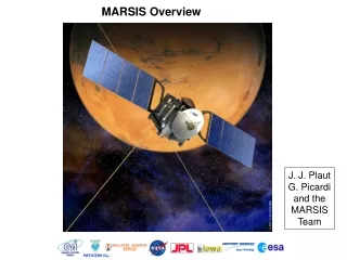
MARSIS data visualization
MARSIS data visualization. using open source tools Anton B. Ivanov ( anton@psi.edu ) Ecole Polytechnique fédérale, Lausanne, Switzerland Planetary Science Institute, Tucson, AZ. Overview. What you need to know Access and plotting tools vanilla, GMT IDL

MARSIS data visualization
E N D
Presentation Transcript
MARSIS data visualization • using open source tools • Anton B. Ivanov (anton@psi.edu) • Ecole Polytechnique fédérale, Lausanne, Switzerland • Planetary Science Institute, Tucson, AZ.
Overview • What you need to know • Access and plotting tools • vanilla, GMT • IDL • Goal for today • Show a simple example of MARSIS data use.
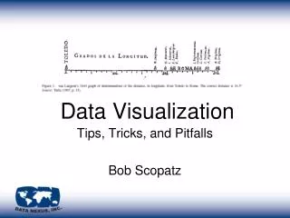
Structure of MARSIS data grd2cpt d1885.grd -E256 -Cgray > ddd.cpt
Software set • What you need to know to process MARSIS data • Get a Mac • On Windows you can get by using Cygwin • Get vanilla executables • http://software.mars.asu.edu/vanilla/ • there might be an updated version of vanilla for more efficiency • I can highly recommend GMT for plotting solution • MOLA datasets come very useful for analysis
vanilla • Originally developed at Arizona State University to access MGS TES data • Provides a database like access to PDS table data. • has capability of joining datasets. In MARSIS case we join radar data and geometry • provides facilities for easy data search • use with MARSIS data require additional description files in the data directory
Use of vanilla with MARSIS • .FMT files • have to be copied into every directory where data resides • located in LABEL directory • dataset file • it is not necessary to have many separate files, it is possible to have just one master file • in order to increase efficiency of search it makes sense to have subsets of dataset files. For example, 3XXX or 4XXX files. • possible to select either part of an orbit, the whole orbit or set of orbits (e.g. lat /lon locations)
vanilla examples • vanilla dataset.ss3 -fields -select • list of fields can be found in .FMT files • grep NAME FRM_SS3_TRK*FMT is very useful command. • possible to select either part of an orbit, the whole orbit or set of orbits (e.g. lat /lon locations)
Simple example • How to plot tracks using vanilla and GMT. • make sure all the LABEL files are in the directory • vanilla -files GEO*DAT -fields "SUB_SC_EAST_LONGITUDE SUB_SC_PLANETOCENTRIC_LATITUDE" > orbit.dat • psxy orbit.dat -JM25 -R-180/180/-60/60.125 -B30/15:."MARSIS coverage": -Sc0.07 -H1 > orbits.ps
A bit more complex • Look at what data was taken • vanilla -files FRM_SS3_TRK_CMP_RDR_1885.DAT -fields "OST_LINE_NUMBER C_LOL " • Retrieve actual data • vanilla -files FRM_SS3_TRK_CMP_RDR_1885.DAT -fields “DIP_F1_R_-1" • Retrieve data for dipole Freq 1, real part, doppler -1 into a binary file (native float). Take only data for OST line number 5 (essentially retrieve a certain frequency band of data ) • vanilla -files FRM_SS3_TRK_CMP_RDR_1885.DAT -Bfm d1885.dat -fields "DIP_F1_R_-1" -select "OST_LINE_NUMBER 5 5" • this line produces a file with 469 records and 513 bytes header. Format : 4 byte native float. • xyz2grd d1885.dat -Gd1885.grd -I1/1 -R1/469/1/512 -ZLTfs513 • grd2cpt d1885.grd -E256 -Cgray > ddd.cpt • grdimage -JX4/4 d1885.grd -B100/100 -R -Cddd.cpt > d1885.ps
1855 Complex browse product
IDL • Use standard PDS tools to read data table by table • read_vanilla • I have put together a simple IDL script which is essentially an interface to the vanilla utility
GIS • It is quite possible and useful to integrate MARSIS tracks into a GIS (ArcView or GRASS). • Makes sense for analysis of data coverage, quality • Integration with other datasets (e.g. MEX HRSC data) • Hard to integrate MARSIS browse products • It is quite possible to produce .shp files using vanilla interface. This is a task in progress. Let me know if you’re interested.
Caveats • With respect to vanilla tool there are still a few issues • current datasets contain small errors • standard vanilla tool does not work in database sense • however allows working with the data file by file • labels have to be fixed in order to allow better handling of the data. • all of these will be fixed in the next data release