CLOUDS
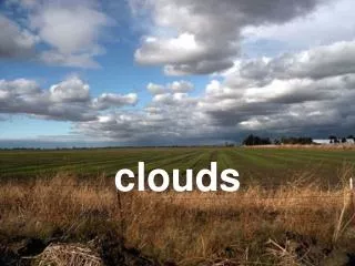
CLOUDS Clouds are classified into a system that uses Latin words to describe the appearance of clouds as seen by an observer on the ground.


CLOUDS
E N D
Presentation Transcript
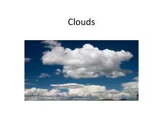
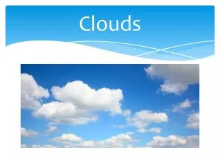
Clouds are classified into a system that uses Latin words to describe the appearance of clouds as seen by an observer on the ground.
High-Level CloudsHigh-level clouds form above 20,000 feet (6,000 meters) and since the temperatures are so cold at such high elevations, these clouds are primarily composed of ice crystals. High-level clouds are typically thin and white in appearance, but can appear in a magnificent array of colors when the sun is low on the horizon.
Cirrus Clouds thin and wispy The most common form of high-level clouds are thin and often wispy cirrus clouds. Typically found at heights greater than 20,000 feet (6,000 meters), cirrus clouds are composed of ice crystals that originate from the freezing of supercooled water droplets. Cirrus generally occur in fair weather and point in the direction of air movement at their elevation.
Cirrus clouds are thin, wispy clouds blown by high winds into long streamers. Cirrus clouds usually move across the sky from west to east.
Cirrostratus Clouds sheet-like and nearly transparent Cirrostratus are sheet-like, high-level clouds composed of ice crystals. Though cirrostratus can cover the entire sky and be up to several thousand feet thick, they are relatively transparent, as the sun or the moon can easily be seen through them. These high-level clouds typically form when a broad layer of air is lifted by large-scale convergence.
Lifting by Convergence broad lifting of an entire layer of air Convergence is an atmospheric condition that exists when there is a horizontal net inflow of air into a region. When air converges along the earth's surface, it is forced to rise since it cannot go downward. Large scale convergence can lift a layer of air hundreds of kilometers across.
Cirrostratus clouds Sometimes the only indication of their presence is given by an observed halo around the sun or moon. Halos result from the refraction of light by the cloud's ice crystals. Cirrostratus clouds, however, tend to thicken as a warm front approaches, signifying an increased production of ice crystals. As a result, the halo gradually disappears and the sun (or moon) becomes less visible.
"A ring around the sun or moon, means rain or snow coming soon" • This lore most commonly works in the cool season and in the mid-latitudes. Mid-latitude storm systems and fronts are more common in the cool season. It is also applicable to tropical storms and hurricanes since there are thin high clouds around the periphery of the storm system. • As an upper level disturbance approaches or warm front approaches the clouds tend to start off as high clouds. Over time the clouds gradually lower and thicken. Near the source of the greatest synoptic lifting is where precipitation and thick clouds are most likely. The sun or moon will no longer be visible once the clouds thicken too much. • The ring around the sun or moon is caused by ice crystals within thin cirrus clouds. The refraction causes light to shine into a ring. Cirrus clouds are generally the first layer of clouds that are seen as a storm system approaches. • Cirrus clouds not associated with a storm system will produce the ring also. In these cases precipitation may not occur.
22 Degree Halo a ring of light 22 degrees from the sun or moon A halo is a ring of light surrounding the sun or moon. Most halos appear as bright white rings but in some instances, the dispersion of light as it passes through ice crystals found in upper level cirrus clouds can cause a halo to have color. Halos form when light from the sun or moon is refracted by ice crystals associated with thin, high-level clouds (like cirrostratus clouds). A 22 degree halo is a ring of light 22 degrees from the sun (or moon) and is the most common type of halo observed and is formed by hexagonal ice crystals with diameters less than 20.5 micrometers.
Cirrocumulus clouds appear as small, rounded white puffs. The small ripples in the cirrocumulus sometimes resemble the scales of a fish. A sky with cirrocumulus clouds is sometimes referred to as a "mackerel sky."
Mid-Level Clouds"Alto" Clouds Clouds with the prefix "alto" are middle level clouds that have bases between 2000 and 7000 m (6500 to 23,000 ft.). Because of their lower altitudes, they are composed primarily of water droplets, however, they can also be composed of ice crystals when temperatures are cold enough.
Altocumulus clouds are composed primarily of water droplets and are located between 6,500 and 20,000 feet (2,000 to 6,000 meters) above the ground.
Altocumulus may appear as parallel bands (left photograph) or rounded masses (right photograph). Typically a portion of an altocumulus cloud is shaded, a characteristic which makes them distinguishable from the high-level cirrocumulus. Altocumulus clouds usually form by convection in an unstable layer aloft, which may result from the gradual lifting of air in advance of a cold front. The presence of altocumulus clouds on a warm and humid summer morning is commonly followed by thunderstorms later in the day. Altocumulus
Lifting by Convection upward moving thermals In meteorology, convection refers primarily to atmospheric motions in the vertical direction. As the earth is heated by the sun, bubbles of hot air (called thermals) rise upward from the warm surface. A thermal cools as it rises and becomes diluted as it mixes with the surrounding air, losing some of its buoyancy (its ability to rise). An air parcel will rise naturally if the air within the parcel is warmer than the surrounding air (like a hot air balloon). Therefore, if cool air is present aloft with warm air at lower levels, thermals can rise to great heights before losing their buoyancy.
"Evening red and morning grey, two sure signs of one fine day"
The weather tends to move from the west toward the east in the mid-latitudes. A red sky in the evening often means the setting sun in the western sky is shining on clouds in the eastern part of the sky. Precipitation in the east will often move away since weather tends to move east. A morning grey sky as the sun rises in the east means the precipitation is already to the east of the area and will thus not move into the area. Precipitation regions do not always move west to east. Also, clouds are not always associated with approaching or exiting storm systems.
Altostratus clouds are gray or blue-gray middle level clouds composed of ice crystals and water droplets. These clouds usually cover the entire sky. In the thinner areas of the cloud, the sun may be dimly visible as a round disk. Altostratus clouds often form ahead of storms that will produce continuous precipitation.
Low-level CloudsLow clouds are of mostly composed of water droplets since their bases generally lie below 6,500 feet (2,000 meters). However, when temperatures are cold enough, these clouds may also contain ice particles and snow.
Stratus clouds are uniform grayish clouds that often cover the entire sky. They resemble fog that does not reach the ground. Usually no precipitation falls from stratus clouds, but sometimes they may drizzle.
When a thick fog "lifts," the resulting clouds are low stratus.
Stratocumulus Clouds low, lumpy layer of clouds Stratocumulus clouds generally appear as a low, lumpy layer of clouds that is sometimes accompanied by weak intensity precipitation. Stratocumulus vary in color from dark gray to light gray and may appear as rounded masses, rolls, etc., with breaks of clear sky in between.
Since the individual elements of stratocumulus are larger than those of altocumulus, one can easily decipher between the two cloud types by extending your arm toward the sky. Altocumulus elements are about the size of a thumb nail while stratocumulus are about the size of a fist (Ahrens, 1994).
Nimbostratus clouds form a dark gray, "wet" looking cloudy layer associated with continuously falling rain or snow. They often produce precipitation that is usually light to moderate.
Fair Weather Cumulus Clouds puffy cotton balls floating in the sky Fair weather cumulus have the appearance of floating cotton and have a lifetime of 5-40 minutes. Known for their flat bases and distinct outlines, fair weather cumulus exhibit only slight vertical growth, with the cloud tops designating the limit of the rising air. Given suitable conditions, however, harmless fair weather cumulus can later develop into towering cumulonimbus clouds associated with powerful thunderstorms.
Fair weather cumulus are fueled by buoyant bubbles of air, or thermals, that rise upward from the earth's surface. As they rise, the water vapor within cools and condenses forming cloud droplets. Young fair weather cumulus have sharply defined edges and bases while the edges of older clouds appear more ragged, an artifact of cloud erosion. Evaporation along the cloud edges cools the surrounding air, making it heavier and producing sinking motion (or subsidence) outside the cloud. The downward motion inhibits further convection and the growth of additional thermals from below, which is why fair weather cumulus typically have expanses of clear sky between them. Without a continued supply of rising air, the cloud begins to erode and eventually disappears.
As the parcel rises, its humidity increases until it reaches 100%. When this occurs, cloud droplets begin forming as the excess water vapor condenses on the largest aerosol particles. Above this point the cloud droplets grow by condensation in the rising air. If the cloud is sufficiently deep or long lived, precipitation will develop. Rising Air a key process in the production of clouds and precipitation Imagine a block of air, or air parcel, rising upward through the atmosphere. The air parcel expands as it rises and this expansion, or work, causes the temperature of the air parcel to decrease.
Vertically Developed CloudsProbably the most familiar of the classified clouds is the cumulus cloud. Generated most commonly through either thermal convection or frontal lifting, these clouds can grow to heights in excess of 39,000 feet (12,000 meters), releasing incredible amounts of energy through the condensation of water vapor within the cloud itself.
Cumulus clouds are usually very isolated with large areas of blue sky in between the clouds. Most cumulus clouds form below 6,000 feet and are relatively thin and associated with fair weather. However, when the atmosphere becomes unstable and very strong, upward air currents form, cumulus clouds can grow into cumulus congestus, or towering cumulus. If the atmosphere is unstable enough, cumulonimbus clouds, better known as thunderstorms, form. Cumulus congestus and cumulonimbus clouds can tower from below 6,000 feet to greater than 50,000 feet.
Cumulonimbus Clouds reaching high into the atmosphere Cumulonimbus clouds (Cb) are much larger and more vertically developed than fair weather cumulus. They can exist as individual towers or form a line of towers called a squall line. Fueled by vigorous convective updrafts (sometimes in excess 50 knots), the tops of cumulonimbus clouds can easily reach 39,000 feet (12,000 meters) or higher.
Single Cell Thunderstorms also known as pulse thunderstorms Single cell storms typically do not produce severe weather and usually last for 20-30 minutes. Also known as pulse storms, single cell storms seem quite random (perhaps because of our lack of understanding) in the production of brief severe events such as downbursts, hail, some heavy rainfall, and occasional weak tornadoes. This is a single cell storm, looking east from about 15 miles. The storm was moving east (into the photo). Some of the anvil cloud has been left behind the storm, but the greater portion of the anvil is blowing off in advance of the storm and is not observable from this perspective. (May storm in the Texas Panhandle near Amarillo.)
The "degree of predictability" is extremely low as forecasters are never quite sure which storm will produce severe weather and from which portion of that storm the severe events will occur. However, the microburst threat to aviation cannot be over-emphasized. The anatomy of a microburst shows that the highest wind speeds occur shortly after the cold air has impinged upon the ground. The spin-up of the microburst curl then results in an acceleration of wind velocities about the curl. An aircraft entering a microburst will encounter strong headwinds, followed by strong tailwinds, as it flies from one side of the microburst to the other. If the pilot compensates for the headwind (to decrease lift) a bit too much, then the aircraft will lose lift in the tailwind and quickly strike the ground.
Multicell line storms consist of a line of storms with a continuous, well developed gust front at the leading edge of the line. An approaching multicell line often appears as a dark bank of clouds covering the western horizon. The great number of closely-spaced updraft/downdraft couplets qualifies this complex as multicellular, although storm structure is quite different from that of the multicell cluster storm.
Multicell Cluster Storms a cluster of storms in varying stages of development A multicell cluster consists of a group of cells moving as a single unit, with each cell in a different stage of the thunderstorm life cycle. As the multicell cluster evolves, individual cells take turns at being the most dominant. New cells tend to form along the upwind (typically western or southwestern) edge of the cluster, with mature cells located at the center and dissipating cells found along the downwind (east or northeast) portion of the cluster. Multicell cluster storms frequently look similar to the one pictured in the photograph, (assuming that low visibilities and/or intervening clouds, trees, or hills do not obscure the view). Looking north from about 10 miles, note the three distinct updraft towers at the left (west) portion of the storm. The heaviest precipitation likely falls beneath the highest cloud top. The right (east) side of the complex is dominated by anvil outflow, moving with the storm from left to right.
Source: National Severe Storms Laboratory and National Weather Multicell severe weather can be of any variety, and generally these storms are more potent than single cell storms, but considerably less so than supercells. Organized multicell storms have the higher severe weather potential, although unorganized multicells, which are simply conglomerates of single cells, can produce pulse storm-like bursts of severe events.
Supercell Thunderstorms thunderstorms with deep rotating updrafts The last of the four major storm types is the supercell. We define a supercell as a thunderstorm with a deep rotating updraft (mesocyclone). In fact, the major difference between supercell and multicell storms is the element of rotation in supercells. As we shall see, circumstances keep some supercells from producing tornadoes, even with the presence of a mesocyclone. Even though it is the rarest of storm types, the supercell is the most dangerous because of the extreme weather generated. This storm was producing baseball hail east of Carnegie, Oklahoma, as it was photographed looking east from 30 miles. From right to left (south to north), we note the flanking line, main Cb, and downwind anvil above the precipitation area.
Mammatus Clouds sagging pouch-like structures Mammatus are pouch-like cloud structures and a rare example of clouds in sinking air. Sometimes very ominous in appearance, mammatus clouds are harmless and do not mean that a tornado is about to form; a commonly held misconception. In fact, mammatus are usually seen after the worst of a thunderstorm has passed.
As updrafts carry precipitation enriched air to the cloud top, upward momentum is lost and the air begins to spread out horizontally, becoming a part of the anvil cloud. Because of its high concentration of precipitation particles (ice crystals and water droplets), the saturated air is heavier than the surrounding air and sinks back towards the earth. The temperature of the subsiding air increases as it descends. However, since heat energy is required to melt and evaporate the precipitation particles contained within the sinking air, the warming produced by the sinking motion is quickly used up in the evaporation of precipitation particles. If more energy is required for evaporation than is generated by the subsidence, the sinking air will be cooler than its surroundings and will continue to sink downward.
The subsiding air eventually appears below the cloud base as rounded pouch-like structures called mammatus clouds. Mammatus are long lived if the sinking air contains large drops and snow crystals since larger particles require greater amounts of energy for evaporation to occur. Over time, the cloud droplets do eventually evaporate and the mammatus dissolve. Mammatus typically develop on the underside of a thunderstorm's anvil and can be a remarkable sight, especially when sunlight is reflected off of them.
Contrails condensation trails A contrail, also known as a condensation trail, is a cirrus-like trail of condensed water vapor often resembling the tail of a kite. Contrails are produced at high altitudes where extremely cold temperatures freeze water droplets in a matter of seconds before they can evaporate. Contrails form through the injection of water vapor into the atmosphere by exhaust fumes from a jet engine. If the surrounding air is cold enough, a state of saturation is attained and ice crystals develop, producing a contrail. If the air in which the contrail develops has a low relative humidity, the cloud particles will quickly evaporate. Even in the presence of higher relative humidities, upper-level winds can spread a contrail apart to produce a horizontal sheet-like cloud. For a contrail to remain in tact for a long period of time, the air must have a high relative humidity in the presence of relatively light winds.
Billow Clouds produced by Kelvin-Helmholtz instability Billow clouds are created from instability associated with air flows having marked vertical shear and weak thermal stratification. The common name for this instability is Kelvin-Helmholtz instability. These instabilities are often visualized as a row of horizontal eddies aligned within this layer of vertical shear. Billow clouds are created in the upward branch of each of the eddies if the air within this branch has a high enough relative humidity that, upon lifting, the air parcel reaches saturation. Individual billow clouds generally have life times of a few minutes. The presence of billow clouds provides a visible signal to aviation interests of potentially dangerous turbulence.
Orographic Clouds forced by the earth's topography Orographic clouds are clouds that develop in response to the forced lifting of air by the earth's topography (mountains for example). Air passing over a mountain oscillates up and down as it moves downstream (as shown in the diagram below). Initially, stable air encounters a mountain, is lifted upward and cools through expansion as it rises. If the air cools to its saturation temperature during this process, the water vapor within condenses and becomes visible as a cloud.
Upon reaching the mountain top, the air is heavier than the environment and will sink down the other side, warming as it descends. Once the air returns to its original height, it has the same buoyancy as the surrounding air. However, the air does not stop immediately because it still has momentum carrying it downward. With continued descent, the air becomes warmer than the surroundings and begins to accelerate back upward towards its original height (beginning the cycle again). It is during the upper-most ascent phase of this cycle that clouds develop. In regions where air is descending, skies are clear.
The lifting of moist air can result in the generation of clouds, while lifting drier air may not produce any clouds at all. The oscillations continue as the air moves further downstream from the mountains but are eventually dampened out by mixing and friction.