Download
1 / 21
210 likes | 353 Vues
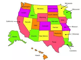
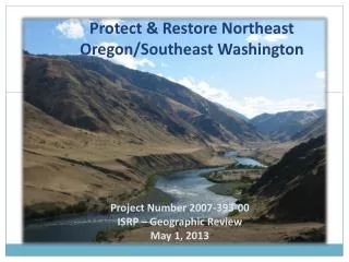
Protect & Restore Northeast Oregon/Southeast Washington. Project Number 2007-393-00 ISRP – Geographic Review May 1, 2013. 13.3 Million Acres. Nez Perce Tribe Treaty Territory. 3 States 6 National Forests 12 Counties. NE Oregon/SE Washington Overview. History.

E N D
Protect & Restore Northeast Oregon/Southeast Washington Project Number 2007-393-00 ISRP – Geographic Review May 1, 2013
13.3 Million Acres Nez Perce Tribe Treaty Territory 3 States 6 National Forests 12 Counties
History • 2001-03 PCSRF funded for inventory work • BPA Project (Wallowa County Culvert Inventory) started in 2003 • Completed inventory, assessment and prioritization of fish passage structures in Wallowa County • Since NPPC Provincial Review process (2007), the project has been titled Protect and Restore Northeast Oregon • 4 proposals submitted for the northeast Oregon Project Area in 2007. • As a result of responding to previous ISRP comments and coordination with NPCC and BPA, all four proposals were combined into one project area covering all of the NPT Territory in northeast Oregon. • Objective was to coordinate with partners and seek addition funds for implementation of restoration work • Through negotiations with BPA in 2010 the project’s geographic area was expanded to include all of the NPT Territory in Washington State as well.
Previous ISRP Concerns • Numerous project proposals were submitted in 2006 • Prioritized and combined
Cost Share / Partners OREGON • Forest Service • Resource Advisory Committee (RAC) • Grande Ronde Model Watershed • Oregon Watershed Enhancement Board • Oregon Wildlife Heritage Foundation • Pacific Salmon Commission – Southern Fund • Wallawa Whitman & Umatilla National Forests • Freshwater Trust WASHINGTON • Snake River Salmon Recovery Board • Umatilla National Forest
Cost Share / Partners OREGON • Forest Service • Resource Advisory Committee (RAC) • Grande Ronde Model Watershed • Oregon Watershed Enhancement Board • Oregon Wildlife Heritage Foundation • Pacific Salmon Commission – Southern Fund • Wallowa Whitman & Umatilla National Forests • The Freshwater Trust WASHINGTON • Snake River Salmon Recovery Board • Umatilla National Forest
Partner/Cost Share Accomplishments • 546 fish passage structures (inventoried, assessed & prioritized) • 2005-09 Engineering Designs- ($174,338 total) • 2003-2010 Riparian Planting- about 2,500 plants annually ($45,000 annually) • 2008-09 Fence Construction- Aspen, Starvation ($82,000) • Fish Passage- Mahogany (2006) (4 partners: $174,442), Tamarack Culvert (In house removal) • Road Decommissioning (2009)- 7.5 miles ($175,915) • 2003-10 Education/Outreach- 500/year
Current Situation of Project • 2012 Budget took a 60% cut • No Project Leader on staff for this project • Covering with existing staff until…. • BPA to restore budget in 2014 • Still coordinating with Partners • Two cost-share projects on-going • Pataha Creek culvert replacements • Mud Creek OWEB grant proposal • Road decommissioning/culvert replacements
Limiting Factors & Proposed Deliverables • Culvert Replacements • Riparian Restoration • Large Wood Placement projects • Road Decommissioning • Irrigation Diversion Improvement & Sprinkler Installation • Habitat Quantity- Anthropogenic Barriers • Riparian Condition- Riparian Vegetation • Channel Structure and Form- In-stream Structural Complexity • Sediment Condition- Increased Sediment Quantity • Water Quantity – Decreased Water Quantity
Limiting Factors & Proposed Deliverables • Culvert Replacements • Diversions • Riparian Restoration • Riparian Planting • Large Wood Placement projects • Channel Ralignment • Road Decommissioning • Road Improvement • Irrigation Diversion Improvement & Sprinkler Installation • Habitat Quantity- Anthropogenic Barriers • Riparian Condition- Riparian Vegetation • Channel Structure and Form- In-stream Structural Complexity • Sediment Condition- Increased Sediment Quantity • Water Quantity – Decreased Water Quantity
Habitat Quantity – Anthropogenic Barriers Mahogany Creek
Adaptive Management • Adjustments to methods and techniques of implementation based on past experience/ results. • Fish passage • Bottomless culverts or bridges • Road Decommissioning • Clump Plantings work well • Too much straw inhibits revegetation • Fertilizer did not increase rate of regrowth • Management • Partnerships
Data Management • Spatial Database • Microsoft SQL Server and ESRI ArcSDE • Organized by Project Area • Tracks all Restoration Implementation location data (Feature Classes), implementation metrics & Monitoring data (SQL Tables)
Data Outreach • Reports, Summarized Data • Nez Perce Tribe DFRM Website • http://www.nptfisheries.org/DFRMHome.aspx • Spatial Data Viewer and Querying • Watershed Division Mapping Site • http://imsland.nezperce.org/DFRMWatershed/nexviewer_flex.html