Inelastic Neutron Scattering, INS,
30 likes | 220 Vues
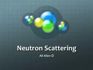
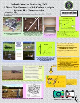
NaI Detectors. Plastic Scintillator. Power. Neutron Generator. GPS. MAGNUS Slave Com. Master Com. E. W.

Inelastic Neutron Scattering, INS,
E N D
Presentation Transcript
NaI Detectors Plastic Scintillator Power Neutron Generator GPS MAGNUS Slave Com. Master Com. E W At least five core samples 40 cm long are taken from each measurement site. The cores are divided into five sections, 5, 5, 10, 10,and 10 cm long and analyzed for, C, N, moisture, and bulk density. Calibration Lines; NC-net counts in the carbon peak (a), CN-carbon net counts after interference correction (b). Interference Correction CN = NC – Cascade – SEP CN = NC – [Si(1.78)INS-(Si+Al)(1.78)TNC(LTINS/LTTNC)- -[Si(4.43)TNC(LTINS/LTTNC] INS Alpha prototype used for stationary and scanning field measurements. Sandpits, 1.5x1.2x0.46 m3, for synthetic soil preparations. Duke Forest calibration, the three sites; G-Grass, P-Pine, and H-Hardwood were combined. The sits were covered with standing water and the solid fraction approached 30%. Measurement sites at Duke Forest NC. Pits 40x40x40 cm3 were excavated for C analysis. Track length – 4.38 miles Mean Speed – 3.6 mph λi Montana wheat field and GPS trace of a scan, in addition three static measurements in the field were taken. λtl λls Tree Litter λo λts Soil Track length – 3.06 miles Mean Speed – 2.4 mph Maryland corn field and GPS trace of a scan, in addition three static measurements in the field were taken. Beta prototype to be deployed in summer 2007 Inelastic Neutron Scattering, INS, A Novel Non-Destructive Soil Carbon Analysis System; II – Characteristics L. Wielopolski1, S. Mitra1,. 1Brookhaven National Laboratory, Environmental Sciences Department Upton, NY 11973 lwielo@bnl.gov • Conventional Applications of the INS System: • Soil quality monitoring on local and large field scales. • In Field monitoring carbon stocks and changes for contract verification in trading with “carbon credits”. • Evaluation of impact of soil management systems; till no-till, crop rotations, land reclamation… • Integration into current global carbon cycle research at the soil atmosphere interface. • New Applications of the INS System: • Integration into US Geological surveys for large scale regional soil carbon mapping. • Independent joint measurements to improve the carbon data base required for modeling carbon climate change in support for policy making decisions • Independent assessment of the changes in the carbon predictions made by the FACE and AmeriFlux facilities. • Independent validation data for the “bottom-up” approach in order of reducing the discrepancy with the “top-down” approach. • Possibly calibrating satellite land images with large scale area assessment with INS. Instead of measuring the difference between λi and λo to assess carbon in soil (Cs), measure Cs and assess lambdas.