Download
1 / 89
890 likes | 1.05k Vues
INTRODUCTION TO OCEANOGRAPHY Instructor: Prof. ANAMARIJA FRANKIĆ Office Number: S-1-061 Office Hours: Posted on office door or by appointment Telephone: 617-287-4415 Email Address: anamarija.frankic@umb.edu Web Page: http://alpha.es.umb.edu/faculty/af/frankic.hml

E N D
INTRODUCTION TO OCEANOGRAPHY Instructor: Prof. ANAMARIJA FRANKIĆ Office Number: S-1-061 Office Hours: Posted on office door or by appointment Telephone: 617-287-4415 Email Address: anamarija.frankic@umb.edu Web Page: http://alpha.es.umb.edu/faculty/af/frankic.hml Department Website: http://www.es.umb.edu/
Oceanography is an observationally driven field! What are the independent variables/parameters for the ocean? What do they measure and what is there use? Geology: coastlines, bathymetry, movement of tectonic plates Chemistry: Carbon, Nitrogen, Iron, Oxygen… Physics: T, U, V, S, SSH Biology: Chl-a, Productivity, Zooplankton, Phytoplankton, Fish and Egg counts, etc…
How was the ocean observed so far? Lots of historical account of early explorations – (see book). HMS Challenger http://www.amazon.com/gp/reader/0393317552/ref=sib_dp_pt/103-3317661-1512644#reader-page
International Observational Programs Deep Sea Drilling Project - DSDP 1968, Glomar Challenger Theory of Plate Tectonics and much more… 1985, Joides Resolution Replace G. Challenger
International Observational Programs The Joint Global Ocean Flux Study (JGOFS) (launched in 1987 at a planning meeting in Paris) The Operational Goal of JGOFS : Spatial Scale: regional to global Temporal Scale: seasonal to interannual 1) Fluxes of carbon between the atmosphere-surface ocean-ocean interior. 2) Sensitivity to climate changes
International Observational Programs The World Ocean Circulation Experiment 1990-1998 http://woce.nodc.noaa.gov/wdiu/ International Programme on Climate Variability and Predictability, 1995-present http://www.clivar.org/index.htm http://www.clivar.org/publications/other_pubs/clivar_transp/index.htm World Climate Research Programme http://www.wmo.ch/web/wcrp/wcrp-home.html
US Programs sponsors: http://www.nsf.gov/ e.g. GLOBEC http://www.pml.ac.uk/globec/ http://www.noaa.gov/ http://science.hq.nasa.gov/oceans/ http://www.onr.navy.mil/focus/ocean/habitats/default.htm
U.S. Coastal Observing Systems http://www.csc.noaa.gov/coos/
Technologies for ocean observing Remote Sensing/Satellite Imagery: Geostationary Server -http://www.goes.noaa.gov/Satellite significant events: http://www.osei.noaa.gov/National Geophysical Data Center: http://www.ngdc.noaa.gov/ngdc.html Floating devices in the ocean: Argo FLoats - http://www.argo.ucsd.edu/ Drifter Programs: http://www.aoml.noaa.gov/phod/graphics/pacifictraj.gif Remotely Operated Vehicles (ROVs) : Amazing discoveries…http://oceanexplorer.noaa.gov/technology/subs/rov/rov.html Automated Underwater Vehicles (AUVs) :
WHAT PEOPLE NEED TO KNOW ABOUT OCEAN SCIENCES • Ways of knowing – “Reflection on how we know what we believe will help our understanding” • Human interactions – “Currently, the human species is significantly affecting earth systems, but has the ability to choose its relationship with the environment” • Ecosystems – “The survival and health of individuals and groups of organisms are intimately coupled to their environment” • Earth system science – “The Earth as a whole acts as a complex set of interacting systems with emergent properties” • Evolution & Biodiversity – “Evolution explains both the unity and diversity of life” • Energy flow and transformation – “Energy transformation drive physical, chemical, and biological processes. Total energy is conserved and flows to more diffuse forms” • Conservation of mass – “Mass is conserved as it is transferred from one pool to another” • Spatio-temporal relationships – “Choosing the appropriate reference frame is the key to understanding one’s environment”
Beginnings • Earth’s formation • Earth’s timeline
Earth’s Formation • The Universe - formed 10-15 billion years ago • Currently referred to as the ‘Big Bang‘ • current theory is that the universe was formed from something • smaller than an atom • the atom exploded and everything was blown outward with great • heat and speed
Earth’s Formation • OurSolar System was formed 4.6 billion years ago • The Earth is assumed to be the same age • At this time, Earth had a surface • known from radiometric dating of meteorites (uranium and potassium) • We think water condensed on the planet 3.9 billion years ago • known from radiometric dating of sedimentary rocks that • formed by processes requiring water
Earth’s Formation Where did oceans come from? • Old Theory: • H2O came from big comets during period of heavy bombardment • H2O locked up in minerals released from • differentiation and heating
Earth’s Formation Where did oceans come from?(cont’d) • New Theory: • Oceans still forming and H2O comes from many small cometessimals that continually bombard the Earth • H2O came from big comets during period of heavy bombardment • H2O locked up in minerals released from differentiation • and heating
Earth’s Timeline Mother Earthformed 4.6 billion years ago.. What has happened during this time?
Divide by 4.6 billion by 100 million years - makes Earth 46 years old • 0-3 yrs no record • 3 yrs dated from rocks in Canada, Africa and Greenland • 8-11 yrs 1st living cells - primitive bacteria • 22-23 yrs oxygen production by cells begins • 31 yrs atmosphere has enough oxygen to support life • 39th yr first invertebrates-hard shelled fossils • 41rst yr primitive fish and corals Earth’s Timeline (cont’d)
41-42 yrs land plants, fish • 43 yr reptiles, dinosaurs, sharks • 44 yr dinosaurs dominate • 45 yr dinosaurs die • 1 yr ago plants and flowers proliferate • 7 mos. ago insects, mammals, birds proliferate • 25 days ago first humans • 6 days ago homosapiens • 1/2 hour ago 1st recorded civilization • 1 minute ago industrial revolution • change Earth and relationship with Earth for all time… Earth’s Timeline (cont’d)
Earth • Coordinates • Earth’s Water • Earth’s Structure
Coordinates • Earth • Highest mountain is Mt. Everest at 8840m above sea level • Lowest trench is the Mariana Trench (Pacific) at 11,000m below sea level Think of earth like a basketball - the bumps would be the mountains and the dimples would be the trenches. Earth has a huge mass!!!
Coordinates (cont’d) Latitude and Longitude • Latitude • Parallel to the equator • Expressed as degrees N or S of the equator where equator = 0
Coordinates (cont’d) Latitude and Longitude(cont’d) • Longitude • Lines of longitude are meridians • Longitudinal lines are at a right angle to • latitudinal grid • 0° longitude is known as the prime meridian • Goes right through Royal Observatory in • Greenwich, England • Greenwich Mean Time = ‘Universal Time’, • when sun is directly above 0longitude • Expressed as degrees E or W of prime meridian where prime meridian = 0
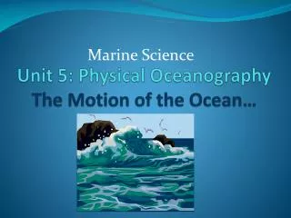
Earth’s Water How Earth's water reservoirs are connected Connected by 2 processes: evaporation and precipitation See fig 1.18 (Intro 7e) or 2.13 (Fund. 4e) Earth’s water reservoirs: Oceans 97.2% Lakes, rivers and inland seas 0.017% Glaciers 2.14% Atmosphere 0.001% Ground H20 0.61% Biosphere 0.005%
Earth’s Structure • Layered system (like an onion, concentric regions) • differentiation of mineral material • Not only Earth’s mineral • material, but also: • hydrosphere • biosphere • atmosphere
Earth’s Structure (cont’d.) Classification according to chemical composition • 4 concentric regions of • mineral material: • crust • mantle • outer core - molten • inner core - solid
Earth’s Structure (cont’d.) Classification according to chemical composition • Crust • Two types: • continentalggranite – composed of • silicates rich in Na, K & Al • oceangbasalt – composed of • silicates rich in Ca, Mg & Fe • represents 0.4% of Earth’s mass • extends down to 75 km
Earth’s Structure (cont’d.) Classification according to chemical composition • Mantle • Three parts: • uppermost/middle/innermost • Composed of Mg-Fe silicates • represents 68% of Earth’s mass • extends down from base of crust to ~2,900 km
Earth’s Structure (cont’d.) Classification according to chemical composition • Core • Two parts: • Outer • Inner • Composed of Fe & Ni • Represents 28% of Earth’s mass • Extends down from base of • mantle ~ 6400km
Earth’s Structure (cont’d.) Classification according to physical properties (factor in temperature and pressure) 4 concentric regions: • lithosphere - rigid outer shell (crust & uppermost mantle) • 100 - 150km thick • does not change shape
Earth’s Structure (cont’d.) • Asthenosphere - soft, flows over geologic time under the weight of the lithosphere (small fraction of middle mantle) • lithosphere ‘floats on top’ • zone where magma formed • 200 – 350km thick • easily deformed, can be pushed down by overlying lithosphere – “plastic” – tar or asphalt
Earth’s Structure (cont’d.) Classification according to physical properties • Mesosphere - rigid but not as hard as lithosphere • higher temp than asthenosphere, but not molten because of compression pressure • 4950km thick
Earth’s Structure (cont’d.) Classification according to physical properties • Core - outer is molten, inner is solid
Earth’s Structure (cont’d.) Isostacy Principle that dictates how different parts of the lithosphere stand in relation to each other in the vertical direction • Continental crust less dense (granitic) therefore rises higher relative to ocean crust (basaltic) • Continents move up and down depending on weight on top (i.e. from glaciers - ‘isostatic rebound’) • Continents pop up after glaciers melt • Canada and Scandinavia rising at a rate of 1m/100yrs because the glaciers are receding
Earth’s Water (cont’d.) • Five oceans: • Atlantic – shallowest, greatest number of adjacent seas- regional seas: i.e. Gulf of Mexico, Caribbean, Mediterranean, North), has the largest freshwater input (i.e. Amazon, Congo, Mississippi) • Pacific – largest, deepest • Indian – smallest, muddiest • Arctic – covers N. Pole, saltiest • Southern Ocean – coldest, most productive
(Some) OCEANS’ related FACTS: • Our planet is actually the Ocean Planet - 77% of the Earth’s surface is covered by oceans and seas. However, less than 10% has been investigated. • Oceans provide more than 70% of oxygen we breathe • 80% of world’s plant and animal species live in oceans • More than 60% of the current human population (5.8 billion) lives in the coastal zones (~60 km wide), the areas representing only 8% of the Earth surface! • ‘Poorest of the poor’ - 1.1 billion people ‘survive’ on less than 1$/day • 1 billion people rely on fish as the only daily source of protein • Global climate change and the humans’ well being depend on the conditions and health of the oceans; • Poverty, hunger, diseases as well as casualties from natural disasters can be alleviated by improving the health of the environment and by sustainable use and management of the coasts and oceans!
Plate Tectonics Horizontal Movement of Earth’s Lithosphere
Plate Tectonics • The Theory of Plate Tectonics • Plate Boundaries • Spreading Centers • Subduction Zones • Transform Faults • Plate Movement
The Theory of Plate Tectonics “Continental Drift” - theory* proposed by Alfred Wagner, a German meteorologist (1915) • Explained by: • geologic fit • fossils * Not accepted by scientific community - no mechanism to explain plate movement
The Theory of Plate Tectonics(cont’d.) • Plate Tectonics- evidence for theory of continental driftHess, Heezen and Tharp (1960’s) • found lithospheres plate boundaries, 3 types: • ridges (spreading centers) • trenches (subduction zones) • transform faults (plates sliding past one another)
The Theory of Plate Tectonics(cont’d.) Lithospheric Plates • minor plates: • Cocos - 5 x10⁶ km2 • Phillipine - 6 x10⁶ km2 • Caribbean - 5 x10⁶ km2 • Nazca - 15 x106 km2 • Arabian - 8 x10⁶ km2 • Indian - 10 x106 km2 • Scotia - 5 x10⁶ km2 • Juan de Fuca - 2 x10⁶ km2 • major plates: • Pacific – 105 x106 km2 • Eurasian - 70 x106 km2 • Antarctic - 60 x106 km2 • Australian - 45 x106 km2 • S. American - 45 x106 km2 • African - 80 x106 km2 • N. American - 60 x106 km2 From Fundamentals of Oceanography, 5h edition, Duxbury Duxbury, and Sverdup. The McGraw-Hill Companies
Plate Boundaries a) Spreading centers - ‘rift zones’(cont’d.) • Convection cells form • Density differences – cool vs. hot • Convection cells cause frictional drag on lithosphere • Lithosphere stretches due to convective movement • Lithospheric crust weakens
Plate Boundaries(cont’d.) a) Spreading centers - ‘rift zones’(cont’d.) • Faulting – break in overlying lithosphere • Magma flows upward • New lithospheric crust formed
Plate Boundaries(cont’d.) a) Spreading centers - ‘rift zones’(cont’d.) • Plates split apart -‘divergent plate’ boundary • New crust formed - ‘constructive’ plate boundary • Evolution of a mid-ocean ridge system • Upwarping • Rift valley • Linear sea • Mid-ocean ridge system • Ex. 1 - oceans: mid Atlantic Ridge • east Pacific Rise • Ex. 2 - continents: E. Africa Rift Valley Baikal Rift Valley
Plate Boundaries(cont’d.) b)Subduction zones • Lithospheric Plates collide - ‘convergent’ plate boundary • Crust destroyed - ‘destructive’ plate boundary • Forms trenches and mountains
Plate Boundaries(cont’d.) b)Subduction zones(cont’d.) • 3 types of subduction zones: • Ocean crust into continental crust – form trenches and • mountain ranges Ex. a): Juan de Fuca plate into the N. American plate - forms Cascade Mtn. Range Ex. b): Nazca plate into the S. American plate - forms Peru-Chile Trench and the Andes Mtn. Range
Plate Boundaries(cont’d.) b)Subduction zones(cont’d.) • Ocean crust into ocean crust – forms trenches and island arcs • Ex. A): Philippine plate into the Pacific plate – formed the Marianna Trench • and the Marianna Island Arc system • Ex. B): N. American plate into the Caribbean plate and then the N. American • plate into the S. American plate – formed the Isthmus of Panama


![Prof. Chris Carothers Computer Science Department Lally 306 [Office Hrs: Wed, 11a.m – 1p.m]](https://cdn2.slideserve.com/4071720/slide1-dt.jpg)