Download
1 / 11
120 likes | 351 Vues
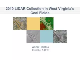
2010 LiDAR Collection in West Virginia’s Coal Fields . WVAGP Meeting December 7, 2010. LiDAR collection specifications. Horizontal postings: 1 meter Vertical accuracy: 15 centimeters Additional derived data products include: ESRI elevation grid Hillshade

E N D
2010 LiDAR Collection in West Virginia’s Coal Fields WVAGP Meeting December 7, 2010
LiDAR collection specifications • Horizontal postings: 1 meter • Vertical accuracy: 15 centimeters • Additional derived data products include: • ESRI elevation grid • Hillshade • 2 foot contours used in AML program • Intensity image useful in QCing LiDAR data • ~ 2 TB of data before derived products
Initially Contracted LiDAR AoI Initial AoI encompassed about 5,000,000 acres or about 33% of the State AoI polygons are watershed rather than county-based.
Project Status as of Nov. 29, 2010 A 1,162,728 acres 1,162,728 acres B 1,322,454 acres Highest priority area of the state was about 3,000,00 acres.2,485,182 acres have been completed collected.
Built an ICI (=isolated computing island) • Isolated three VERY high performance computers from central IT C&C duringVERY long compute jobs: • No pushes of server OS upgrades • … followed by the requisite reboots • Isolated from any network dependence for software licenses network outages • Enough local storage and bandwidth to create more than 8 TB of local storage and a peer-to-peer within-the-room network • UPS on each PC still working on this.
QCing LiDAR & LiDAR software Approval of software purchase still pending 10 months after start of the project … no end in site!!! • QCing LiDAR deliverables • 2003 Statewide GCPs file • Multiple LiDAR datasets that overlap difference grid calculation • Trimble R8 GNSS receivers • Outsource via FEMA monies a go too • Software 64 bit, use multicores • Virtual Geomatics 2 floating seats • Applied Imagery’s Quick Terrain Modeler 1 seat
Two Shorted URISA LiDAR Workshop Topics • Wide area vs. corridor LiDAR • Use of LiDAR intensity data as a substitute for aerial photography • LAS Version 1.1 (… dates back to 1.0)
LiDAR Intensity Image Produced from spring 2009 flight contracted by the Cabell County Assessor’s Office two whole LiDAR tiles
LiDAR Intensity Image Zoom in from here Produced from spring 2009 flight contracted by the Cabell County Assessor’s Office two whole LiDAR tiles
LiDAR News Headlines … • The good • WVDEP has some more funding for additional LiDAR data deliverables • The bad • About 50% of our initial AoI remains uncollected 17% of West Virginia • The ugly • WVU’s existing LiDAR hardware and software is supported by Optech for only 1 more year.
The end If we don’t take a shot at partnering more effectively … … future opportunities may be lost