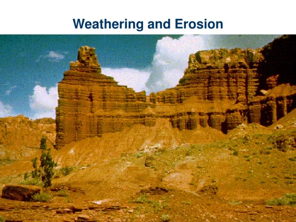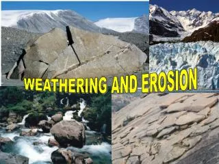
Erosion and Landscape Evolution
Erosion and Landscape Evolution . How Do We Know Rivers Cut Their Valleys? . John Playfair, 1800 Tributary valleys almost always join the main valley at exactly the same elevation, even though the valleys may begin many miles apart. This is very unlikely unless the rivers have cut the valleys.


Erosion and Landscape Evolution
E N D
Presentation Transcript
How Do We Know Rivers Cut Their Valleys? John Playfair, 1800 • Tributary valleys almost always join the main valley at exactly the same elevation, even though the valleys may begin many miles apart. This is very unlikely unless the rivers have cut the valleys. • How Rivers Widen Valleys
Constructive and Destructive Processes Highlands • Erosion Dominates • Destructive Processes • History not Preserved • Little Geological Record Transport Lowlands, Coastal Plain, Lakes and Seas • Deposition Dominates • Constructive Processes • History Preserved • Good Geological Record
The Ideal Stream Cycle (W.M. Davis, 1880) Not a Literal Time Sequence • Youth • Maturity • Old Age • Rejuvenation
Youth • V-Shaped Valley • Rapids • Waterfalls • No Flood Plain • Drainage Divides Broad and Flat, Undissected by Erosion • Valley Being Deepened • General Agreement on this stage, lots of examples
Maturity (Early) • V-Shaped Valley • Beginnings of Flood Plain • Sand and Gravel Bars • Sharp Divides • Relief Reaches Maximum • Valleys stop deepening • General Agreement on this stage, lots of examples
Maturity (Late) • Valley has flat bottom • Narrow Flood Plain • Divides begin to round off • Relief diminishes • Sediment builds up, flood plain widens • River begins to meander • Many geologists believe slopes stay steep but simply retreat.
Old Age • Land worn to nearly flat surface (peneplain) • Resistant rocks remain as erosional remnants (monadnocks) • Rivers meander across extremely wide, flat flood plains
Rejuvenation • Some change causes stream to speed up and cut deeper. • Uplift of Land • Lowering of Sea Level • Greater stream flow • Stream valley takes on youthful characteristics but retains features of older stages as well. • Can happen at any point in the cycle.
Why the Stream Cycle Doesn't Explain Everything • Rises and falls in sea level during the ice ages rejuvenated most landscapes to some extent. • Climate changes mean that mass-wasting processes in temperate regions may have undergone radical changes repeatedly in the last few million years. • In places where conditions have remained uniform for long times, like the stable interiors of Africa, Australia and South America, the ideal stream cycle seems to work best.
Superposed (Antecedent) DrainageStreams Cut Right Through High Topography