Download
1 / 33
350 likes | 540 Vues
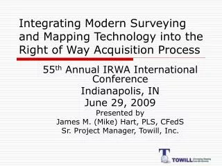
Integrating Modern Surveying and Mapping Technology into the Right of Way Acquisition Process. 55 th Annual IRWA International Conference Indianapolis, IN June 29, 2009 Presented by James M. (Mike) Hart, PLS, CFedS Sr. Project Manager, Towill, Inc. The next 75 minutes.

E N D
Integrating Modern Surveying and Mapping Technology into the Right of Way Acquisition Process 55th Annual IRWA International Conference Indianapolis, IN June 29, 2009 Presented by James M. (Mike) Hart, PLS, CFedS Sr. Project Manager, Towill, Inc.
The next 75 minutes • Examine the ROW acquisition steps (remember who’s up front…) • Kick some tires about the ‘good old days’ and whine about how hard it was and how this new generation has it easy. • Make a few “oohs” and “aahhs” about some of the new tools and whine about how hard it used to be and how this new generation has it easy. • Gain a little ground on understanding how it is (or can be) done today (some of us may not have caught up yet…things are moving pretty quickly) • Perhaps recognize opportunities to integrate some of the items into daily procedures
Unless you’ve been in hibernation for the last 40 years, you can’t help but notice some changes…. • The Earth is no longer flat • Technology has developed geometrically the last 4 decades • Information is now at our fingertips • The pace is much quicker
So, when did it stop being “then” and become “now” or “modern”? When we got comfortable with: • PC’s – vastly improved computing capabilities • GPS – vastly improved ability to measure and overcome many of the obstacles associated with the previous instrumentation • Internet – vastly improved our ability to acquire data and move information • GIS – vastly improved our ability to relate important features spatially • Autocad – vastly improved boundary resolution and document production
So, what is the ROW Acquisition process? • Figure out where it needs to go • Figure out who can stop it • Talk them into letting it happen • Make it so they can’t back out (way over simplified – but isn’t this essentially it?)
Consider a transmission line project for example – in “the old days” • Route selection using paper maps (USGS 7 ½’ quads) and aerial photography • Engineering design using hand calcs and sag templates • Now comes the survey
The field survey (then) • Physically occupy the centerline • Features related by station down line and offset L/R of centerline • Line of sight required for angle and distance measurements – to generate position • Centerline staked as work progressed • Most of the effort was in the field • Brush, critters, weather, terrain • Every foot of the line walked (multiple times) • Very high profile activity – lot’s of interaction with landowners; everyone can see where the line is to go
Along comes GPS (RTK) • Line of sight moved from the ground (where the brush was) to the sky (where the satellites are) • No need to occupy the centerline – or stake it – or cut brush – or get anywhere near it • Position – w/o calcs (don’t misunderstand about this) • Everything related in homogenous data set by position – not relative to a centerline – makes changes easy
Today • RTK crew can get in and out without leaving a trace of their visit • “reach” almost limitless • Survey highly retraceable – error doesn’t accumulate as in the old days • 2-person crew can cover miles per day
GPS (Global Positioning System) • Grades of receivers • Survey – 2cm (2 sigma) real time - $50K • Mapping – sub-meter real time - $10K • Recreational – meter or so - $100
Survey Grade GPS • Static • RTK (real time kinematic) • Typically base recur/broadcast radio + rover receiver • Can be rover only from RTN • Can really burn you if not used properly • Please leave this one to the professionals
Mapping Grade GPS • Typically sub-meter • Backpack or hand held • Typically has GIS data capture capabilities • Post-process or real time • USCG base, OmniStar • A little more “turn key” and easier to use • Can load background maps/photography/GIS line work
Recreational Grade GPS • Garmin, Magellan, others • Can get this at Walmart • Spend more if you want, but $100-$250 will get the functionality – the extra is typically just fluff (maps) • Limited in ability to import files • Geo-caching fun tool • Recognize its limits!!! You cannot survey with this – you can only approximate!!!!
Recreational Grade GPS – N.B. • Lat/Lon – DDD.dddd vs DDD.MMM.sss • Note datum (NAD27 vs NAD83 for ex.) • You can almost use this without knowing anything…..almost
Some misconceptions about GPS in the land business • GPS is not a magic black box – it will burn you!! • The ability to make quicker, more precise measurements does not mean surveyors are “fixing” anything – the monument still controls • GPS will not take you to the property corner all by itself • Just because you have seconds to five decimal places in Lat/Lon doesn’t mean you are “that close”
Aerial photography • Been around a long time • Color digital ortho rectified photography • Satellite imagery
Film vs. Digital Flight Design Stereo Overlap Aerial Photo Mission
Orthophoto Generation • Aerial Photography • Digital Terrain Model (DTM) • Differential Rectification • Tiling & Color Matching
Benefits of aerial photography • Insert line work and features • Great with landowners Ask around – it is probably available since this is an integral part of the engineering design process.
Google Earth • Free • Can import points and lines • Great as a demonstration/planning/visualization tool • *.kml files • Beware of data lost in flight • Google Earth Pro
Canned photography • Aerials Express for example available at a reasonable cost • Generally more up to date than Google Earth – but not as good as custom flown photography that is “fresh”
LIDAR • LIght Detection And Ranging • Airborne laser scanning system that allows rapid collection of dense 3D digital terrain data to model the ground and above ground objects • Of limited utility to ROW specialist – but could provide some higher definition terrain models if the need arises – ask the PM what’s available.
LiDAR • Great mapping tool • Not for boundary determination – some people are confused about that
Data1, data2, data3…data∞ • GIS • Tax assessor parcel layers • Roads, railroads, pipelines, OH electric • Be aware of datums and coordinate systems!! Not all data is created equal; there are apples, oranges, lemons, and all kinds of other stuff that can all look alike. • Just because the position is stated to five places right of the decimal point doesn’t mean it is that precise. Watch out!! • Typically *.shp are of most utility – but also watch for *.dxf, *.csv
Data1, data2, data3…data∞ • Bureau of Land Management (US Department of Interior) • PLSS *.shp files (NOTE!!!!!!!) • GCDB • Note datum (a lot of the files are NAD27) • On-line GLO/BLM notes and plats
Miscellaneous stuff • DeLorme XMAP • Paperless project • Email • *.doc/*.pdf • *.xls • *.dwg/*.shp/*.csv • ftp • scanner
Consider the possibilities • GPS for navigation • Google Earth on laptop live via cell phone with GPS input and project data loaded = live interaction with landowner • Rapid data exchange via email/ftp
So, has it really changed that much? • The tools have changed dramatically • Society has changed • Becoming Cell phone based – increases contact rate • Email – impersonal • Face-to-face may not be as much as it used to be • Project schedules perhaps have created a shorter fuse to condemnation (PM’s not understanding process) • What was billed as labor saving introduced higher levels of complexity • More knowledge required to utilize the technology • More computing horsepower required • Necessary to be competitive in today’s environment
So, has it really changed that much? • Fundamentals have not • The monument is King • Landowner negotiations “on the front porch” • Negotiation skills • Relationships/rapport
Remember…. • the US land tenure system is MONUMENT based – so this data only points toward the corner point – you’ve got to have the monument
“Please remain in your seats with your seatbelt securely fastened until we arrive at the gate and the Captain has turned off the ‘fasten seatbelt’ sign.”
Contact information James M. (Mike) Hart 760.828.7121 mike.hart@towill.com www.towill.com