Download

1 / 25
300 likes | 484 Vues
RAINFALL-RUNOFF MODEL FOR BLACK CREEK WATERSHED, NAVAJO NATION.

E N D
RAINFALL-RUNOFF MODELFOR BLACK CREEK WATERSHED, NAVAJO NATION Aregai Tecle1, Angie Garcia1, Paul Heinrich1, Gregg Garfin2, Diana Anderson1, John Leeper3 and Jolene Tallsalt-Robertson31Northern Arizona University in Flagstaff, 2University of Arizona in Tucson, and3Navajo Nation Department of Water Resources in Fort Defiance, Arizona 53rd ANNUAL MEETING OF THEARIZONA-NEVADA ACADEMY OF SCIENCEUNIVERSITY OF ARIZONATUCSON, AZAPRIL 4, 2009
STUDY OBJECTIVES This work is a part of larger Navajo Nation Hydroclimate Capacity Building Project Specifically the purpose for our modeling effort is to produce a reliable watershed model in the presence of inadequate data that can be used throughout the Navajo Nation using the Black Creek Watershed as an example.
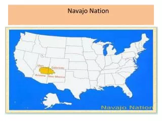
BLACK CREEK WATERSHED Located in the Navajo Nation Elevation ranges between 6100 to 8100 feet North of 35o latitude West of 108o longitude In Apache County, Northern Arizona Area of watershed is 655 square miles It is drained by Black Creek, a tributary of the Puerco River (one of the LCR tributaries)
THE MODELING EFFORT The modeling effort has used a Watershed Modeling System (WMS) by AQUAVEA The model basically uses the NRCS event-based rainfall-runoff relationship and GIS routine in its algorithm The GIS overlays were produced from shape files obtained from various sources
Creating WMS Black Creek Watershed Model - Inputs Delineate the watershed 1. GIS elevation file 2. Compute Topaz 3. Turn on flow direction in display 4. Create outlet point 5. Delineate Basin Wizard will create your watershed boundary 6. Create soil coverage 7. Create land-use coverage Create Sub-basin 1. Create sub-basins 2. Create rain gage coverage 3. Create rain gages on watershed Calculate discharge Q 1. Create daily precipitation data 2. Design SCS Type II storm based on 24 hour duration 3. Discharge calculations Create Hec-HMS Interface within WMS 8.1 1. Set up Job Control 2. Update Basin Parameters 3. Setting up Routing Parameters 4. Save Hec-HMS files and open in Hec-HMS software
RAINFALL DATA CONDITION The study area does has many raingages most of which are cans that collect periodic rainfall; some are recording gages. Data are mostly available incomplete and when they are complete, they are in the form of monthly totals Monthly totals are not conducive for estimating event flows and flood peaks
11, "Residential", 57,72,81,86 12, "Commercial and Services", 89,92,94,95 14, "Transportation, Communications, and Utilities", 83,89,92,93 16, "Mixed Urban or Built-up Land", 81,88,91,93 17, "Other Urban or Built-up Land", 63,77,85,88 21, "Cropland and Pasture", 49,69,79,84 31, "Herbaceous Rangeland", 49,69,79,84 32, "Shrub and Brush Rangeland", 35,56,70,77 33, "Mixed Rangeland", 35,56,70,77 42, "Evergreen Forest Land", 36,60,73,79 75, "Strip Mines, Quarries, and Gravel Pits", 77,86,91,94
BLACK CREEK:GAUGE CONDITION Instrument has been operating continuously, however, data recording has been interrupted a number of times Problems with the gauging station • Channel invasion by Exotic vegetation • Channel bed sediment accumulation • Channel aggredation & degradation Sediment accumulation Stilling well & vegetation