A Geomorphic Process-Based Approach to Delineate Debris Flow Activity
170 likes | 301 Vues
This study, presented at the Geological Society of America National Meeting in November 2012, explores a geomorphic, process-based method for delineating debris flow activity using various inventory methodologies. We analyze critical drainage areas, identify process signatures via Digital Elevation Models (DEMs), and assess the proficiency of semi-automated land classification techniques. Our findings suggest that limiting debris flow inventories can enhance detection accuracy in regions with varying recurrence intervals, ultimately improving inventory methodology effectiveness.

A Geomorphic Process-Based Approach to Delineate Debris Flow Activity
E N D
Presentation Transcript
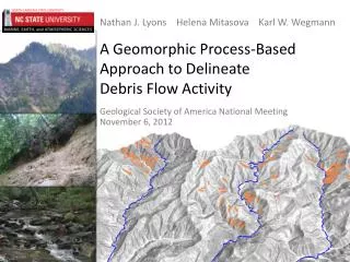
Nathan J. LyonsHelena MitasovaKarl W. Wegmann A Geomorphic Process-Based Approach to DelineateDebris Flow Activity • Geological Society of America National Meeting • November 6, 2012
Recurrence interval [ky] In lower order basins 0.4 (May and Gresswell, 2008) 2-4 (Eaton et al., 2003) 0.3(Hubert and Filipov, 1989) 0.4-1.6(Kochel, 1990) Radbruch-Hall et al. (1982)
1998 Inventory methodologies • Field mapping • Aerial photography interpretation (API) • Digital elevation models (DEMs) • Landform indicators • Semi-automated detection 2006 2008
Process regions Area-SlopePlot Curved region Scaling break Transition Power law region Stock et al. (2005) Stock and Dietrich (2005)
Our questions • Can we determine debris flow extent, the critical drainage area of debris flows (Adf) ? • Identify process signatures in a DEM. • Will inventory proficiency improve when we limit it to Adf ? • Semi-automated land classification. • Compare evaluations of 2 inventories. Macon County landslide inventory, NCGS (2005)
Setting 5 catchments (C) of the lower Oconaluftee River Area:269 km2
Identifying debris flow-dominated channels • Area-slope plot data obtained from a digital elevation model • Multiple regressions in area-slope plots bound by: • Transition from hillslope to channel processes (AC) • Knickpoints • Maximum negative concavity index, in • Defined as the scaling break, Adf • Indicates a decrease in reach channel slope
Study streams • Area-slope analyses: • Limited to“6th order channels” • 32 in 5 catchments • Drainage area: 1.2 ±0.2 km2 • Catchment truck channels included
Critical drainage area of debris flow activity • Debris flow deposits above Adf • ksn peaks near Adf • Position of Adfinfluenced by bedrock gneiss slate metasandstone quartzite debris fan debris flow
Debris flow inventories • Two inventories compared: • Same methodology for both inventories Catchments: 269 km2 Adf: 111 km2
Inventory methodology Texture maps of inputs (slope, hillslope curvature, NDVI) Subareas: “Is a debris flow” or “Is not a debris flow” defined by USGS debris flow map Segment statistics “Is not a debris flow candidate” Classes: “Is a debris flow candidate” or Length:width = 1.8 to 16 True positives Area = 0.5 to 20 ha Slope > 0.03 USGS debris flow map Figure modified from Neteler and Mitasova (2008)
Conclusions Limiting debris flow inventories can improve inventory proficiency. • Detection outperforms semi-automated classification without spatial extent limit • Target inventory areas in other methods Especially well suited for regions with: • Large areas of incidence • Long recurrence interval
References Eaton L, Morgan B, Kochel R, Howard A (2003) Role of debris flows in long-term landscape denudation in the central Appalachians of Virginia. Geology 31:339–342. Gilbert GK, (1877) Report on the geology of the Henry Mountains [Utah]. Publication of the Powell Survey, US Government Printing Office, Washington DC. Hubert JF, Filipov AJ (1989) Debris flow deposits in alluvial fans on the west flank of the White Mountains, Owens Valley, California, U.S.A. Howard A (1994) A Detachment-Limited Model of Drainage-Basin Evolution. Water Resour Res 30:2261–2285. Korup O, Schlunegger F (2007) Bedrock landsliding, river incision, and transience of geomorphic hillslope-channel coupling: Evidence from inner gorges in the Swiss Alps. J Geophys Res 112:F03027. Matmon A, Bierman P, Larsen J, Southworth S, Pavich Matmon, Caffee M (2003) Temporally and spatially uniform rates of erosion in the southern Appalachian Great Smoky Mountains. Geology 31:155–158. Neteler M, Mitasova H (2008) Open Source GIS: A GRASS GIS Approach. Third Edition.The International Series in Engineering and Computer Science: Volume 773, New York, NY. Radbruch-Hall DH, Colton RB, Davies WE, Lucchitta I, Skipp BA, Varnes DJ (1982) Digital compilation of landslide overview map of the coterminous United States. US Geological Survey Open-File Report 97-289. Southworth S, Schultz A, Denenny D, Triplett J (2005) Surficial geologic map of the Great Smoky Mountains National Park Region, Tennessee and North Carolina. US Geological Survey Professional Report and Geological Map, scale 1:100,000. Stock J, Dietrich WE (2003) Valley incision by debris flows: Evidence of a topographic signature. Water Resour Res 39:1089.