Download
1 / 47
480 likes | 618 Vues
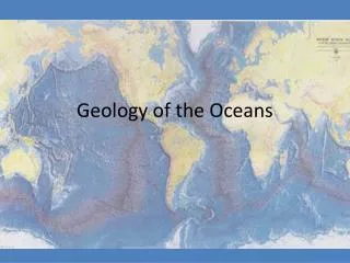
Geology of the Ocean. Origin of Earth. 4.6 billion years ago began as giant disk of dust and gases orbiting the sun grains came together forming comets, asteroids, planets (The Nebular Theory). Earth Structure Density Stratification. core – very dense (iron & nickel) inner core is solid

E N D
Origin of Earth • 4.6 billion years ago • began as giant disk of dust and gases orbiting the sun • grains came together forming comets, asteroids, planets (The Nebular Theory)
Earth StructureDensity Stratification • core– very dense (iron & nickel) • inner core is solid • outer core is liquid (viscous); creates magnetic field • mantle – dense rock, mostly solid does NOT melt because of rapidly increasing pressure
Earth Structure (cont.) • asthenosphere – upper part of mantle, nearly molten, flows very slowly • Hot, partially melted • lithosphere– rigid outer layer (60-125 mi. thick) – floats in the asthenosphere • Comprised of crust and uppermost portion of the mantle
Earth Structure (cont.) • crust– upper part of lithosphere – rigid because of low temperature two types: • continental crust –thicker than oceanic crust, lighter in color, less dense • oceanic crust – thinner, darker, more dense
Kontinentalverschiebung • Theory of Continental Drift Proposed in 1912 byAlfred Wegener • continents fit together like pieces of a jigsaw puzzle. • Suggested that 200 million years ago, continents formed one big land mass Pangaea similarities in fossils and rock formations on different continents bordered by the Atlantic Ocean
Continental Drift • Geologists ignored his theory initially…continents did not fit together exactly like “puzzle pieces”. • Harry Hess – Continents floated on asthenosphere (semi-fluid) Usedthe end of the continental shelf to put continent pieces together—fit exactly
Isostasy • Lithospheric plates float in the asthenosphere in a balance called • Thicker (less dense rocks) continental crust floats higher than thin oceanic crust • Large glaciers weigh down crust, when glaciers melt, plates rise (can be measured).
Plate Tectonics • Lithosphere (crust) is made of several very large plates which move. Theory explains geological changes and features and events such as earth quakes, continental drift and volcanoes.
Plate Boundaries (3 types) • Divergent boundaries – Found at Mid-ocean ridges – • plates move awayfrom each other • new crust formed • seafloor spreading • crust forms from magma at a rift valley
Divergent boundaries • Midocean Ridges • Mid-Atlantic Ridge • most prominent feature steep-sided, very tall mountains • rift valley 25-50 km wide • small e-quakes occur frequently on crests
Divergent boundaries • Rises • Shorter than ridges because plates spread apart faster than @ridges • Have less time to accumulate • Frequently found in Pacific Ocean
Convection Currents • Causes molten magma to rise through mantle and into crust creating oceanic ridges
Magnetic Reversals • Magnetic bands show that new crust is formed and moves away from the ridge over time, has allowed us to date oceanic crust
Convergent Boundaries • Plates converge (come together) • Crust is destroyed-(recycled into mantle) or pushed up to form mountains.
Convergent boundaries • Subduction –zone where dense lithosphere (crust) sinks into mantle and is reabsorbed • Occurs widely in western Pacific basin
Convergent boundaries • Trenches • Deepest part of the ocean floor • Most occur in Pacific (esp. western Pacific) • Most of Pacific Ocean bordered by trenches
Transform Boundaries • Transform faults – plates slide past each other. • Result in earthquakes • Ex. San Andreas fault in California
Seafloor Features • Principal boundary between continents and ocean basins is called the continental margin … • Continental shelf • Continental slope • Continental rise
Continental shelves • The relatively flat, submerged margin of a continent between the shoreline and depth of 200 meters.
Continental slope • steep portion at the end of the continental shelf that ends at the beginning of the ocean basin
Continental rises • Occur at the base of the continental slope… slopes gently…connects with the deep-sea floor
Seafloor Features • Submarine canyons • Are formed by turbidity currents • Began with a large earthquake off of the Grand Banks in the late 1920’s
Deep-Ocean Floor(30% or Earth’s surface) • abyssal hills – cover about 80% of Pacific floor and half of the Atlantic • typically 200m high (many extinct volcanoes) • Are very short compared to midocean ridge mountains • abyssal plains– flat deep ocean floor
Hot spots • midoceanridges (Iceland) • in middle of lithospheric plates (Hawaii) • remain fixed for a very long time
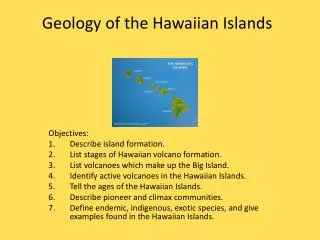
Hot Spots Example: Hawaii • plates move over hot spots and form chains of volcanoes • youngest islands remain active while near hot spot • after crust moves away, volcano becomes extinct