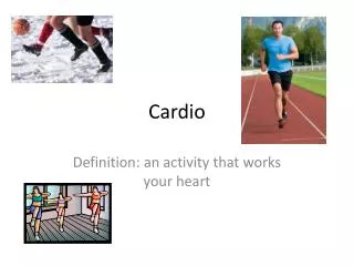
CARDIO
CARDIO. According to the map on page 20 of your textbook , Greenland looks bigger than it really is. What other areas do you think might look larger than they should? Why? Tell me absolute location of Canada, and South America. Section 3: Using the Tools of Geography

CARDIO
E N D
Presentation Transcript
CARDIO According to the map on page 20 of your textbook, Greenland looks bigger than it really is. What other areas do you think might look larger than they should? Why? Tell me absolute location of Canada, and South America.
Section 3: Using the Tools of Geography Information about places on the Earth and their locations is shown on maps and globes. A globe is the most accurate tool because it is a round ball like the Earth. The sizes of oceans and continents are in proportion, that is, they are the right size in relation to one another. There are problems with globes, however: They cannot be large enough to show details and they are hard to carry around. Flat maps solve these problems. They can be any size and they can show small areas in great detail. Unfortunately, a projection, showing a round area on a flat map, causes distortion. Things can look smaller or larger than they really are.
compass rose Maps include features to make them easier to understand. A compass rose is a model of a compass that shows the cardinal directions, north, south, east, and west. The intermediate directions are northeast, southeast, southwest and northwest.
Scale A map scale tells what a distance on the map stands for on Earth. For example, 1 inch on a map might stand for 1 mile (or 100 miles) on Earth. A map key tells what the symbols mean, such as a star for a capital city and a plane for an airport.
Time Zones • The Earth is divided into 24 time zones, corresponding to 24 hours in a day. • As the earth rotates, the sun shines in different areas, moving from east to west during the course of a day. • Places that have the same longitude will be in the same time zone.
Religions Legend Map Legends • The legend is the key to unlocking the secrets of a map. Objects or colors in the legend represent something on the map.
Legend Age Expectancy
Legend Reading Activities • What You Can Learn From A Map • What do Maps Show Activity • Road Map • Road Map Legend • Road Map of Salt Lake City Region • Map Worksheet
HOME LEARNING • IDENTIFY 10 DIFFERENT COUNTRIES AND THEIR TIME ZONE. TELL ME WHAT TIME WILL BE IN EACH ONE. • GIVE ME THE ABSOLUTE LOCATION OF 3 COUNTRIES
Use Page 585 of your textbook to locate the following countries. • 40 N 100 W • 20 N 90 W • 10 N 70 W • 60 N 100 W • 0 LATITUDE 80 W • 20 S 60 W • 50 N 10E • 50 N 20 E • 40 N 30 E • 60 N 10 E 11. 20 S 20 E 12. 0 LATITUDE 40 E 13. 0 LONGTITUDE 20 N 14. 0 LONGTITUDE 40 N 15. 50 N 110 E 16. 20 S 140 E 17. 60 N 80 E 18. 40 N 60 E 19. 80 S 160 E 20. 20 N 80 E http://www.nationsonline.org/oneworld/map/world_map2.htm
Use Page 585 of your textbook to locate the following countries. • UNITED STATES • MEXICO • VENEZUELA • CANADA • ECUADOR • PARAGUAY • GERMANY • POLAND • TURKEY • nORWAY • NAMBIA • KENYA • MALI • SPAIN • MONGOLIA • AUSTRALIA • RUSSIA • TURKMENISTAN • ANTARTICA • INDIA http://www.nationsonline.org/oneworld/map/world_map2.htm