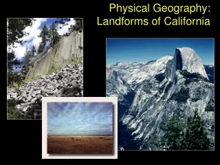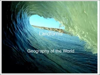
Landforms Geography
Landforms Geography. Glaciers. Development of a Glacier. Glacier – slowly moving mass of dense ice formed by gradual thickening, compaction, and refreezing of snow & water over time After summer melt, some snow left over

Landforms Geography
E N D
Presentation Transcript
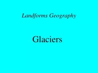
Landforms Geography Glaciers
Development of a Glacier • Glacier – slowly moving mass of dense ice formed by gradual thickening, compaction, and refreezing of snow & water over time • After summer melt, some snow left over • With weight and partial melting, snow turns to Firn, crunchy transition from snow to ice • Further compaction, ice crystals align, become dense glacial ice which flows slowly downslope • At least 40-m thick to become glacier
Glacial Mass Budget • Glacial input : Snow • Glacial output : ice, meltwater or water vapor • Zone of Accumulation – top of glacier where temps are cooler - input > output • Zone of Ablation – lower part of glacier where temps are higher – output > input • Equilibrium line – point on glacier where input = output
Glacial Movement • Glaciers move through internal deformation • Interior of glacier like malleable plastic
Glacier Types • Mountain Glaciers • Ice Cap – Continuous sheet of ice covering entire landscape • Ice Field – Buries all but tallest mountains – can be very thick • Alpine Glacier – Flows down valleys away from high country • Cirque - Bowl-shaped depression on mountain flank due to glacial erosion – snow source
Alaskan Glaciers Hubbard Glacier
Continental Glaciers • Huge ice masses covering a large part of a continent or large island – also called ice sheets • More than 3000 m deep in places • Covers most of Antarctica and Greenland • Weight of ice presses lithosphere down into asthenosphere, called isostatic depression
Glacial Landforms • Rock & debris picked up by glaciers, transported in direction of movement & deposited • Glacial erosion: • Glacial Abrasion – scratch and gouge bedrock • Glacial Striations – caused by glacial abrasion • Glacial Grooves – deep striations • Glacial Plucking – boulders ripped from ground by glacier – deposited by retreating glacier, called Glacial Erratics
Glacial Erosional Landforms • Roche Moutonnée – rounded hill, gradual on side toward direction from which glacier comes Glacial Erratic Glacial Striations
Alpine Erosional Landforms • Glacial Erosion: • Cirque – bowl-like feature on mountain flanks • Tarn – small lake in bottom of cirque • Arête – narrow, steep ridges between cirques • Horn – mountain with 3 or more arêtes at summit • Glacial Trough – u-shape valley eroded by glacier • Hanging Valley – side trough above main trough – possible waterfall
Alpine Erosional Landforms Cirque Horn “Matterhorn” Glacial Trough
Glacial Depositional Landforms (Till) • Glacial Till – sediment directly deposited by glacier – many particle sizes • Moraine – winding ridge formed by till at the front or side of glacier – Moraine types: • Lateral – along former edges of glacier • Terminal – along front of former glacier • Recessional – formed as glacier recedes • Medial – between 2 glaciers • Ground – irregular deposition as glacier recedes
Glacial Depositional Landforms (outwash) • Glacial Outwash – sediments deposited by water out & under a glacier as it melts – forms Outwash Plain, flat feature in front of former glacier • Kame – large mound deposited near glacier front • Esker – winding ridge from water flowing in tunnel through ice under glacier • Kettle Lake – big ice block fallen off glacier front is buried by outwash, melts later forming lake
Physical Geography Arid Landscapes and Eolian Processes
Arid Landscapes & Eolian Processes • Arid Landscapes • Eolian Erosion & Transportation • Eolian Deposition & Landforms • Human Interactions with Eolian Processes
Arid Landscapes • 3 factors influence arid climates: • Subtropical high pressure • Rainshadow • Distance from large bodies of water
Desert Geomorphology • Water important to landforms in arid regions – little vegetation to slow intermittent erosion • Arroyo – steep-sided gully cut into alluvium • In undisturbed, horiz. rock layers more resistant sandstone or limestone forms flat caprock above easily eroded shale • Result is landforms flat on top w/steep sides: • Plateau -Canyon -Butte -Mesa • Pinnacle -Playa
Desert Landforms Note: Tops of most landforms once part of same surface, since partially eroded away
Eolian Erosion and Transport • Wind-based processes important in deserts b/c: • Strong winds common in desert • Large supply of sand & silt to be blown • Vegetation minimal – wind free to erode
Fluid Behavior of Wind • Wind acts like a fluid, like water, but less dense • Faster wind can move larger particles Threshold Velocity for wind to carry different sized particles
Particle Transport • Silts and Clays carried in suspension • Sand bounces along – saltation, or • Sand rolls slowly along – creep
Eolian Erosional Landforms • 2 types of wind erosion: • Deflation – wind blows loose soil away: • leaves coarser pebbles & cobbles, called Desert Pavement • when deflation causes basin to form, called Deflation Hollow
Eolian Erosional Landforms • Abrasion – wind blows sand along a surface to polish & abrade it • Ventifacts – rocks shaped by abrasion: pitted, grooved, polished • Yardangs – elongated, wind-sculpted ridges caused by abrasion
Eolian Erosional Landforms Deflation/Desert Pavement
Eolian Erosional Landforms Abrasion Ventifacts Yardangs
Loess • Fine-grained, wind-blown silt – high in calcium – usually from alluvial deposits or glacial till • Can be transported farther than sand
Loess Deposits Arid Landscapes and Eolian Processes Loess Deposits around the World
Human Impact/Desertification • Desertification – transforming a vegetated landscape to one that is barren & susceptible to wind erosion • Population pressure has forced more people to clear marginal, semi-arid-to-arid land for agriculture & firewood • In wind, cleared land loses topsoil and nutrients • Vegetation unlikely to reestablish
Desertification in African Sahel • Semi-arid region in transition region from Sahara Desert in north to rainforest in south • Traditionally nomadic herders & small, sedentary farmers – north-south migrations to follow rain • Into 20th century, European borders & resource exploitation made people more sedentary – over-cultivation of soil, overgrazing, and tree removal • Add in extended drought since late 1960s, & you have desertification
Desertification in Great Plains • Great Plains lie east of Rocky Mts in semi-arid climate with short grass as dominant natural vegetation Dust Bowl Region
Desertification in Great Plains • Early 1900s Americans moved to region to farm, plowing and clearing native grasses – unusually wet period • 1930s – terrible drought hits – topsoil blows into dust storms – called “Dust Bowl” • Many migrated to California & elsewhere • Those who stayed have employed irrigation & soil conservation, including windbreaks, and conservation tillage