Download
1 / 12
130 likes | 377 Vues
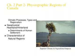
Ch. 2 Part 2- Physiographic Regions of Canada. Climatic Processes, Types and Regionalism Geophysical Heartland/Hinterland Determinants of Human Settlement Characteristics of Natural Regions. Superior Climate & Vegetational Impacts. Climatic Processes, Types and Regionalism.

E N D
Ch. 2 Part 2- Physiographic Regions of Canada Climatic Processes, Types and Regionalism • Geophysical Heartland/Hinterland • Determinants of Human Settlement • Characteristics of Natural Regions Superior Climate & Vegetational Impacts
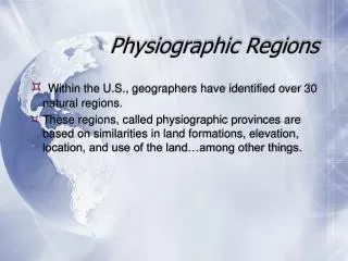
Climatic Processes, Types and Regionalism • Climatic Processes • Climate • The average weather conditions of a region over a long period • Effects: Winds, oceans, latitude, longitude • Global Circulation Patterns
Atlantic climate effects are very different from environments created by Pacific, Arctic or lacustrine and riverain influences • -quantity and quality of water available • -exchange of warmer and cooler currents • -soils and waters rich in minerals and oxygen • -both lower and higher order of species more abundant
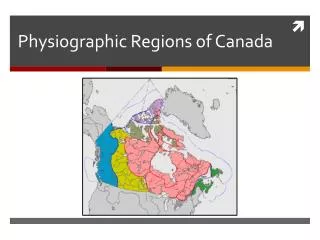
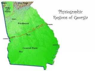
Physiographic Regions Arctic plains, plateaux and mountains (10% - Platform, Plain, Innuit.) Interior Plains (20% - inland lake deposits) Great Lakes-St. Law- rence lowlands (2% - Champlain sea deposits Hudson Bay Lowlands (muskeg wetlands) Canadian Shield (50% Paleozoic igneous) Cordillera plateaux, mountains & valleys (16% area – young & geologically active)
On this Regional Map, trace the major Climate Zones of Canada On this map, situate the Capital Cities of each province & territory
On this Physiographic Map, do the major Climate Zones of Canada correspond to political regions? Why not?
Continuous permafrost (80% frozen) Avge. Temp >-15 0C Discontinuous permafrost (30-80% frozen) Avge. Temp -5 -15 0C Sporadic permafrost (<30% frozen) Avge. Temp -5 0C Canada’s permafrost zones impact on settlement and resource exploitation
Locate the major rivers in these 5 drainage basins. How have Canada’s drainage basins impacted on settlement and resource use?
Acknowledgement of Image Sources • Glacial images and landforms from The Canadian Encyclopedia, 2003. CD Edition, available from Petro-Canada outlets. • Maps: • Physiographic regions: Robert Bone. 2002. The Geography of Canada, 2nd Edition. • Tracing the Magnetic Pole, The Canadian Encyclopedia, 2003. CD Edition • Wisconsin Ice Sheet, Gleick, 2000: p. 70 (fig. 20) • World map Pangea 200M years ago, and world today from http://www.pbs.org/wgbh/nova/ice/continents/ • Global Core, Mathez (ed.). 2001. Earth: Inside & Out pp. 157, 156, 68 respectively. • Erosion images, German Newspaper website http://www.sueddeutsche.de, 2002. • Cyclone and Wave Erosion, EPA website, Great Lakes, July 2002, http://www.epa.gov/glnpo/visual.html,