Download
1 / 20
200 likes | 437 Vues
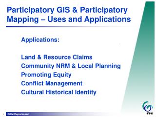
Participatory GIS a tool for land and water management. MENARID Knowledge Exchange workshop 24th to 28th of March, Hammamet , Tunisia H . Jazi National Project Manager MENARID, Iran. Description of the innovation. Participatory GIS as a tool for land and water management

E N D
Participatory GISa tool for land and water management MENARID Knowledge Exchange workshop 24th to 28th of March, Hammamet, Tunisia H. Jazi National Project Manager MENARID, Iran
Description of the innovation • Participatory GIS as a tool for land and water management • Yazd, Iran • This method is practiced in one village and it is going to be repeated for other villages in the area.
Description of the innovation (2) • Lots of dispute over land tenure • 32 hectare divided into 359 parcels with the average of 0.09 ha. • Planning for INRM needs information and tools • Traditional knowledge and community information have to be analyzed via suitable tools • Monitoring is a part of INRM which is possible through map and its attributes updating process • Map is of powerful means for visualization of the points to all parties to understand the main problems • Consensus over maps should made by stakeholders
Dispute over land tenure and water • Differences between government and local people over state rangelands and forests. • Conversion of range and forest to other land uses • Differences between local people • Water management is difficult and confusing due to smallness of the land parcels • Water demand increases and upstream-downstream story is started
Method • Cause and effect analysis workshop on water shortage problem was held • Based on root analysis we agreed to get insight into the current situation through mapping • Preparation of the concept note, instruction and TOR papers • Contracting a local expert • A local active group aware of traditional irrigation system and land tenure status was formed by rural development committee • Preparation of the map • Re-consulting meeting with local community for map review • Make the consensus over the map, boundaries and water paths • Projects like proper water running system via pipes and improvement of cropping system were design
Attribute tables • All forms of information were collected and put in tables • Demographic data were collected via questioners and added to the tables
Result • Creation of the common ground for government and local people for land tenure issue • Updateable database for future change detection • Fundamental information for INRM • Participation of rural people help them to find out about their resources and limitation • Planning projects based on the innovation
Maps are on the wall of rural development office to be used for projects planning
Tangible result • Local people were complain on water scarcity, now they understand that having a proper management plan will lead to excess of water
Recommendations to policy-makers to scale-up the innovation, and to remove constraints • Indigenous knowledge and new technologies could be used in an integrated manner • Resource management need correct information and should be prepare with the people • A monitoring system should be provided to the local people using maps and GIS
Let us discuss it ! Questions, comments and suggestions are welcome!