Task
Exploring American Geography. Task. Teacher Page. Introduction. Welcome Explorers! Today we’re going to travel to the S outh Atlantic states of our country to discover more about their cool features. So put on your hiking boots and get ready to explore!. Task.

Task
E N D
Presentation Transcript
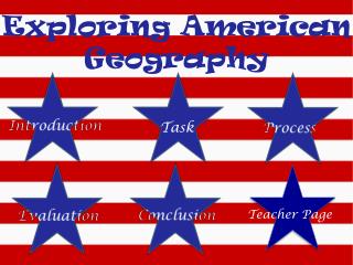
Exploring American Geography Task Teacher Page
Introduction Welcome Explorers! Today we’re going to travel to the South Atlantic states of our country to discover more about their cool features. So put on your hiking boots and get ready to explore!
Task We will work together to exploreAmerica’s Southern geographic states, their features and where they are located. In assigned pairs, explorers will create a postcard with a visual and description of one of the geographic landmarks we learn, and a graphic organizer for each of the eight states. Click the pictures to learn more about the assignments!
Postcard • On a blank, 5x8 notecard, draw or illustrate one of America’s significant geographic features. On the back of the notecard, the following should be included: • Location (city, state) • Climate • Significance • Brief description of the feature • *Some independent research may need to be done to further visual knowledge of particular landforms Return to Task Page
Click here for the graphic organizer Graphic Organizer • Print one Graphic Organizer for each of the eight states we learned. Label each state, their common geography (Ex-mountainous/flat/etc ), any significant features/landmarks (Ex-Appalachian Mountains),and any major tourist attractions. • *These should be cut out and placed on poster board, with a picture of each state labeled and colored beside it. • Students will then answer the following question on the back of your posterboard: • Choosing ONE major tourist attraction from one of the states we’ve learned, how do you think that this attraction effects the states population and economy? • (this part will be evaluated and discussed leading into or next unit of study)
State: Common Geography: Significant Features: Major Tourist Attractions: Print this page at the end of the lesson
Process • The states that we will explore are: • Florida • Georgia • Maryland • North Carolina • South Carolina • Virginia • West Virginia • Delaware Click on one of the South Atlantic states to learn more about each one and their specific geography. You may study each state on your own or with your partner, but make sure to explore each and every state! Click on the whole map to get started! Click here
Things to look for: Common Geography Significant Features/landforms Major tourist attractions West Virginia Maryland Delaware Click on one of the states to get started! • States to explore: • Florida • Georgia • Maryland • North Carolina • South Carolina • Virginia • West Virginia • Delaware
Conclusion Great job explorers! We’ve exploredeight of our countries most interesting states and learned all about their geography. Now it’s time to relax on one of the beautiful beaches we learned about! To learn more about these eight states, click here! Contact Information: kstaton01@bellarmine.edu
Learning Extensions Click the state you want to learn more about!
Curriculum/Teacher page Context • Explain how this lesson relates to the unit of study or your broad goals for teaching about the topic • *Students will begin to learn the more detailed geography and economic factors in the South Atlantic geographic region. • Describe the students' prior knowledge or the focus of the previous lesson • *Students have basic prior knowledge to the states’ geographic locations, basic/minimum prior knowledge of significant landmarks and tourist attractions. • Describe generally any critical student characteristics or attributes that will affect student learning • *Students may become distracted from independent use of computer and Internet. Since it is an online/computer task, students may not take advantage of in class work time if they have the capability of finishing work at home. • Describe how content connects to life experiences of students • *Students can relate this content to personal travel experience; places they may have been or may be interested in going/learning more about. • Name: Kara Staton • Date: 11/7/11 • Age/Grade Level: Primary • Number of Students: N/A • Number of Students with IEP / 504 plan: N/A • Number of Gifted Students: N/A • Number of English Language Learners: N/A • Subject: Geography • Major Content: Social Studies • Lesson Length: N/A • Unit Title: South Atlantic Geography • Lesson Number and Title: N/A
Learning Objective(s) • State what the students will be able to do as a result of this lesson. Objectives must be student-centered and observable/measurable. • Be able to illustrate geographic details of one of the eight South Atlantic states. Focus higher on details of chosen state and elaborate (should be more detailed than the states description in the graphic organizer) • Recognize the eight South Atlantic states and their common geography (mountainous/flat/etc), any significant features/landmarks (ex-Appalachian Mountains), and any major tourist attractions (effecting economy) • Connections • Connect your unit goals to the appropriate Program of Studies and/or Academic Expectations. Connect your learning objectives to the Kentucky Core Content for Assessment. Use no more than two or three connections, and if not obvious, explain how the objectives are related to the Core Content. • *Student’s understand/use maps, recognize geographic features, begin to think about describing community and economic effects of geographical tourist attractions, use Internet tools to investigate earths surface, etc
Program of Studies: Understandings Program of Studies: Skills and Concepts Related Core Content SS-P-G-U-1 • Students will understand that the use of geographic tools (e.g., maps, globes, charts, graphs) and mental maps help to locate places, recognize patterns and identify geographic features. SS-P-G-U-2 • Students will understand that patterns emerge as humans move, settle and interact on Earth’s surface and can be identified by examining the location of physical and human characteristics, how they are arranged and why they are in particular locations. SS-P-G-U-3 • Students will understand that people depend on, adapt to, and/or modify the environment to meet basic needs. Human actions modify the physical environment and in turn, the physical environment limits and/or promotes human activities. SS-P-G-S-1 • Students will develop an understanding of patterns on the Earth’s surface using a variety of geographic tools (e.g., maps, globes, charts, graphs): • locate and describe familiar places at school and the community • create maps that identify the relative location of familiar places and objects (e.g., school, neighborhood) • identify major landforms (e.g., continents, mountain ranges) and major bodies of water (e.g., oceans, rivers) SS-P-G-S-2 • Students will investigate the Earth’s surface using print and non-print sources (e.g., books, magazines, films, Internet, geographic tools): • locate and describe places (e.g., local environments, different habitats) using their physical characteristics (e.g., landforms, bodies of water) • identify and explain patterns of human settlement in different places
SS-P-G-S-3 • Students will compare ways people and animals modify the physical environment to meet their basic needs (e.g., clearing land to build homes versus building nests and burrows as shelters) SS-P-G-S-4 • Students will recognize how technology helps people move, settle, and interact in the world SS-EP-4.1.1 • Students will use geographic tools (e.g., maps, globes, mental maps, charts, graphs) to locate and describe familiar places at home, school and the community. SS-EP-4.1.2 • Students will use geographic tools to identify major landforms (e.g., continents, mountain ranges), bodies of water (e.g., oceans, major rivers) and natural resources on Earth’s surface and use relative location. SS-EP-4.1.3 • Students will describe how different factors (e.g. rivers, mountains) influence where human activities are located in the community SS-EP-4.2.1 • Students will describe places on Earth’s surface by their physical characteristics (e.g., climate, landforms, bodies of water). SS-EP-4.3.1 • Students will describe patterns of human settlement in places and regions on the Earth’s surface. SS-EP-4.3.2 • Students will describe how technology helps us move, settle and interact in the modern world. SS-EP-4.4.1 • Students will describe ways people adapt to/modify the physical environment to meet their basic needs (food, shelter, clothing). DOK 1 SS-EP-4.4.2 • Students will describe how the physical environment can both promote and restrict human activities.
Resources, Media and Technology • List the specific materials and equipment needed for the lesson. Attach copies of printed materials to be used with the students. • If appropriate, list technology resources for the lesson including hardware, software, and Internet URL's and be sure to cite the sources used to develop this lesson. (Provide any additional documentation of additional technologies used but not represented by this lesson; see Teacher Standard 6) *Materials used: Computer- Microsoft Word, Microsoft PowerPoint, Internet Explorer/Firefox/Safari URL’s- http://www.factmonster.com/ipka/A0108198.html Florida http://www.factmonster.com/ipka/A0108201.html Georgia http://www.factmonster.com/ipka/A0108223.html Maryland http://www.factmonster.com/ipka/A0108254.html North Carolina http://www.factmonster.com/ipka/A0108268.html South Carolina http://www.factmonster.com/ipka/A0108283.html Virginia http://www.factmonster.com/ipka/A0108289.html West Virginia http://www.factmonster.com/ipka/A0108194.html Delaware Extensions: http://www.apples4theteacher.com/usa-states/florida/facts/ http://www.apples4theteacher.com/usa-states/georgia/facts/ http://www.apples4theteacher.com/usa-states/maryland/facts/ http://www.apples4theteacher.com/usa-states/north-carolina/facts/ http://www.apples4theteacher.com/usa-states/south-carolina/facts/ http://www.apples4theteacher.com/usa-states/virginia/facts/ http://www.apples4theteacher.com/usa-states/west-virginia/facts/ http://www.apples4theteacher.com/usa-states/delaware/facts/
Procedures • Describe the strategies and activities you will use to involve students and accomplish your objectives, including how you will trigger prior knowledge and adapt strategies to meet individual student needs and the diversity in your classroom. • *Students will use prior knowledge of geographic directions to locate the area of south atlantic states. Knowledge will be strengthened by learning in depth more about each of these eight states through the use of internet browsing and hyperlinks from webquest. Individual students may be allowed more time to work and complete assignments outside of class time, but this work will be completed individually on their own time. • Describe the sequential activities you will use to involve students and accomplish your objectives—be sure to include approximate time-frames • *Students should spend no more than a few minutes reviewing the introduction and task. Time will be available to ask questions regarding the task in class, and email is provided in case students find they have other questions at a later time. Students will be allowed class time to explore the Webquests links to learn about the states. Extra time may be used to complete task, or should be finished outside of class if more time is needed. • List any special accommodations used for ESL learners, inclusion and various learning skills including academically talented (gifted) students. • *Extra time is to be allowed outside of class time for all students who cannot complete the work in the time given in class. Assessment Plan Objective / Assessment Organizer • Objective 1- Summative: Postcard-visual and written description *If not completed in class time, students may complete assignment online at home (download from wiki) • Objective 2- Summative: Graphic organizer * If not completed in class time, students may complete assignment online at home (download from wiki)