Download
1 / 20
210 likes | 404 Vues
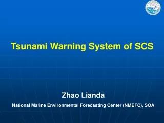
Tsunami Hazard and Risk Assessment and Warning System for Coastal Areas of Vietnam. Institute of Geophysics/VAST, Vietnam GNS Science, New Zealand. Dr Terry H. Webb , Professor Bui Cong Que, Dr Le Huy Minh, Dr My Thanh Tran Thi, Dr Nguyen Dinh Xuyen, Dr Ken R. Gledhill , and Dr Mark W. Stirling.

E N D
Tsunami Hazard and Risk Assessment and Warning System for Coastal Areas of Vietnam Institute of Geophysics/VAST, VietnamGNS Science, New Zealand Dr Terry H. Webb , Professor Bui Cong Que, Dr Le Huy Minh, Dr My Thanh Tran Thi, Dr Nguyen Dinh Xuyen, Dr Ken R. Gledhill , and Dr Mark W. Stirling
NZAID/ADAF Programme Goals • To assist in strengthening the capacity of Vietnamese scientists to enable Vietnam to minimise the impact of tsunami disasters on coastal and offshore island communities so that risk can be assessed and mitigation strategies developed. (Objective 1) • To strengthen the capacity of scientists at IGP in the development of an earthquake information and tsunami early warning system. (Objective 2) Institute of Geophysics, VAST
Tsunami Hazard Now Defined Roadmap for a Probabilistic Tsunami Hazard & Risk Assessment Hazard Source Identification - Local, Regional, Distant earthquake, volcano, landslide Tsunami wave height at coast, with likelihood (magnitude/frequency) numerical modelling, historical data, empirical approach Inundation empirical equations & GIS or hydrodynamic modelling Loss/Risk Exposure, census data, casualty & infrastructure models Output Losses at specified return period (loss curve) Is the level of risk acceptable? • Natural and engineering mitigation • Land-use Planning • Effective early warning systems Institute of Geophysics, VAST
Objective 1 – Tsunami hazard and risk assessmentCapacity building by training to date: • Introductory workshops, April 2007; • Working session to define tsunami sources, August 2007; • Training in New Zealand for 3 scientists, October 2007; • Technical Review (at IGP/VAST, April 2008); • Field campaign – Asset data collection, April 2008; and • Training in New Zealand for 3 scientists, October 2008. Institute of Geophysics, VAST
Objective 1 Tsunami Hazard and Risk Assessment – Nha Trang pilotCapacity building by application – Ongoing • Develop input for propagation model • Source catalogue development (2008) • Bathymetry model for propagation paths (2008) • Community assets defined • Data collection & ground truth (April 2008) • Building inventory • Population distribution • Local creation of asset inventory – GIS based (Sept 08) • Development of roughness layer for inundation modelling (underway) Institute of Geophysics, VAST
Current Training Applied training at GNS Science for 3 IGP staff: • Source definition confirmation • Propagation modelling – Nha Trang • Impact tables development – Nha Trang • Inundation modelling • Asset model quantification • Risk application – principles and application Institute of Geophysics, VAST
Philippines Subduction Source Preliminary Segmentation Model Institute of Geophysics, VAST
Maximum Wave Heights for Full Subduction Source (Mw 9.2) Institute of Geophysics, VAST
Maximum Wave Heights for Full Subduction Source (Mw 9.2) Institute of Geophysics, VAST
Nha TrangTopographyModel Institute of Geophysics, VAST
Nha Trang Preliminary Inundation Model Camfield algorithm implemented in GIS 6 m inundation depth at shore assumed Institute of Geophysics, VAST
Building Block Definition and Assignment Institute of Geophysics, VAST
Building Block Definitions Institute of Geophysics, VAST
Ground Truthing Building Type and Use Institute of Geophysics, VAST
Building Types Institute of Geophysics, VAST
Building Attribute Data Institute of Geophysics, VAST
Pathway forward (Objective 1; 2009 1st quarter) • Methodology for development of Tsunami Hazard Maps (‘Wave Height at Coast’) • 3–6 Coastal Zones • Interpolation for full coastal coverage • For Nha Trang • Scenario propagation and inundation models applied • Probabilistic loss models developed • Tsunami risk evaluated Institute of Geophysics, VAST
Objective 2 – Earthquake information and tsunami early warning system • Review of Vietnet proposal; • Options for Operations Centre; • Study Tour to New Zealand; • IRIS training course in KL; • Attendance at Taiwan early warning meeting Feb 2008 by Berryman; and • Visit to Vietnam by Webb & Gledhill in late Nov 2008. Institute of Geophysics, VAST
Summary • Objective 1 • Progress made according to expectations • Skill transfer for modelling hazard and loss consistent with expectations • Probabilistic modelling to be addressed during current training at GNS Science • Objective 2 • Overview guidance on VietNet provided (and ongoing) • Early warning system support provided • Capacity Building concludes in April 2009 • Memorandum of Understanding GNS Science/VAST in place • Future collaboration anticipated • Future funding support needed Institute of Geophysics, VAST