Download
1 / 35
350 likes | 495 Vues
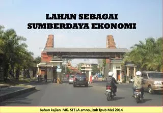
Bahan kajian MK. STELA LANDUSE ECONOMIC Malang , smno April 2013. The Market and Land Use. The Market and Land Use. Why is a particular piece of land used in aparticular way ? One piece of land used for agricultural production, Another for an industrial site, and

E N D
Bahankajian MK. STELA LANDUSE ECONOMIC Malang , smno April 2013
The Market and Land Use Why is a particular piece of land used in aparticular way ? One piece of land used for agricultural production, Another for an industrial site, and A third piece of land used for office blocks. QUALITY & LOCATION of a piece of land KUALITAS LAHAN Kualitas lahan merupakan konsep “fungsional”, harus didefinisikan dalam kaitanhnya dengan aktivitas tertentu pemanfaatannya/penggunaannya. Kualitas lahan untuk memproduksi tanaman tgt pd iklim, topografi, tipe tanah, dan kesuburannya; semua faktor ini berpengaruh pd pertumbuhan tanaman, biaya produksi dan biaya panen. Setiap aktivitas penggunaan mempunyai persyaratan tertentu. LOKASI LAHAN Teori lokasi lahan ini pertama kali dikemukakan oleh von-Thunen dari Jerman. Teori ini berdasarkan pada biaya angkut hasil panen pertanian ke pasar. Nilai lokasi = f (biaya transportasi, jarak riil)
A : lahan kualitasnya rendah unt memproduksi jagung B : lahan kualitasnya medium C : lahan kualitasnya tinggi. QUALITY OF LAND (a) Revenue & Cost Net revenue Total revenue Cost of production A B C (b) ceiling rent Low Kualitas lahan High
Teori Lokasi ini pertama kali dikembangkan oleh von Thunen. Nilai lokasi sebidang lahan ditentukan oleh jaraknya dari pusat pasar; Jarak ini akan menentukan biaya transportasi hasil produksi lahan LOCATION OF LAND (a) Revenue , Cost, Ceiling rent (Rp/ha) Ceiling rent Cost of transport Total revenue Cost of production Pasar Jarak ke pasar (b) cost of transport Kentang Daging Pasar jarak ke pasar
Asumsinya: Kualitas lahan sama Petani kentang akan bersedia menyewa lahan di dekat pasar dengan nilai sewa yang lebih besar dibandingkan dengan peternak sapi potong LOCATION OF LAND (a) Ceiling rent (Rp/ha) Daging Kentang X O X Jarak ke pasar Pasar Jarak ke pasar Daging Daging Kentang Pasar
Biaya transportasi biasanya dipengaruhi oleh: 1. Aksesibilitas lahan thd jalur komunikasi / transport yg baik 2. Biaya transportasi meningkat linier dg jarak ke pasar 3. Kualitas lahan tidak seragam 4. ……. Interaksi Lokasi - Kualitas Lahan (a) Harga pasir atau batu bahan bangunan (Rp/ton) Revenue & cost (rp/ton) Harga pasir di pasar P Revenue per ton pasir dikurangi biaya transpor ceiling rent Q Extraction cost Lokasi A Lokasi B Pasar Jarak ke pasar Lokasi B mempunyai kualitas lebih baik untuk penambangan pasir dan batu, shg biaya ekstraksinya lebih murah
Penetapan lokasi industri: 1. Biaya transportasi bahan mentah 2. Biaya distribusi hasil produksi ke pasar 3. Lokasi optimum Total Biaya transport minimum Industrial vs Urban Land-Use Transport Cost per ton produce (Rp) (a). Heavy industry Total transport cost Transport cost of raw materials Transport cost of product Raw Material Jarak Market Biaya jagung (b). Usahatani Jagung Total biaya Biaya distribusi Biaya produksi Lahan usaha Jarak Pasar
Penetapan lokasi industri: 1. Lokasi Toko A dan Toko B identik, hanya Toko A lokasinya lebih dekat dengan pusat kota 2. QA : Permintaan barang di toko A dg harga P 3. QB : Permintaan barang di toko B dg harga P Ceiling rent for Urban- sites Harga barang P Demand at A Demand at B QB QA Kuantitas barang Rp/ha ceiling rent operating cost Total revenue A B Pusat Kota Jarak
Concentric landuse zoning : 1. The central zone is devoted to offices, dept. Store, commercial uses, etc. 2. Industry, residential uses, ets 3. Agriculture Urban Ceiling rent vs Landuse Ceiling rent Offices Manufacturing, Warehouses, Industry Residential agriculture Town centre Jarak Industry & Warehouses Offices Residensial Industry Pertanian
Land Use Planning Land use planning -------- Land Suitability Analysis (LSA) Tiga fase dalam LSA : 1. Asses the requirements of potential activities 2. Determine the capability of the land resources 3. Match land resources capability to the needs of society Agricultural Land Use Planning (Teladan dari Young & Goldsmith) Enam alternatif penggunaan lahan adalah: 1. Annual cropping 4. Natural forest 2. Perennial cropping 5. Plantation forest 3. Livestock 6. Tourism & Recreation. (1). Asses requirements of potential activities Persyaratan Arable Cropping di Malawi (Young & Goldsmith, 1977) Karakteristik lahan Persyaratan Limitasi Diagnostic measure Drainage Free Poor Kelas drainase tanah Bahaya erosi Nil/Low High Slope; Soil permeability index Zone perakaran Deep soil Shallow soil Kedalaman efektif Easy root penetration Poor Tekstur / Struktur Retensi hara High Low KTK
Land Use Planning (2). Determine the capability of land resources Aerial photography -------- to identify areas characteristics Ground analysis ------------ to asses the diagnostic features of land unit Data management ------------- Analysis & interpretasi ------- Suitability of land unit for arable cropping (Young & Goldsmith) Land unit Drainase Bahaya erosi Zone perakaran Suitability Lilongwe Mainly free drained Nil to Low Very good (deep Highly suitable (75% free, (Slope < 3%) well structured soil) (S1) 25% imperfect) Thiwi Mainly free Low to medium Moderate Marginally (Slopes 6o) Soil depth < 100 cm suitable (S3) Dedza Free Medium to high Poor (Shallow soils) Permanently mountains (steep slopes) not suitable (N2) Kesesuaian unit lahan untuk suatu aktifitas dinilai pd kisaran sekala: 1. S1 : Highly suitable 2. S2 : Moderately suitable 3. S3: Marginally suitable 4. N1: Currently not suitable 5. N2: Permanently not suitable.
Land Use Planning (3). Match land resource capability to the needs of activities Hasil LSA menyatakan “production possibility” untuk setiap land unit, belum mencerminkan “the best allocation” Alokasi penggunaan lahan lazimnya melibatkan kebijakan pembangunan daerah, sehingga seringkqali harus ada trade-off dalam pengambilan keputusan Suitability of land units Land unit Annual Perennial Livestock Natural Plantation Tourism and cropping cropping forests forests recreation Lilongwe S1 N2 S2 n.a. S2 n.a. Thiwi S3 N2 S2 S2 S2 n.a Dedza- N2 N1/N2 S2 S3 S1 S2 mountains Kelemahan LSA dari perspektif ekonomi: 1. Existing versus potential capability 2. Location, biasanya berkaitan dengan biaya transportasi dan konservasi SDA 3. External effects, biasanya berkaitan dengan pencemaran lingkungan
The Market and Land Use The foundations for a systematic understanding of the principles of land use were laid more than a century and a half ago by a scientifically minded North German estate owner named Johann Heinrich von Thünen.9 He set himself the problem of how to determine the most efficient spatial layout of the various crops and other land uses on his estate, and in the process developed a more general model or theory of how rural land uses should be arranged around a market town. The basic principle was that each piece of land should be devoted to the use in which it would yield the highest rent. An Introduction to Regional Economics ( Edgar M. Hoover and Frank Giarratani) http://www.rri.wvu.edu/WebBook/Giarratani/chaptersix.htm
The Market and Land Use The Interaction of the Land Use and Transportation Markets in the MEPLAN Framework Source: Johnston, Rodier, Choy, and Abraham (2000). http://www.fhwa.dot.gov/planning/toolbox/sacramento_methodology_land.htm
CONCEPTS OF LAND SUITABILITY LAND PROPERTIES: (*) Land Quality (*) Land characteristics LANDUSE: (*) Requirement DYNAMIC ANALYSIS : (*) Landuse Systems (*) Agroecological Zoning
What Is Land-Use Planning? As population and human aspirations increase, land becomes an increasingly scarce resource, calling for land-use planning. Land-use planning is important to mitigate the negative effects of land use and to enhance the efficient use of resources with minimal impact on future generations. Land-use planning is defined as a systematic assessment of land and water potential, alternatives for land use, and the economic and social conditions http://www.waterencyclopedia.com/La-Mi/Land-Use-Planning.html
LAND-USE PLANNING Land and water resources are essential for farming, grazing, forestry, wildlife, tourism, urban development, transport infrastructure, and other environmental functions. The increasing demand for land, coupled with a limitation in its supplies, is a major cause for more conflicts over land use throughout the world. The Watershed Perspective Each type of land use has a varying effect on the hydrologic cycle , thereby affecting the people and the natural resources on a landscape. A watershed perspective can be used to scientifically study the effect of land uses on water and downstream ecosystems . A watershed is defined as a topographically delineated area drained by a stream system; that is, the total land area above some point on a stream or river that drains past that point. A watershed acts as a receiver, collector, and conveyer of precipitation on a landscape. Land uses affect these pathways by altering surface runoff and groundwater infiltration, thereby changing the quantity and quality of water resources. Read more: Land-Use Planning - river, effects, important, system, source, effect, humanhttp://www.waterencyclopedia.com/La-Mi/Land-Use-Planning.html#ixzz1f2Ozm3A2 http://www.waterencyclopedia.com/La-Mi/Land-Use-Planning.html
IMPACTS AND BENEFITS OF LAND USES Natural vegetation, such as forest cover, is usually the most benign of land uses, with higher infiltration and reduced runoff rates. The opposites of forest cover are urbanized areas, where large surface areas are impermeable, and pipes and sewer networks augment the natural channels. The impervious surfaces in urban areas reduce infiltration and can reduce the recharge of groundwater. In addition, urban runoff contributes to poor water quality. Agricultural activities are major forms of land use, including row crops, rangelands, animal farms, aquaculture , and other agribusiness activities. Cropping activities involve soil and water manipulation through tillage and irrigation , thereby affecting runoff water and groundwater resources. If improperly used, fertilizer and plant protection chemicals in agricultural operations can affect water resources and ecosystems. Read more: Land-Use Planning - river, effects, important, system, source, effect, humanhttp://www.waterencyclopedia.com/La-Mi/Land-Use-Planning.html#ixzz1f2OpOP9n http://www.waterencyclopedia.com/La-Mi/Land-Use-Planning.html
LAND-USE PLANNING A typical planning process involves the following steps: Establishing goals and a baseline; Inventorying and organizing resources; Analyzing problems; Establishing priorities and alternatives; Checking for land suitability; Evaluating alternatives and choosing the best option; Developing a land-use plan; Consulting and implementing the plan; and Revising the plan. Read more: Land-Use Planning - river, effects, important, system, source, effect, humanhttp://www.waterencyclopedia.com/La-Mi/Land-Use-Planning.html#ixzz1f2OMNkXK http://www.waterencyclopedia.com/La-Mi/Land-Use-Planning.html
LAND USE, TRANSPORTATION, AND GROWTH The complex relationship between transportation, land use, and growth in a REGION context. It describes the causes of growth generally and the link between transportation and growth specifically. Highway projects can affect the location, rate, type, or amount of growth in an area. Some types of development may be directly induced by a project (e.g., projects serving specific types of land development). However, most land use changes in a REGION are not direct consequences of a highway project, but rather occur indirectly due to changes in travel time and increased land accessibility in areas that may be ripe for development. The result may be a change in spatial distribution of development over time, such as commercial development around a new highway interchange. These types of growth-land use-transportation relationships are more complex and difficult to analyze than those for a project specifically designed to encourage or facilitate land use change and development. http://www.dot.ca.gov/ser/Growth-related_IndirectImpactAnalysis/gri_guidance.htm
FACTORS INFLUENCING LAND USE AND DEVELOPMENT Source: FHWA May 1999. An Overview: Land Use and Economic Development in Statewide Transportation Planning. http://www.dot.ca.gov/ser/Growth-related_IndirectImpactAnalysis/gri_guidance.htm
GENERALIZED PROFILE OF LAND USE BY ECONOMIC VALUE. http://ucanr.org/repository/cao/landingpage.cfm?article=ca.v045n03p10&fulltext=yes
EKONOMI GUNA-LAHAN • Land has some characteristics that make it quite different to other goods: • 1. There is a fixed supply (vertical supply curve), and • 2. It is costless to produce (the producer surplus starts at a price of zero). http://ckmurray.blogspot.com/2009/11/some-empirical-support-for-land.html
The Supply and Demand of Land Undeveloped land, or ‘pure’ land, refers solely to the land mass provided by nature. For example, the land mass across the earth’s surface, or more particularly the area of a Local Authority District, can be considered to be in fixed supply. Remember, your economics supply and demand curves – the land supply curve would be a vertical line on the graph where the x-axis is quantity and the y-axis is price. http://aspinallverdi.wordpress.com/2013/01/30/cil-economics-the-supply-and-demand-of-land/
..LANDUSE CHANGE.. Land use changes can have positive and negative effects on human well-being, and on the provision of ecosystem services (great increases in the human population and density, increased productivity, higher incomes and consumption patterns, and technological, political and climate change). Indeed, activities such as agriculture, forestry, transport and housing use land and alter its natural state and functions. Also, many environmental problems are rooted in the use of land; it leads to climate change, biodiversity loss and the pollution of water, soils and air. http://www.wikiprogress.org/index.php/Land
Economic Rent = Price of Resource in its Native State Among the factors of production, land is fundamentally different from labor and capital, because the supply of labor and capital depends on its price in the marketplace while the supply of land does not. Land rent has no incentive function because the supply of land is not dependent on the rent paid. Land rent is considered to be a surplus payment, because even if no rent was paid, land would still be available. http://thismatter.com/economics/economic-rent.htm
Economic Rent and The Market for Land The price of a one-acre parcel of land is determined by the intersection of a vertical supply curve and the demand curve for the parcel. The sum paid for the parcel, shown by the shaded area, is economic rent. http://www.web-books.com/eLibrary/NC/B0/B63/067MB63.html
Land Use Change: Bio-Physical and Socio-Economic Drivers The analysis of land use change revolves around two central and interrelated questions: "what drives/causes land use change" and "what are the (environmental and socio-economic) impacts of land use change". http://www.rri.wvu.edu/WebBook/Briassoulis/chapter1%28introduction%29.htm
Components of land suitability assessment The assessment of land quality for a specific type of land use should be based on land use requirements and constraints. Such requirements and constraints are then used as the basis for establishing what are termed ‘evaluation criteria’ or ‘decision criteria’. The matching procedure (FAO, 1976) then gives rise to a ranking of the potential of land for a given purpose, whether categorical or continuous grades. http://www.regional.org.au/au/gia/26/828baja.htm
LAND SUITABILITY INDEX. There are at least two important groups of land attributes for land suitability analysis: inherent qualities of soils and external characteristics. The former are soil attributes which have the function for accommodating plant growth, while the latter are those determining the level of ‘workability’ (FAO, 1976), runoff, sedimentation, and erosion in the catchment. http://www.regional.org.au/au/gia/26/828baja.htm
Factor rating of land quality for low land rice The land qualities to be used in this evaluation thus include a number of land characteristics : Water Availability (W), Nutrient Availability Index (NAI), Water and Nutrient Retentions(R), Salt Hazard (S) and Topography (T) Selengkapnyalihat: http://geospatialworld.net/Paper/Application/ArticleView.aspx?aid=145#sthash.8WT6KYuv.dpuf http://geospatialworld.net/Paper/Application/ArticleView.aspx?aid=145
- See more at: http://geospatialworld.net/Paper/Application/ArticleView.aspx?aid=145#sthash.8WT6KYuv.dpuf . Suitability evaluation of rice. The diagnostic factors of each thematic layer were assigned values of factor rating . The evaluation model is defined using the value of factor rating as follows: Suitability = W x NAI x R x S x T. These five layer are then spatially overlaid to produce a resultant polygon layer. Application of the model to the resultant layer yields a suitability map with 4 classes according to the resultant values proposed in the following table . http://geospatialworld.net/Paper/Application/ArticleView.aspx?aid=145
Land suitability evaluation for watershed pond A hierarchical modeling scheme with multi criteria land evaluation (MCLE) and multi objectives land allocation (MOLA) to evaluate suitability of location for watershed pond aquaculture and to resolve associated conflicts. http://www.gisdevelopment.net/application/nrm/water/overview/ma03166pf.htm
ECONOMY OF LAND USE www.marno.lecture.ub.ac.id 2013