Download
1 / 28
280 likes | 400 Vues
The WATERS Network aims to improve our understanding of the interactions between Earth systems and human activities in the cycling of water, nutrients, and contaminants. Through an integrative approach centered on scaling, it addresses challenges in large-scale water processes, such as Mississippi Basin runoff impacts on Gulf of Mexico hypoxia. The initiative employs advanced sensing technology to gather multi-scale data, essential for enhancing water management and policy design amidst climate and population changes, while fostering a comprehensive understanding of water dynamics.

E N D
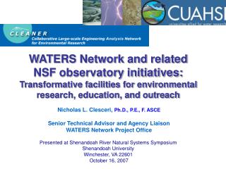
The WATERS Network: Conceptual Design Update David Tarboton Utah State University Team: Barbara Minsker (PI) Jerry Schnoor, Chuck Haas, Roger Bales, Rick Hooper, Jami Montgomery, John Braden, Nick Clesceri, Martha Conklin, Beth Eschenbach, Ilya Zaslavsky with contributions from many others …
WATer and Environmental Research Systems Network: WATERS Network The Waters Network seeks to examine the interactions between Earth Systems processes and human systems involved with the cycling of water, sediment, nutrients, and contaminants. Understanding how natural processes, technology, and humans interact in response to climate and population changes will provide the knowledge required to better manage water and the broader environment.
Outline • Scaling as the integrative theme • Requirements tracing • Common observation requirements • National Network Design • Modeling platform for integration and hypothesis testing
An Example of a Large-Scale Critical Water Process: • Gulf of Mexico hypoxia caused by runoff from Mississippi Basin • In 2007, dead zone was 7,900 mi2 Mississippi River meets the Gulf of Mexico (Source: http://www.gulfhypoxia.net)
Scaling Challenges (e.g. in the Mississippi River Basin/Gulf Hypoxia) • Spatial • Our understanding of water comes primarily from small-scale experiments to understand individual processes. • Large-scale water processes are dynamic, non-linear combinations of individual processes that are not well understood. • How do localized actions (contaminant releases, water treatment, and management practices) accumulate at the river basin scale? • Temporal • Storms drive much of the runoff in short-term episodic events that are not well captured by current observations • Long-term effects of climate and population changes on large-scale systems cannot be predicted • Organizational • Disconnections between perceptions and attitudes on one hand and behavior on the other challenge the design of policies for water use • We know little about the dependence of effective institutional design and theory of adaptive organizational response to water problems WATERS Network proposes to use emerging sensing and information technology to integrate across multiple scales. Multi-scale water dynamics are a coupled human and natural system – interactions are not well understood
Typical Small-Scale Experimentation: Preferential Flow in Soils (Markus Weiler, ETH Zurich)
Patterns and self-organization in water systems at large scales: LANDSAT image over coastal Sarawak, Malaysia, 1996
The Importance of Scales in Time Kirchner, HP Today, 2002
Discovery Science, Nonlinearities, and Scaling Night-time reaeration due to cooling temperature in small streams! W. Q. Standard How do these effects integrate as small streams converge to larger scales? Instrumental Variation in D.O. at Clear Creek, Iowa, 2006 (Schnoor)
How Can Basin-Scale Policy Adapt to Small-Scale Hydrologic Variation? Brozović et al. (2006)
Integrated Infrastructure to Advance Knowledge Informatics/Cyberinfrastructure Observatories/ Experimental & Field Facilities Sensors & Measurement Facility Synthesis/Modeling User Community
Community Science Priorities • CLEANER Committee Reports (http://www.watersnet.org/plngdocs.html) • CUAHSI Science Plan (http://www.cuahsi.org/SciPlan-20070402.html) • NRC CLEANER Report (http://www.nap.edu/catalog/11657.html) • Water, Earth, Biota (WEB) Report (http://cires.colorado.edu/science/groups/gupta/projects/web/) • CUAHSI vision and synthesis papers (http://www.cuahsi.org/news.html) • Many others
Lead with the Science Precisely relate the measurements being proposed to the questions being addressed • Question/Topic • Importance • Barriers and Enabling Technology • Observatory Design • Network Design
How do land-use changes affect sediment loading and contaminant transport? Enabling technology • Sediment source fingerprinting • Water quality sondes • Tunable diode laser absorption spectroscopy Design • Observatory level • Spatially dense sonde network nested within sparse TDL network • Water flux infrastructure • Network level • Representative coverage of variability in climate, geology, population density, land use, etc.
Plot Group Flux tower and footprint Streamgage Subwatershed How does vegetation mediate hydrologic processes? Enabling technology • LIDAR • Eddy covariance • Acoustic Doppler stream gauging • Fiber optic temperature sensing • Precipitation Radar • Multispectral imagery • Near surface geophysics Design • Observatory level • Nested instrument clusters in different vegetation classes and subwatersheds to provide measured closure of water balance • Network level • Representative coverage of variability in climate, geology, population density, land use, etc.
How does source water quality variability affect water treatment? Enabling technology • Pathogen and other water quality sensors • Control algorithms Design • Facility level • Intake sensors • Watershed instrumentation for intake water quality forecasting • Multiple treatment trains for experimentation • Network level • Replication in different locales with differing source water qualities and influent characteristics
How is the carrying capacity of a hydrologic region affected by physical processes, infrastructure investment and social organization? • Design • Observatory level • Stratification by geology, land use, human effects, land form • Network level • Stratification across climate and other strata constant at observatory level Enabling technology • Near surface geophysics • CFC and isotope dating and tracing technology • Tracer injection discharge techniques • Fiber optic temperature sensing • ADCP stream gauging • LIDAR • Managed system and human response sensing • Decision theatre
Common Requirements Allow a Regional Focus Across National Scales • Fluxes and stores of water and contaminants at various scales • Meteorology (precip, evap, wind, solar, eddy) • Groundwater piezometry and quality • Soil moisture • Flow discharge, velocities, stage, bathymetry • Water quality (pH, temp, cond, turb,D.O.,chla) • Nutrients (NO3-, PO43-, DOC) for mass fluxes • Sediments (TSS, turbidity, bed load?) • Pathogens (Enterococcus, E. Coli, others)
National Network Design • Enable multi-scale, dynamic predictive modeling for water, sediment, • and water quality (flux, flow paths, rates), including: • Near-real-time assimilation of data • High frequency measurements • Point- to national-scale prediction • Observatory provides data sets/framework to test: • Sufficient data to test science hypotheses • Alternative model conceptualizations across • entire range of attributes (popn., hydrology) • Master Design Variables: • Scale • Climate • Hydrologic setting • Land form and geology • Land use & population Nested Observatories over Range of Scales: Point to Plot (100 m2) Subcatchment (2 km2) Catchment (10 km2) – single land use Watershed (100–10,000 km2) – mixed use Basin (10,000–100,000 km2) Continental scale-up by HIS, models & remote sensing (MODIS, Landsat, flyovers)
National Network Design Human dominated Environment (Anthropogenic Landscape) Concept: design and construct an observing and modeling system that addresses water dynamics over the full range of human and naturally dominated environments Naturally dominated Environment (Hydrologic Landscape)
Population per unit area by county 1996 Population/Km2 0-5 5-10 10-20 20-50 > 50
mm/year 0 0 – 1 1 – 10 10 – 100 > 100 Public supply water use intensity by county Source: USGS Estimated Water Use in the United States in the year 2000 http://pubs.usgs.gov/circ/2004/circ1268/
NETWORK DESIGN An example showing 9 categories of granular precipitation and population for conterminous U.S.
Overlay Observatory 4-Digit Hydrologic Unit Codes onto the geospatial polygons of granular Popn/Precipitation… HUC-8 watersheds from USGS
Hypothetical random examples from USGS 4 digit HUC’s that cover the Physiographic Attributes of the Nation. Statistical selection techniques indicate that 14 (or fewer) observatories can adequately cover all the attributes of the nation.
National Modeling Platform • Models enable us to organize the information about very complex systems • Catalyst for advancing knowledge • Drive and exploit data fusion cyberinfrastructure • Drive and exploit sensor system • Drive and exploit experimental facility • Integrate knowledge across disciplines